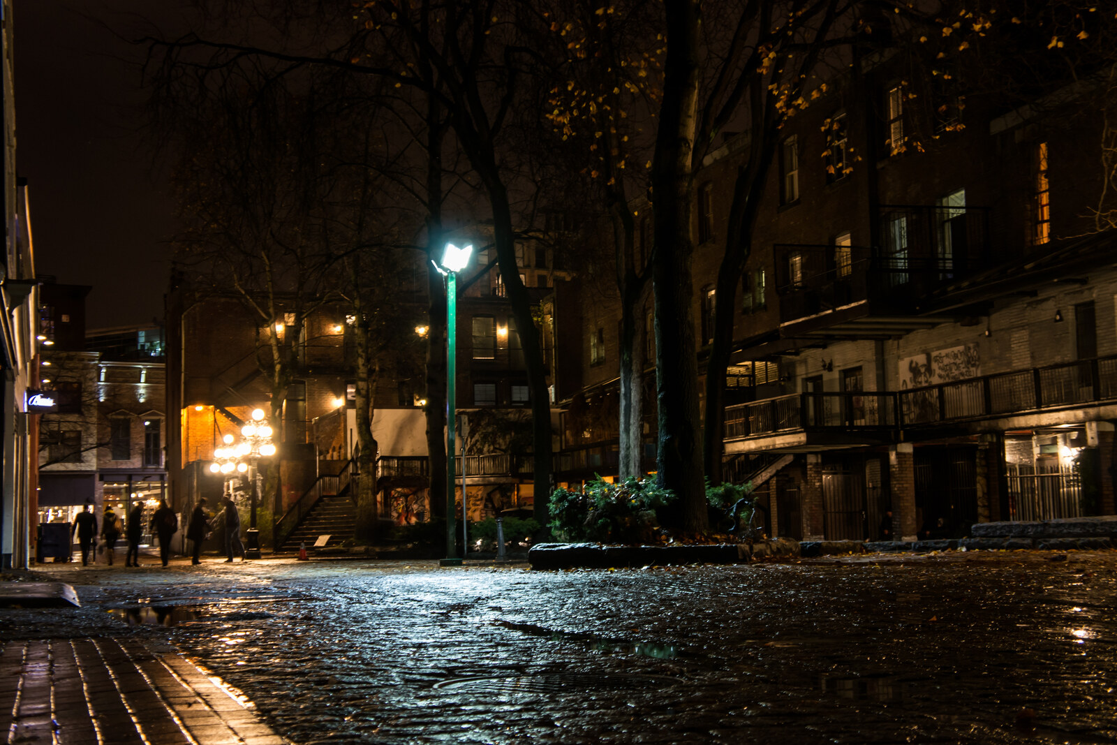
Blood Alley History Blood Alley: story on the “Port, Railway, and Gastown” route This stop separates the documented origin of the name from later stories of slaughterhouses and gallows.
Brockton Point Lighthouse History Brockton Point Lighthouse: story on the “Stanley Park Along the Water” route Here, the park's maritime service becomes a story of watch duty, rescue, and an unsuccessful descent to the water.
Canada Place History Canada Place: story on the “Port, Railway, and Gastown” route Here, the harbor's ceremonial facade meets the story of a ship that was never allowed to dock.
Chinese Cultural Centre of Greater Vancouver and Dr. Sun Yat-Sen Classical Chinese Garden History Chinese Cultural Centre of Greater Vancouver and Dr. Sun Yat-Sen Classical Chinese Garden: story on the “Chinatown and Strathcona: Streets of Mutual Aid and Protest” route The garden will show how traditional construction had to be reconciled with local regulations and ongoing expenses.
Hogan’s Alley and Union Street History Hogan’s Alley and Union Street: story on the “Chinatown and Strathcona: Streets of Mutual Aid and Protest” route A single surviving address will put a family restaurant and a vanished Black neighborhood back on the map.
Lost Lagoon History Lost Lagoon: story on the “Stanley Park Along the Water” route This stop will connect the poetic name with the physical transformation of a tidal bay.
Lumberman's Arch History Lumberman's Arch: story on the “Stanley Park Along the Water” route This stop will show how an ornament for a single city passage acquired a second location and a second structure.
MacLean Park and the Militant Mothers of Raymur Overpass History MacLean Park and the Militant Mothers of Raymur Overpass: story on the “Chinatown and Strathcona: Streets of Mutual Aid and Protest” route The finale will link the redevelopment of Strathcona with the parents' campaign for a safe route to school.
Maple Tree Square History Maple Tree Square: story on the “Port, Railway, and Gastown” route Here, Gastown’s founding legend leads to an intersection that has outlived a bar, a hotel, and a maple tree.
Millennium Gate History Millennium Gate: story on the “Chinatown and Strathcona: Streets of Mutual Aid and Protest” route The gate will show the urban compromise the community needed to create a visible boundary for Chinatown.
Prospect Point History Prospect Point: story on the “Stanley Park Along the Water” route The height above the narrows makes it possible to piece together the ship's fate from traces left on shore and underwater.
Rock by the western cliff History Rock by the western cliff: story on the “Stanley Park Along the Water” route Geology and legend offer two different answers to the question of why the rock stands apart from the shore.
Sam Kee Building History Sam Kee Building: story on the “Chinatown and Strathcona: Streets of Mutual Aid and Protest” route The scrap of land left after the street was widened reveals an entrepreneurial response to expropriation.
Second Beach and the public shore History Second Beach and the public shore: story on the “Stanley Park Along the Water” route The finale brings together the material once gathered here and the city beach along a single stretch of shore.
Societies on Pender Street History Societies on Pender Street: story on the “Chinatown and Strathcona: Streets of Mutual Aid and Protest” route These facades show how community organizations stood in for family for newcomers and worked for family reunification.
The Green Carrall Street and Maple Tree Square History The Green Carrall Street and Maple Tree Square: story on the “Chinatown and Strathcona: Streets of Mutual Aid and Protest” route Here, the street layout meets the history of the first saloon, which vanished along with the hotel and the old maple.
The Narrow Passage at Coal Harbour History The Narrow Passage at Coal Harbour: story on the “Stanley Park Along the Water” route Here it will become clear why the city entered the park through this narrow strip of land and water.
Totem Poles at Brockton Point History Totem Poles at Brockton Point: story on the “Stanley Park Along the Water” route The row of poles helps trace who decided which carvings would represent Indigenous peoples to park visitors.
Vancouver Lookout History Vancouver Lookout: story on the “Port, Railway, and Gastown” route Here, a commercial view of the city will be linked to a missing boot print.
Victory Square History Victory Square: story on the “Port, Railway, and Gastown” route The finale will show how a place for recruiting and collecting aid became the city’s main memorial.
Water Street and the Gastown Steam Clock History Water Street and the Gastown Steam Clock: story on the “Port, Railway, and Gastown” route You will see how a decorative commission turned into a long engineering experiment.
Waterfront Station History Waterfront Station: story on the “Port, Railway, and Gastown” route This stop will show how a single overnight relocation secured Vancouver's role as the western terminus.
Wing Sang Building and the Chinese Canadian Museum History Wing Sang Building and the Chinese Canadian Museum: story on the “Chinatown and Strathcona: Streets of Mutual Aid and Protest” route The rescued postal archive will turn a trading house into testimony to families separated by an ocean.
15th Field Artillery Regiment, RCA Museum and Archives Museums Bard on the Beach Museums BC Place With children Beatty Street Drill Hall Museums Bentall 5 History Bill Reid Gallery of Northwest Coast Art Museums Bloedel Conservatory History Broadway Theatre Museums Brockton Point Totem Poles Museums Nearest audio-route stop: Totem Poles at Brockton Point — 30 m in a straight line, route Stanley Park Along the Water
Bud Kerr Baseball Museum Museums Burrard Bridge History Canada's Northern House Museums Capilano River Regional Park Parks Cardero Park Parks Carnegie Community Centre Museums Cathedral of Our Lady of the Rosary, Vancouver Sacred sites Catriona Jeffries Gallery Museums Chehalis Cross History Chinatown Storytelling Centre Museums Chinese Canadian Military Museum Society Museums Nearest audio-route stop: Chinese Cultural Centre of Greater Vancouver and Dr. Sun Yat-Sen Classical Chinese Garden — 140 m in a straight line, route Chinatown and Strathcona: Streets of Mutual Aid and Protest
Chinese Canadian Museum Museums Nearest audio-route stop: Wing Sang Building and the Chinese Canadian Museum — 80 m in a straight line, route Chinatown and Strathcona: Streets of Mutual Aid and Protest
Chinese Cultural Centre Museum Museums Nearest audio-route stop: Chinese Cultural Centre of Greater Vancouver and Dr. Sun Yat-Sen Classical Chinese Garden — 130 m in a straight line, route Chinatown and Strathcona: Streets of Mutual Aid and Protest
Chinese Freemasons Building Museums Nearest audio-route stop: Sam Kee Building — 20 m in a straight line, route Chinatown and Strathcona: Streets of Mutual Aid and Protest
Christ Church Cathedral Sacred sites City Square Mall Streets and squares Cleveland Park Parks Coastal Church Sacred sites Commodore Ballroom Museums Confederation Park Parks Congregation Beth Israel Sacred sites Contemporary Art Gallery Museums Contemporary Art Gallery Museums Corkscrew History Cory Weeds’ Cellar Jazz Club Museums Devonian Harbor Park Parks Nearest audio-route stop: Lost Lagoon — 80 m in a straight line, route Stanley Park Along the Water
Devonian Harbour Park Parks Nearest audio-route stop: Lost Lagoon — 90 m in a straight line, route Stanley Park Along the Water
Dominion Building History Nearest audio-route stop: Victory Square — 20 m in a straight line, route Port, Railway, and Gastown
Douglas Reynolds Gallery Museums Dr. Sun Yat-Sen Classical Chinese Garden Parks Nearest audio-route stop: Chinese Cultural Centre of Greater Vancouver and Dr. Sun Yat-Sen Classical Chinese Garden — 40 m in a straight line, route Chinatown and Strathcona: Streets of Mutual Aid and Protest
Empire Landmark Hotel History Fairmont Pacific Rim History Falaise Park Parks Firehall Arts Centre Museums First Lutheran Church Sacred sites FortisBC Centre History Gallery Gachet Museums Nearest audio-route stop: Sam Kee Building — 100 m in a straight line, route Chinatown and Strathcona: Streets of Mutual Aid and Protest
George Wainborn Park Parks Granville Street Bridge History grunt gallery Museums H. R. MacMillan Space Centre Museums Habitat Island Parks Harbour Green Park Parks Hastings Mill Museums Hastings Park Parks Hastings Racecourse Parks Holy Trinity Ukrainian Orthodox Cathedral Sacred sites Hotel Vancouver History HSBC Canada Building History Jack Poole Plaza Streets and squares Jameson House History Japanese Canadian War Memorial History King Edward VII fountain History Law Courts Streets and squares Lim Sai Hor Association Building History Nearest audio-route stop: Chinese Cultural Centre of Greater Vancouver and Dr. Sun Yat-Sen Classical Chinese Garden — 50 m in a straight line, route Chinatown and Strathcona: Streets of Mutual Aid and Protest
Lions Gate Bridge History Living Shangri-La History Malkin Bowl Museums Malkin Building History Nearest audio-route stop: Blood Alley — 80 m in a straight line, route Port, Railway, and Gastown
Maple Community Garden Parks Marina Square Streets and squares Marine Building History Means of Production Community Garden Parks MNP Tower History Museum of Vancouver Museums Musqueamview Street Streets and squares New Brighton Park Parks One Wall Centre History Oppenheimer Park Parks Orpheum Museums Pacific Central Station History Pacific Centre Streets and squares Pacific Cinémathèque Museums Pacific Spirit Regional Park Parks Pantages Theatre Museums Paradox Vancouver History Park and Tilford Gardens Parks Park Theatre Museums Pine Street Community Garden Parks Playland History Queen Elizabeth Theatre Museums Redeemer Lutheran Church (Vancouver) Sacred sites Rio Theatre Museums Robert Burns Memorial, Stanley Park History Robson Square Streets and squares Roedde House Museum Museums Rogers Tower History Rupert Park Parks Science World Museums Scotia Tower History Seaforth Armoury Museums Seaforth Peace Park Parks Seawall Parks Siwash Rock Parks St. Andrew's United Church Sacred sites St. Andrew's-Wesley United Church Sacred sites St. James Anglican Church Sacred sites St. Paul’s Anglican Church Sacred sites Stanley Industrial Alliance Stage Museums Stanley Park Parks Sun Tower History Nearest audio-route stop: Millennium Gate — 120 m in a straight line, route Chinatown and Strathcona: Streets of Mutual Aid and Protest
The Cultch Museums The Fox's Den History The Melville History The Polygon Gallery Museums Unit/Pitt Gallery Museums Van Dusen Botanical Garden Visitor Centre Museums Vancouver Aquarium History Vancouver Art Gallery Museums Vancouver Block History Vancouver Convention Centre Museums Vancouver Downtown Historic Railway Museums Vancouver House History Vancouver International Film Centre Museums Vancouver Maritime Museum Museums Vancouver Marriott Pinnacle Downtown Hotel History Vancouver Playhouse Museums Vancouver Police Museum Museums VanDusen Botanical Garden Parks Vanier Park Parks Victoria Park Parks Victory Square, Vancouver Streets and squares Nearest audio-route stop: Victory Square — 80 m in a straight line, route Port, Railway, and Gastown
Vogue Theatre Museums Western Front Society Museums Wooden Roller Coaster History Woodward's 43 History Nearest audio-route stop: Maple Tree Square — 110 m in a straight line, route Port, Railway, and Gastown
 Guide On Map