 Guide On Map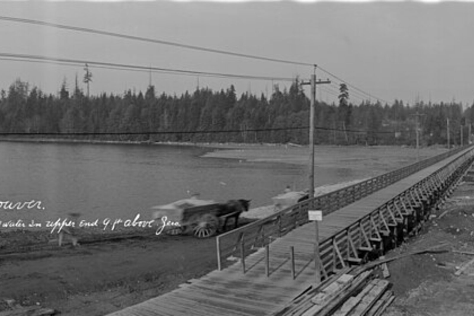
Look around first
What to notice
- Lost Lagoon pond
- The causeway between the pond and Coal Harbour
The story of the place
This is Lost Lagoon—a park pond. Pauline Johnson, a poet and stage performer of Mohawk and English descent, settled in Vancouver in the summer of nineteen oh nine. For seventeen years, she earned her living by performing while traveling across Canada, the United States, and England; books brought in far less money. When breast cancer forced her to stop touring, Johnson rented a modest apartment in the West End and decided to live by literary work.
Canoeing remained her habit. In those years, the water before her was the western end of Coal Harbour. At high tide, the shallow bay filled, and at low tide it left broad mudflats. Long before Johnson, the Squamish gathered shellfish here; one of their names for this place meant “sometimes dries up.”
Johnson came out here in a light canoe. She recalled how, at her favorite time for a walk, low tide left the bay without water for several days in a row. The place where she planned to paddle disappeared. For herself, she called it Lost Lagoon.
The name began to live beyond her daily walk. In one of her own stories, Johnson recalled Joe Capilano, a Squamish chief who passed on stories of his people to her for a future book. He immediately took up the words Lost Lagoon and used them in conversation with her. Johnson then carried the name into prose and poetry.
She prepared her final books while already seriously ill, with help from Vancouver friends. In March nineteen thirteen, Pauline Johnson died. She did not see the name she had coined for her canoeing become a city name: in nineteen twenty-two, the Vancouver Park Board officially assigned it to this water.
By then, people were already destroying the reason Lost Lagoon had appeared. The British landscape architect Thomas Mawson proposed creating a permanent park lake here and building a convenient causeway to Stanley Park instead of the old bridge. The city carried out this plan. In nineteen twenty-six, the causeway finally blocked off the bay and ended the free tidal exchange with Coal Harbour.
The water was turned into a freshwater park pond, where trout were raised, boats were rented out, and later a bird sanctuary was created. The cost of blocking the tide is now visible elsewhere: most of Lost Lagoon is less than one meter deep, the water stagnates, and algae spread in summer and autumn.
The causeway still runs between Lost Lagoon and Coal Harbour. Beneath it, the water no longer moves freely as it once did; on the map remains the name Johnson coined for the hour when there was nowhere to launch her canoe.
Useful on site
Open section of Stanley Park; park hours are usually 06:00-22:00. Nature House hours are separate.
Checked: June 26, 2026. Check the official source before visiting.Observe from the path and leave the birds space by the water.