 Guide On Map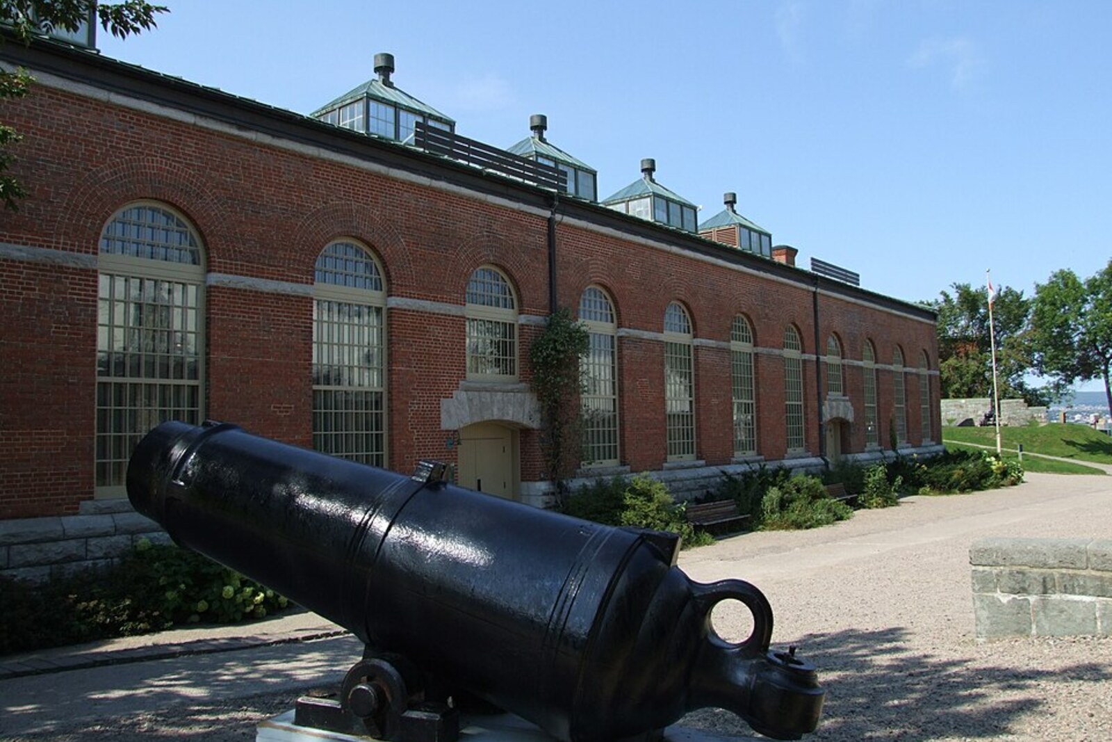

This place does not have an audited photo yet.
Selected place
Artillery Park
Local name: Parc de l’Artillerie
Here, one restoration project will make you decide what matters more: a coherent image of the past or traces of its different periods.
Start with 24 highlights or open the complete catalog of 149 curated places.
Highlights include Artillery Park, Basilica-Cathedral of Notre-Dame de Québec, Château Frontenac, Citadel of Québec, from the outside, Côte de la Montagne, Dufferin Terrace.
We have connected important places into ready-made walks with a clear order, stories and practical details.
Start with 24 highlights, or reveal all 149 curated places.
Local name: Parc de l’Artillerie
Here, one restoration project will make you decide what matters more: a coherent image of the past or traces of its different periods.
Here, one restoration project will make you decide what matters more: a coherent image of the past or traces of its different periods.
Here, the history of a restored colony leads to the lost burial place of its founder.
The hotel links the tourist image of the old city with a closed wartime meeting.
Beyond the military ramparts lies a place where the Allies agreed on the rules for secret scientific cooperation.
The descent will explain why the main link between the city’s two levels became a conflict between defense and movement.
This is where the story begins of how the city’s residents adapted the military edge of the cliff for peaceful life.
The military parade ground will reduce a vast imperial campaign to a single line beside a volunteer's surname.
This is where the story begins of how a dismantled urban object found a new place in front of Québec City's main political facade.
The final stop concludes the route with a path conceived alongside the rescue of the walls, but built almost a century later.
A private mansion adds to the government facades the story of a family building an expensive home at a dangerous moment for its business.
These gates were needed to reconcile preserving the wall with a new route through the city.
The tower will turn the museum’s discussion of war into an examination of a specific decision made without the authorities’ permission.
The finale will show how a museum exhibition gave a rejected artist public recognition and changed his standing in his homeland.
This stop connects the church's name with two attempts to capture Quebec City.
This stop presents the parliament not only as a place where laws are passed, but also as a space for personal decisions in moments of attack.
This stop will show how ordinary townspeople were turned into a reserve for the defense.
Here, the military strip in front of the wall would successively become a residential suburb, a market, and a public square.
Here you will see why a symbol of royal power could become an obstacle to the market.
Here, the name of a famous landscape will connect with several former functions of a single military building.
Here you will see how an official memorial was altered after its design collided with the everyday life of the street.
The finale will show how the tenants kept the houses and the choice of neighboring shops for themselves.
This stop will show how urban transport first destroyed the old passage and then determined the form of the new one.
Here, the present decorative arch marks the site of a real fort entrance, toward which the defeated army was retreating.
This stop is here for the story of what was carried out of the fire and why one closed door decided the archive's fate.
Nearest audio-route stop: Place d’Armes — 150 m in a straight line, route Old Québec: From the Cliff to the River
Nearest audio-route stop: Governors’ Promenade — 40 m in a straight line, route Québec City’s Fortified Walls: Gates and the Citadel
Nearest audio-route stop: Promenade des Premiers-Ministres — 130 m in a straight line, route Québec City: Parliament Quarter and the Plains of Abraham
Nearest audio-route stop: Côte de la Montagne — 60 m in a straight line, route Old Québec: From the Cliff to the River
Nearest audio-route stop: Saint-Jean Gate — 90 m in a straight line, route Québec City’s Fortified Walls: Gates and the Citadel
Nearest audio-route stop: Basilica-Cathedral of Notre-Dame de Québec — 40 m in a straight line, route Old Québec: From the Cliff to the River
Nearest audio-route stop: Citadel of Québec, from the outside — 20 m in a straight line, route Québec City’s Fortified Walls: Gates and the Citadel
Nearest audio-route stop: Place d’Youville — 120 m in a straight line, route Québec City’s Fortified Walls: Gates and the Citadel
Nearest audio-route stop: Grande Allée — 120 m in a straight line, route Québec City: Parliament Quarter and the Plains of Abraham
Nearest audio-route stop: National Museum of Fine Arts of Québec — 10 m in a straight line, route Québec City: Parliament Quarter and the Plains of Abraham
Nearest audio-route stop: Governors’ Promenade — 100 m in a straight line, route Québec City’s Fortified Walls: Gates and the Citadel
Nearest audio-route stop: National Museum of Fine Arts of Québec — 140 m in a straight line, route Québec City: Parliament Quarter and the Plains of Abraham
Nearest audio-route stop: Kent Gate — 40 m in a straight line, route Québec City’s Fortified Walls: Gates and the Citadel
Nearest audio-route stop: Martello Tower 1 — 110 m in a straight line, route Québec City: Parliament Quarter and the Plains of Abraham
Nearest audio-route stop: Saint-Jean Gate — 60 m in a straight line, route Québec City’s Fortified Walls: Gates and the Citadel
Nearest audio-route stop: Rue du Petit-Champlain — 60 m in a straight line, route Old Québec: From the Cliff to the River
Nearest audio-route stop: Basilica-Cathedral of Notre-Dame de Québec — 90 m in a straight line, route Old Québec: From the Cliff to the River
Nearest audio-route stop: Parliament Building — 100 m in a straight line, route Québec City: Parliament Quarter and the Plains of Abraham
Nearest audio-route stop: Place Royale — 60 m in a straight line, route Old Québec: From the Cliff to the River
Nearest audio-route stop: Basilica-Cathedral of Notre-Dame de Québec — 100 m in a straight line, route Old Québec: From the Cliff to the River
Nearest audio-route stop: Kent Gate — 60 m in a straight line, route Québec City’s Fortified Walls: Gates and the Citadel
Nearest audio-route stop: Fontaine de Tourny — 150 m in a straight line, route Québec City: Parliament Quarter and the Plains of Abraham
Nearest audio-route stop: Voltigeurs de Québec Armoury — 40 m in a straight line, route Québec City: Parliament Quarter and the Plains of Abraham
Nearest audio-route stop: Rue du Petit-Champlain — 50 m in a straight line, route Old Québec: From the Cliff to the River
Nearest audio-route stop: Place Royale — 140 m in a straight line, route Old Québec: From the Cliff to the River
Nearest audio-route stop: National Museum of Fine Arts of Québec — 50 m in a straight line, route Québec City: Parliament Quarter and the Plains of Abraham
Nearest audio-route stop: Saint-Jean Gate — 60 m in a straight line, route Québec City’s Fortified Walls: Gates and the Citadel
Nearest audio-route stop: Voltigeurs de Québec Armoury — 50 m in a straight line, route Québec City: Parliament Quarter and the Plains of Abraham
Nearest audio-route stop: Place Royale — 30 m in a straight line, route Old Québec: From the Cliff to the River
Nearest audio-route stop: Basilica-Cathedral of Notre-Dame de Québec — 90 m in a straight line, route Old Québec: From the Cliff to the River
Nearest audio-route stop: Governors’ Promenade — 140 m in a straight line, route Québec City’s Fortified Walls: Gates and the Citadel
Nearest audio-route stop: Place Royale — 20 m in a straight line, route Old Québec: From the Cliff to the River
Nearest audio-route stop: Rue du Petit-Champlain — 50 m in a straight line, route Old Québec: From the Cliff to the River
Nearest audio-route stop: Rue du Petit-Champlain — 50 m in a straight line, route Old Québec: From the Cliff to the River
Nearest audio-route stop: Artillery Park — 130 m in a straight line, route Québec City’s Fortified Walls: Gates and the Citadel
Nearest audio-route stop: Artillery Park — 150 m in a straight line, route Québec City’s Fortified Walls: Gates and the Citadel
Nearest audio-route stop: Citadel of Québec, from the outside — 110 m in a straight line, route Québec City’s Fortified Walls: Gates and the Citadel
Nearest audio-route stop: National Museum of Fine Arts of Québec — 60 m in a straight line, route Québec City: Parliament Quarter and the Plains of Abraham
Nearest audio-route stop: Citadel of Québec, from the outside — 90 m in a straight line, route Québec City’s Fortified Walls: Gates and the Citadel
Nearest audio-route stop: Artillery Park — 70 m in a straight line, route Québec City’s Fortified Walls: Gates and the Citadel
Nearest audio-route stop: Côte de la Montagne — 50 m in a straight line, route Old Québec: From the Cliff to the River
Nearest audio-route stop: Dufferin Terrace — 50 m in a straight line, route Old Québec: From the Cliff to the River
Nearest audio-route stop: Basilica-Cathedral of Notre-Dame de Québec — 130 m in a straight line, route Old Québec: From the Cliff to the River
Nearest audio-route stop: Martello Tower 1 — 130 m in a straight line, route Québec City: Parliament Quarter and the Plains of Abraham
Nearest audio-route stop: Dufferin Terrace — 60 m in a straight line, route Old Québec: From the Cliff to the River
Access and construction years come from OpenStreetMap and Wikidata, snapshot of August 25, 2026: database data, not a check on the ground.