 Guide On Map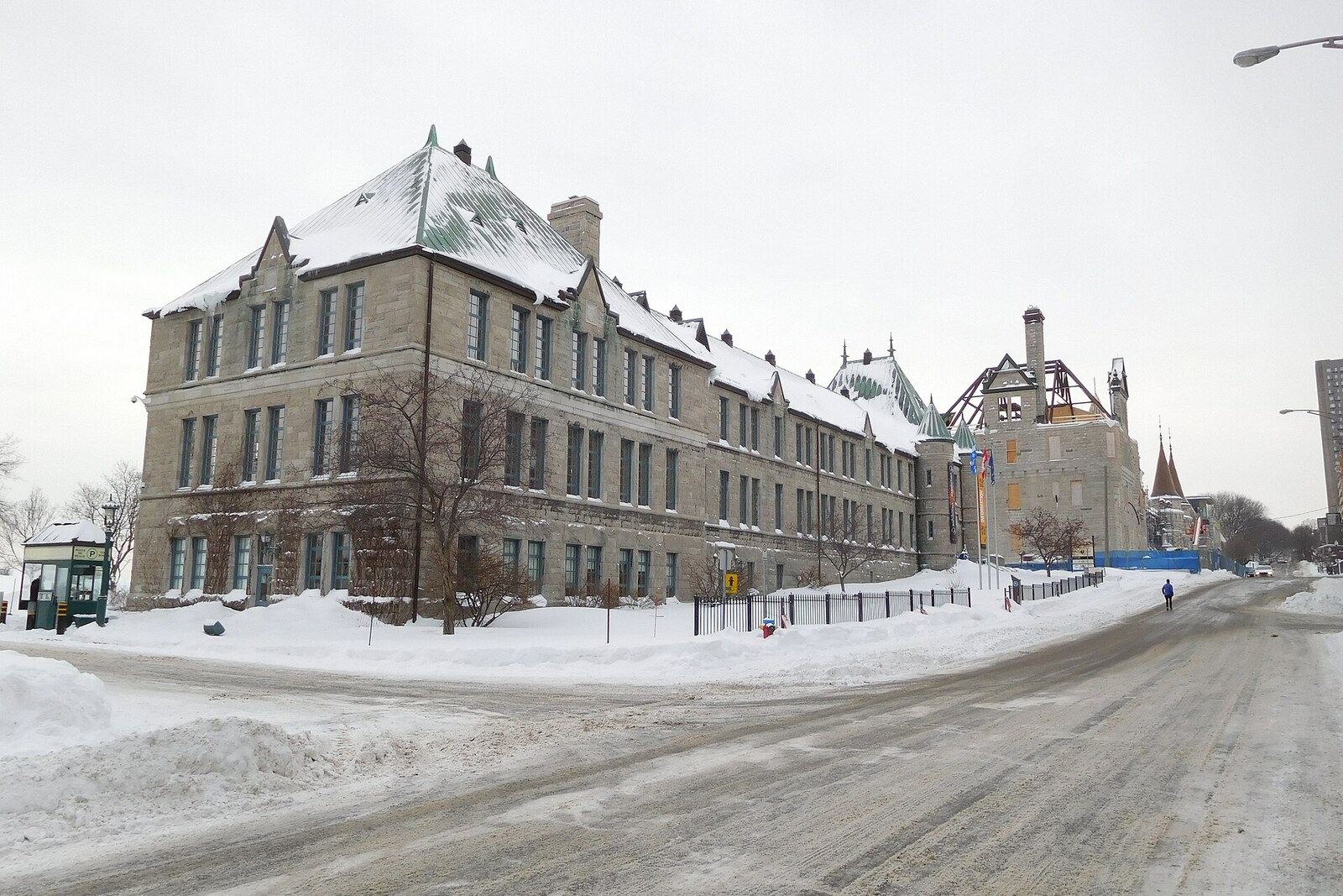
Look around first
What to notice
- Limestone walls
- Copper roof
- Conical turrets
- Museum sign
The story of the place
Beneath the museum sign stands a building with limestone walls, a steep copper roof, and small turrets, like a scaled-down French château beside the Voltigeurs de Québec Armoury. Its rooms once served as naval classrooms: residents of Québec City were prepared for service, while outside almost everything remained the same. Now this is where walks through the Plains of Abraham begin, park maps are collected, and weapons, uniforms, plans, and finds connected with the siege of the city are displayed.
When this building opened in nineteen thirty-nine, visitors were not invited here. The Canadian military department housed a service that inspected and tested weapons and ammunition. Nearby stood the Dominion Arsenal, a state factory for cartridges and shells. Inspectors checked its products, dealt with military complaints about weapons, and conducted comparative tests. Whether the next batch would be accepted depended on their conclusion.
Previously, these specialists worked in different rooms. The new building brought them together in a single service with the chief inspector of weapons and ammunition. Architects Ludger Robitaille and Gabriel Desmeules received a thoroughly modern technical brief, but made the facade resemble a French château: limestone walls, a high copper roof, and turrets with conical caps. In this way, the laboratory and offices visually continued the nearby Voltigeurs de Québec Armoury.
In May nineteen forty-seven, some of the rooms were given to Canadian naval reservists. They called their shore establishment HMCS Montcalm, in honor of Louis-Joseph de Montcalm, the French commander who tried to hold Québec City during the siege of seventeen fifty-nine. A naval unit on land was considered a ship, so it had a ship’s name, emblem, and motto. Gradually, the reservists occupied the whole building, set up classrooms and offices here, and prepared residents of Québec City for naval service. The interior layout was remodeled for them; the stone walls, windows, turrets, and copper roof remained.
In nineteen ninety-five, the sailors moved to the Old Port of Québec. A year later, the building was transferred to the National Battlefields Commission, and in the spring of nineteen ninety-eight a visitors’ pavilion for the park opened here. Later it received its present straightforward name, the Plains of Abraham Museum. Now, maps of the park are handed out in the former military acceptance center, and the exhibition displays weapons, uniforms, plans, and archaeological finds connected with the siege of Québec City and the battles of seventeen fifty-nine and seventeen sixty.
Abraham on the museum sign appeared much earlier than both this building and the famous battle. He was Abraham Martin, known as the Scot, one of the first French settlers of Québec City. Around sixteen twenty, he arrived here with his wife Marguerite Langlois and earned a living by fishing and piloting vessels along the St. Lawrence River. When the English occupied Québec City in sixteen twenty-nine, the family left for France. After the colony was returned to the French, the Martins came back.
In sixteen thirty-five, the Company of New France allotted Abraham twelve arpents of land on the heights, about four hectares. Samuel de Champlain, the founder of Québec City, gave the couple six hundred livres specifically for clearing the plot and for food. Martin left his former trade and became a farmer. He received another twenty arpents ten years later. Residents grew used to meeting the Martins on the heights and began to speak of the Heights of Abraham.
This name does not mark the precise boundary of his holdings. A significant part of the present park belonged to other families, while Martin’s land lay mainly farther north, in the area of the modern Saint-Jean-Baptiste neighborhood. Abraham Street is already marked on a map from seventeen thirty-four, but it does not reach the present-day Plains. Over time, the name itself moved along with development: at first it referred to a broad elevated area beyond the city, then to tracts farther and farther west.
After Abraham and Marguerite died, their heirs sold the land to the Ursuline nuns. The family had long ceased to own it when French and British troops met here in September seventeen fifty-nine. The military used the already existing local name, and the battle fixed it on maps. On the present museum sign, two strands in the building’s story remain side by side: the word “museum” replaced the ammunition service and naval classrooms, while Abraham’s name outlived his plot.
Useful on site
The museum and the exhibition about the battles are open daily 09:00–17:00; tickets are sold online and at the desk. Individual free days, discounts, and temporary exhibitions change according to the calendar.
Checked: June 30, 2026. Check the official source before visiting.From outside, the contrast between the peaceful park and the site’s military past is easiest to see. Plan the exhibition with maps and objects as a separate museum visit.