 Guide On Map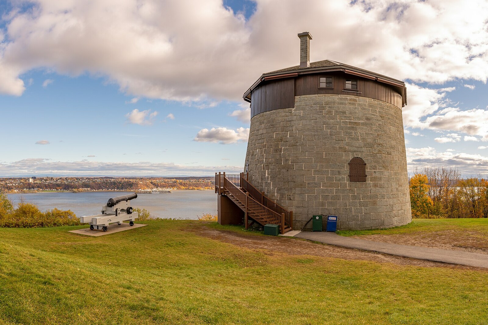
Look around first
What to notice
- Round stone wall
- High door
- Exterior staircase
- Upper parapet
The story of the place
An exterior staircase leads to the high door of the round stone tower; when a garrison served here, the ladder was pulled inside. Gunpowder and supplies were stored below, artillerymen lived on the floor above, and positions for three guns were prepared on the upper platform. Martello Tower 1 stood at the end of a chain of four fortifications above the Saint Lawrence River, and their garrisons kept the gaps between neighboring structures under fire. The thicker wall faces west, the thinner one faces the city, so that if the tower were captured, the city’s own artillerymen could destroy it before its guns were turned against Québec City.
In the spring of eighteen oh eight, James Craig, Governor General of British North America, had to decide how to defend Québec City against a possible attack by the United States. The instructions received from London contradicted one another: if war was close, temporary fortifications were to be erected in haste; if it could be avoided, permanent ones were to be repaired. Craig did not know which outcome was more likely, but he clearly saw the city’s weak point. Open high ground lay west of the fortress walls, where a besieging army could place its guns.
The military engineer Ralph Henry Bruyère had long been seeking money for a forward line of fortifications across the Plains of Abraham. Craig agreed with him, but did not wait for approval from London. Discussing the project would have taken up the construction season. The governor ordered the work to begin using military funds, and informed his superiors when four towers were already under construction. He was breaking instructions and was personally responsible for the decision; London ultimately accepted the fait accompli.
Bruyère intended to use the round towers in Halifax as a model, but Craig chose the Martello type, which he knew from earlier service. The name arose from a foreign military defeat. In seventeen ninety-four, British ships unsuccessfully shelled a small French tower at Cape Mortella in Corsica. British engineers copied the successful fortification, and “Mortella” became “Martello” in their documents.
The four Québec City towers were given numbers. Martello Tower 1 occupied the end of the line above the Saint Lawrence River. The others continued the chain across the cape, so that the garrisons could fire into the gaps between the structures and keep siege artillery from reaching the city walls.
The stonework here was designed for two possible outcomes of battle at once. On the western side, from which the enemy was expected, the wall is about three and one-third meters thick. On the Québec City side, it is almost twice as thin. If the enemy captured the tower, the city’s artillerymen could destroy it and prevent its guns from being turned against the fortress. The only door was raised above the ground and faced the city; soldiers entered by a ladder, then pulled it inside. Gunpowder and supplies were stored below, artillerymen lived on the floor above, and three guns were to stand on the upper platform.
Bruyère completed the line in early eighteen twelve. That same summer, the United States declared war on the United Kingdom of Great Britain and Ireland, but American troops did not reach Québec City. None of the four towers entered combat, and by the eighteen sixties the military already considered them obsolete.
Today, a permanent exterior staircase leads to the high door of Martello Tower 1, and an exhibition is housed inside. The thin wall on the city side remains intact: Québec City’s artillerymen never had to destroy their own tower.
Useful on site
The tower can be viewed from outside during park access hours. Interior summer viewing in 2026 is announced from 1 July to 7 September, daily 09:00–17:00; there are three levels inside and no accessibility for people with limited mobility.
Checked: June 30, 2026. Check the official source before visiting.Walk around the tower as much as the open space allows: its defensive purpose is clearer when viewed from different sides. The interior layout is accessible only as part of authorized visits.