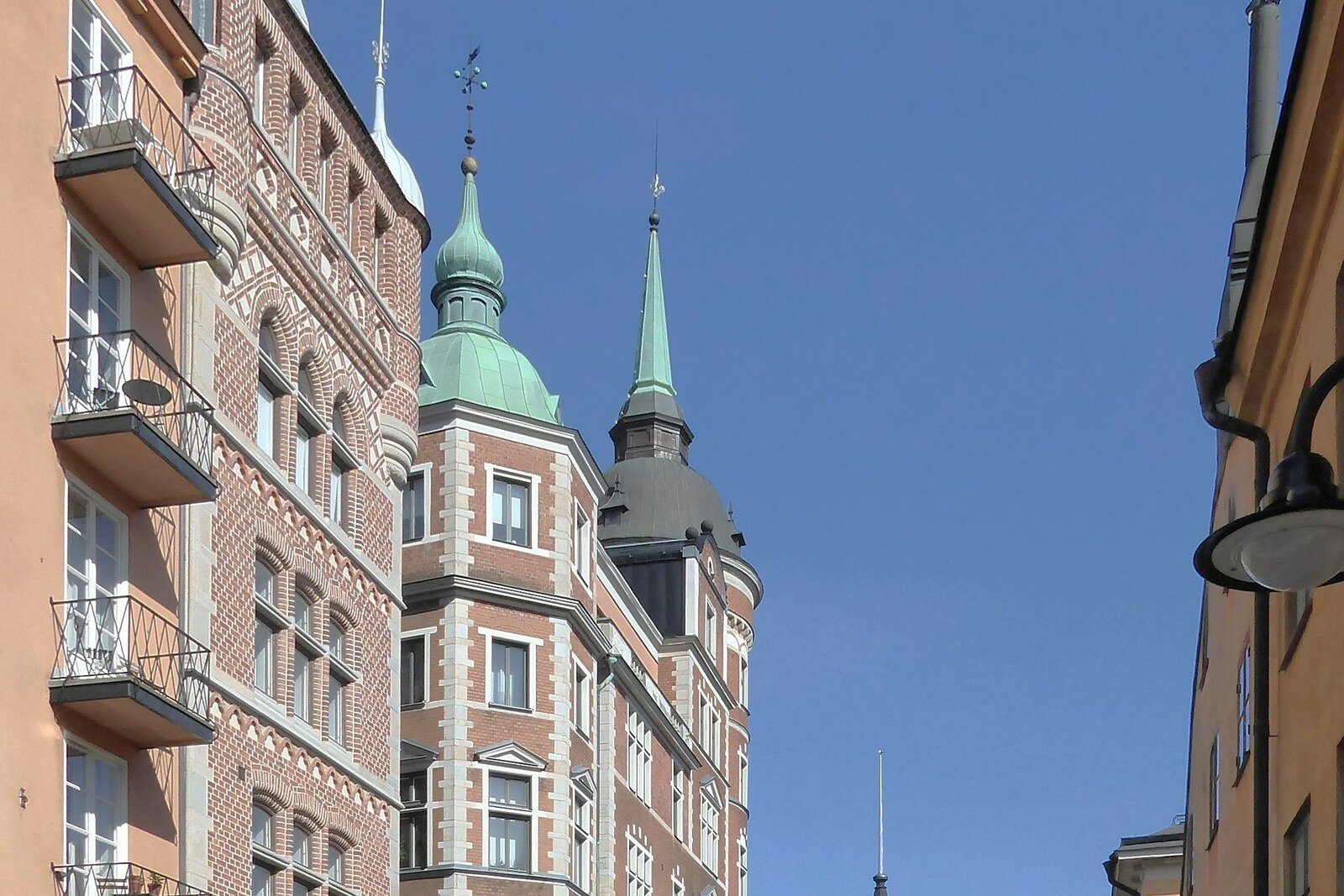
Bellmansgatan and Mariahissen History Bellmansgatan and Mariahissen: story on the “Södermalm Above the Water: Heights, Elevators, and Old Streets” route The interrupted route from the steamboat to the upper streets preserves both a business calculation and an unsettling city legend.
Djurgårdsbron History Djurgårdsbron: story on the “Djurgården: museums, rides, and gardens” route Here the transition from the city to the former royal grounds begins, and you will learn why the current crossing was preceded by a series of unreliable bridges.
Fjällgatan History Fjällgatan: story on the “Södermalm Above the Water: Heights, Elevators, and Old Streets” route The final panorama comes together through two decisions: to clear the edge above the harbor and to preserve the modest houses opposite.
Galärvarv Cemetery History Galärvarv Cemetery: story on the “Djurgården: museums, rides, and gardens” route Here, the ship's story continues with the fate of the people found and the careful attempt to restore a name to one of them.
Gröna Lund History · built 1883 Gröna Lund: story on the “Djurgården: museums, rides, and gardens” route The park will help you see Djurgården not as a museum preserve, but as a place of family business, competition, and risky decisions.
Ivar Lo's Park and Bastugatan twenty-one History Ivar Lo's Park and Bastugatan twenty-one: story on the “Södermalm Above the Water: Heights, Elevators, and Old Streets” route An ordinary one-room apartment will connect the city slope with the rural workers’ struggle for cash wages.
Köpmangatan History Köpmangatan: story on the “Gamla stan and Riddarholmen: Who Owned the City” route The surviving name helps trace the route goods took from the shore to the city’s main market.
Kungliga slottet History Kungliga slottet: story on the “Gamla stan and Riddarholmen: Who Owned the City” route A brief chase inside the residence will explain why the present royal family belongs to a different dynasty.
Maria Magdalena Church History Maria Magdalena Church: story on the “Södermalm Above the Water: Heights, Elevators, and Old Streets” route The surviving medieval masonry will take the route back to a time when this slope was a dangerous approach to Stockholm.
Mårten Trotzigs gränd History Mårten Trotzigs gränd: story on the “Gamla stan and Riddarholmen: Who Owned the City” route One city address shows how private property can outlive its owner in a street name.
Monteliusvägen History Monteliusvägen: story on the “Södermalm Above the Water: Heights, Elevators, and Old Streets” route The fence and retaining walls will show the price paid to separate the shared view from private gardens.
Mosebacke and Södra Teatern History Mosebacke and Södra Teatern: story on the “Södermalm Above the Water: Heights, Elevators, and Old Streets” route The theater terrace will show just how far entertainment promoters were willing to go for a paying audience.
Nordic Museum History Nordic Museum: story on the “Djurgården: museums, rides, and gardens” route This stop will show how the household collection of two spouses grew into a museum for which only part of the planned building was ever constructed.
Riddarholmskyrkan History Riddarholmskyrkan: story on the “Gamla stan and Riddarholmen: Who Owned the City” route The final stop will conclude the route with a dispute over who decided the fate of a royal burial.
Rosendals Trädgård History Rosendals Trädgård: story on the “Djurgården: museums, rides, and gardens” route The finale will show an old training farm that gardeners turned into a self-financing cycle from garden bed to kitchen and back again.
Skansen History Skansen: story on the “Djurgården: museums, rides, and gardens” route Here Hazelius’s museum idea unfolds through the work of women who replaced the costumed mannequins in the old houses.
Skinnarviksberget History Skinnarviksberget: story on the “Södermalm Above the Water: Heights, Elevators, and Old Streets” route Here you will learn why the name of a vanished craft remained on the highest natural point in the old city.
Slottsbacken History Slottsbacken: story on the “Gamla stan and Riddarholmen: Who Owned the City” route Here, a pair of official gifts shows how the city and the monarchy expressed their mutual gratitude.
Slussen and Katarinahissen History Slussen and Katarinahissen: story on the “Södermalm Above the Water: Heights, Elevators, and Old Streets” route Here, the natural difference in water levels and the city's difference in elevation come together in a single transport hub.
Storkyrkan History Storkyrkan: story on the “Gamla stan and Riddarholmen: Who Owned the City” route A medieval sculpture will connect a personal vow, a military victory, and the struggle to govern Sweden.
Stortorget History Stortorget: story on the “Gamla stan and Riddarholmen: Who Owned the City” route The square will help trace how the promised reconciliation turned into the collapse of an entire political union.
Tyska kyrkan History Tyska kyrkan: story on the “Gamla stan and Riddarholmen: Who Owned the City” route The history of a shared house of worship shows how two language communities fought for the right to a single building.
Vasa Museum History Vasa Museum: story on the “Djurgården: museums, rides, and gardens” route The route’s main stop brings together a dangerous test, a first voyage, a search on the seabed, and the ship’s rescue over many years.
ABBA: The Museum Museums Adolf Fredrik Church Sacred sites Anders Franzéns park Parks Aquaria water museum History Artists' House of Stockholm History Arvfurstens palats History Axel Oxenstierna Palace History Nearest audio-route stop: Storkyrkan — 80 m in a straight line, route Gamla stan and Riddarholmen: Who Owned the City
Baltic Sea Science Center History Bellevue park Parks Bergian botanic garden Parks Berzelii park Parks Biological museum Museums Birger Jarls torg Streets and squares Nearest audio-route stop: Riddarholmskyrkan — 60 m in a straight line, route Gamla stan and Riddarholmen: Who Owned the City
Black Friars' Monastery of Stockholm Sacred sites Nearest audio-route stop: Mårten Trotzigs gränd — 50 m in a straight line, route Gamla stan and Riddarholmen: Who Owned the City
Blekholmen Parks Blomsterdalen Parks Bonde Palace History Brända tomten Streets and squares Nearest audio-route stop: Köpmangatan — 50 m in a straight line, route Gamla stan and Riddarholmen: Who Owned the City
Brantingtorget Streets and squares Nearest audio-route stop: Storkyrkan — 140 m in a straight line, route Gamla stan and Riddarholmen: Who Owned the City
Brunkebergstorg Streets and squares Central Post Office of Stockholm History Engelbrecht Church Sacred sites Estonia memorial History Nearest audio-route stop: Galärvarv Cemetery — 50 m in a straight line, route Djurgården: museums, rides, and gardens
Fåfängan History Finnish Church Sacred sites Nearest audio-route stop: Köpmangatan — 50 m in a straight line, route Gamla stan and Riddarholmen: Who Owned the City
Folkoperan Museums Franska reformerta församlingens hus, Stockholm Sacred sites Fridhemsplan Streets and squares Gåstorget Streets and squares Nearest audio-route stop: Stortorget — 120 m in a straight line, route Gamla stan and Riddarholmen: Who Owned the City
Gullmarsplan Streets and squares Gustaf Adolf Church Sacred sites Gustaf Vasa Church Sacred sites Gustav Adolfs torg Streets and squares Gustav III's Pavilion History Haga Palace History Hallwyl Museum Museums Hedvig Eleonora Church Sacred sites Högalid Church Sacred sites Högvaktsterrassen Streets and squares Nearest audio-route stop: Storkyrkan — 60 m in a straight line, route Gamla stan and Riddarholmen: Who Owned the City
Hötorget Streets and squares Humlegården Parks Index-The Swedish Contemporary Art Foundation Museums Insane History Nearest audio-route stop: Gröna Lund — 70 m in a straight line, route Djurgården: museums, rides, and gardens
Järntorget Streets and squares Nearest audio-route stop: Mårten Trotzigs gränd — 40 m in a straight line, route Gamla stan and Riddarholmen: Who Owned the City
Jetline History Nearest audio-route stop: Gröna Lund — 60 m in a straight line, route Djurgården: museums, rides, and gardens
Junibacken Museums Kaknästornet History Karl Johans torg Streets and squares Karlaplan Parks Karlberg Palace History Katarina Bangata History Katarina Church Stockholm Sacred sites Katarina gångbro History Nearest audio-route stop: Mosebacke and Södra Teatern — 50 m in a straight line, route Södermalm Above the Water: Heights, Elevators, and Old Streets
Klara Church Sacred sites Köpmantorget Streets and squares Nearest audio-route stop: Köpmangatan — 70 m in a straight line, route Gamla stan and Riddarholmen: Who Owned the City
Kornhamnstorg Streets and squares Nearest audio-route stop: Mårten Trotzigs gränd — 80 m in a straight line, route Gamla stan and Riddarholmen: Who Owned the City
Kronobergsparken Parks Kulturhuset Stadsteatern Museums Kungsholmen Church Sacred sites Kungsträdgården Parks Leksaksmuseet Museums Liljevalchs konsthall Museums Mälartorget Streets and squares Maria Magdalena Church Sacred sites Nearest audio-route stop: Bellmansgatan and Mariahissen — 50 m in a straight line, route Södermalm Above the Water: Heights, Elevators, and Old Streets
Mariatorget Parks Maritime Museum Museums Medborgarplatsen Streets and squares Millesgården Museums Milliken Gallery Museums Moderna Museet Museums Monster History Nearest audio-route stop: Gröna Lund — 80 m in a straight line, route Djurgården: museums, rides, and gardens
Munkbron Streets and squares Nearest audio-route stop: Riddarholmskyrkan — 130 m in a straight line, route Gamla stan and Riddarholmen: Who Owned the City
Museum of Ethnography Museums Museum of Far Eastern Antiquities Museums Museum of Medieval Stockholm Museums Museum of Mediterranean and Near Eastern Antiquities Museums Mynttorget Streets and squares Nearest audio-route stop: Storkyrkan — 140 m in a straight line, route Gamla stan and Riddarholmen: Who Owned the City
National Museum of Science and Technology Museums Nationalmuseum Museums Nobel Prize Museum Museums Nearest audio-route stop: Stortorget — 20 m in a straight line, route Gamla stan and Riddarholmen: Who Owned the City
Norra Bantorget Parks Norrmalmstorg Streets and squares Nybroplan Streets and squares Nytorget Streets and squares Odenplan Streets and squares Oscars Church Sacred sites Östermalm Market Hall Streets and squares Östermalmstorg Streets and squares Prince Eugens Waldemarsudde Museums Rålambshovsparken Parks Riddarhustorget Streets and squares Nearest audio-route stop: Riddarholmskyrkan — 130 m in a straight line, route Gamla stan and Riddarholmen: Who Owned the City
Ritz Museums Rosendal Palace Museums Royal Armoury Museums Nearest audio-route stop: Kungliga slottet — 80 m in a straight line, route Gamla stan and Riddarholmen: Who Owned the City
Royal Chapel Sacred sites Nearest audio-route stop: Kungliga slottet — 70 m in a straight line, route Gamla stan and Riddarholmen: Who Owned the City
Royal National City Park Parks Saint James's Church Sacred sites Saint John's Church Sacred sites Saint Sava Serbian Orthodox Church Sacred sites Sergels torg Streets and squares Skansen History Nearest audio-route stop: Skansen — 50 m in a straight line, route Djurgården: museums, rides, and gardens
Södermalmstorg Streets and squares Nearest audio-route stop: Slussen and Katarinahissen — 50 m in a straight line, route Södermalm Above the Water: Heights, Elevators, and Old Streets
Sofia Church Sacred sites Spårvägsmuseet Museums St. Eric's Cathedral, Stockholm Sacred sites Stockholm City Museum Museums Nearest audio-route stop: Slussen and Katarinahissen — 40 m in a straight line, route Södermalm Above the Water: Heights, Elevators, and Old Streets
Stockholm Court House History Stockholm Mosque Sacred sites Stockholm Observatory Museums Stockholm Palace Museums Nearest audio-route stop: Kungliga slottet — 30 m in a straight line, route Gamla stan and Riddarholmen: Who Owned the City
Stockholm Synagogue Sacred sites Strömparterren Parks Stureparken Parks Stureplan Streets and squares Swedish Army Museum Museums Swedish Centre for Architecture and Design Museums Swedish Film Institute Museums Swedish History Museum Museums Swedish House of Nobility History Nearest audio-route stop: Riddarholmskyrkan — 150 m in a straight line, route Gamla stan and Riddarholmen: Who Owned the City
Swedish Museum of Natural History Museums Tantolunden Parks Tegnérlunden Parks Tessin Palace History Nearest audio-route stop: Köpmangatan — 90 m in a straight line, route Gamla stan and Riddarholmen: Who Owned the City
Thiel Gallery Museums Twister History Nearest audio-route stop: Gröna Lund — 90 m in a straight line, route Djurgården: museums, rides, and gardens
Tyska brunnsplan Streets and squares Nearest audio-route stop: Tyska kyrkan — 70 m in a straight line, route Gamla stan and Riddarholmen: Who Owned the City
Ulriksdal Palace History Ulvsunda Castle History Vanadislunden Parks Vasa Museum Museums Nearest audio-route stop: Vasa Museum — 70 m in a straight line, route Djurgården: museums, rides, and gardens
Vasaparken Parks Vera Siöcronas torg Streets and squares Nearest audio-route stop: Stortorget — 110 m in a straight line, route Gamla stan and Riddarholmen: Who Owned the City
Wetterling Gallery Museums Willy Brandts Park Parks Wrangel Palace History Nearest audio-route stop: Riddarholmskyrkan — 130 m in a straight line, route Gamla stan and Riddarholmen: Who Owned the City
 Guide On Map