 Guide On Map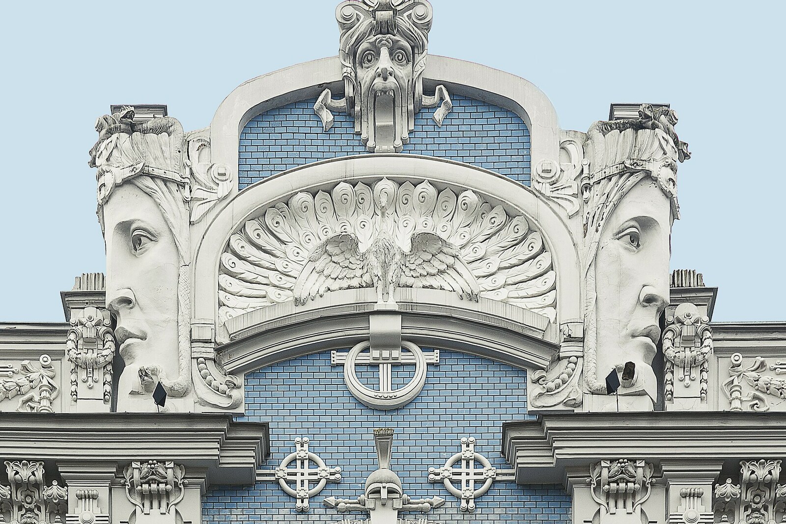

This place does not have an audited photo yet.
Selected place
10b Elizabetes Street
Local name: Elizabetes iela 10b
Here you will see which part of the famous facade appeared in Riga and which came from a printed album.
Start with 19 highlights or open the complete catalog of 138 curated places.
Highlights include 10b Elizabetes Street, 4a Strēlnieku Street, Bastejkalns, Cathedral of the Nativity of Christ, Eight Antonijas Street, Esplanāde.
We have connected important places into ready-made walks with a clear order, stories and practical details.
Start with 19 highlights, or reveal all 138 curated places.
Local name: Elizabetes iela 10b
Here you will see which part of the famous facade appeared in Riga and which came from a printed album.
Here you will see which part of the famous facade appeared in Riga and which came from a printed album.
This stop will show how the building became Latvia's contribution to a new international school.
The terrain and the bridge explain why the film crew came under fire and could not cross the canal.
The archbishop’s basement room will link the return of services with the church’s legal recognition.
Here you will see how the position of the staircase determined the design of the entire facade.
The industrial exhibition explains how the city obtained permission to landscape the edges of the military parade ground.
The public laying of flowers will show how the monument once again became a place of open civic action.
A memorial stone links a closed club garden to the first Riga performance in the Latvian language.
Here, a temporary exhibition site will explain the origins of the museum collection and the public park.
A museum purchase will show how controversial modernists became recognized classics.
This is where it will be decided how the Latvian troupe gained a stage, state funding, and a national name.
Here you will distinguish the authentic parts of the architect's apartment from the museum furnishings assembled later.
The final stop will shift the discussion from apartment-building facades to the production facilities hidden in the courtyard.
This stop will show how a dispute over church services turned into a struggle for control of the city's church.
The finale will link a residential house, the defensive wall, and the townspeople’s daily route to the center.
Here, an archival construction dispute invites a closer look at the building's position relative to the street.
Here you will make out which parts of the ensemble the restorer preserved, removed, or moved from other buildings.
Here you will understand how a visiting merchant moved from a temporary association to the rights of a burgher.
A private donation explains why the city garden remained open to everyone.
Nearest audio-route stop: Riga Art Nouveau Centre at 12 Alberta Street — 70 m in a straight line, route Riga's Quiet Centre: Art Nouveau and Apartment Buildings
Nearest audio-route stop: Bastejkalns — 70 m in a straight line, route Boulevard Ring: How Riga Became a Capital
Nearest audio-route stop: Three Brothers — 120 m in a straight line, route Old Riga: a city inside the wall
Nearest audio-route stop: Esplanāde — 50 m in a straight line, route Boulevard Ring: How Riga Became a Capital
Nearest audio-route stop: Freedom Monument — 50 m in a straight line, route Boulevard Ring: How Riga Became a Capital
Nearest audio-route stop: St. Peter's Church — 120 m in a straight line, route Old Riga: a city inside the wall
Nearest audio-route stop: St. Peter's Church — 120 m in a straight line, route Old Riga: a city inside the wall
Nearest audio-route stop: Sixty-Two Dzirnavu Street — 110 m in a straight line, route Riga's Quiet Centre: Art Nouveau and Apartment Buildings
Nearest audio-route stop: St. Peter's Church — 60 m in a straight line, route Old Riga: a city inside the wall
Nearest audio-route stop: Latvian National Opera — 140 m in a straight line, route Boulevard Ring: How Riga Became a Capital
Nearest audio-route stop: Town Hall Square and the House of the Blackheads — 40 m in a straight line, route Old Riga: a city inside the wall
Nearest audio-route stop: Town Hall Square and the House of the Blackheads — 80 m in a straight line, route Old Riga: a city inside the wall
Nearest audio-route stop: Cathedral of the Nativity of Christ — 110 m in a straight line, route Boulevard Ring: How Riga Became a Capital
Nearest audio-route stop: Cathedral of the Nativity of Christ — 90 m in a straight line, route Boulevard Ring: How Riga Became a Capital
Nearest audio-route stop: Cathedral of the Nativity of Christ — 20 m in a straight line, route Boulevard Ring: How Riga Became a Capital
Nearest audio-route stop: Latvian National Museum of Art — 150 m in a straight line, route Boulevard Ring: How Riga Became a Capital
Nearest audio-route stop: Esplanāde — 60 m in a straight line, route Boulevard Ring: How Riga Became a Capital
Nearest audio-route stop: St. Peter's Church — 140 m in a straight line, route Old Riga: a city inside the wall
Nearest audio-route stop: St. Peter's Church — 120 m in a straight line, route Old Riga: a city inside the wall
Nearest audio-route stop: Freedom Monument — 100 m in a straight line, route Boulevard Ring: How Riga Became a Capital
Nearest audio-route stop: Three Brothers — 140 m in a straight line, route Old Riga: a city inside the wall
Nearest audio-route stop: Latvian National Opera — 20 m in a straight line, route Boulevard Ring: How Riga Became a Capital
Nearest audio-route stop: Three Brothers — 60 m in a straight line, route Old Riga: a city inside the wall
Nearest audio-route stop: St. Peter's Church — 90 m in a straight line, route Old Riga: a city inside the wall
Nearest audio-route stop: Three Brothers — 70 m in a straight line, route Old Riga: a city inside the wall
Nearest audio-route stop: St. Peter's Church — 10 m in a straight line, route Old Riga: a city inside the wall
Nearest audio-route stop: Latvian National Opera — 90 m in a straight line, route Boulevard Ring: How Riga Became a Capital
Nearest audio-route stop: Vērmanes Garden — 90 m in a straight line, route Boulevard Ring: How Riga Became a Capital
Access and construction years come from OpenStreetMap and Wikidata, snapshot of August 25, 2026: database data, not a check on the ground.