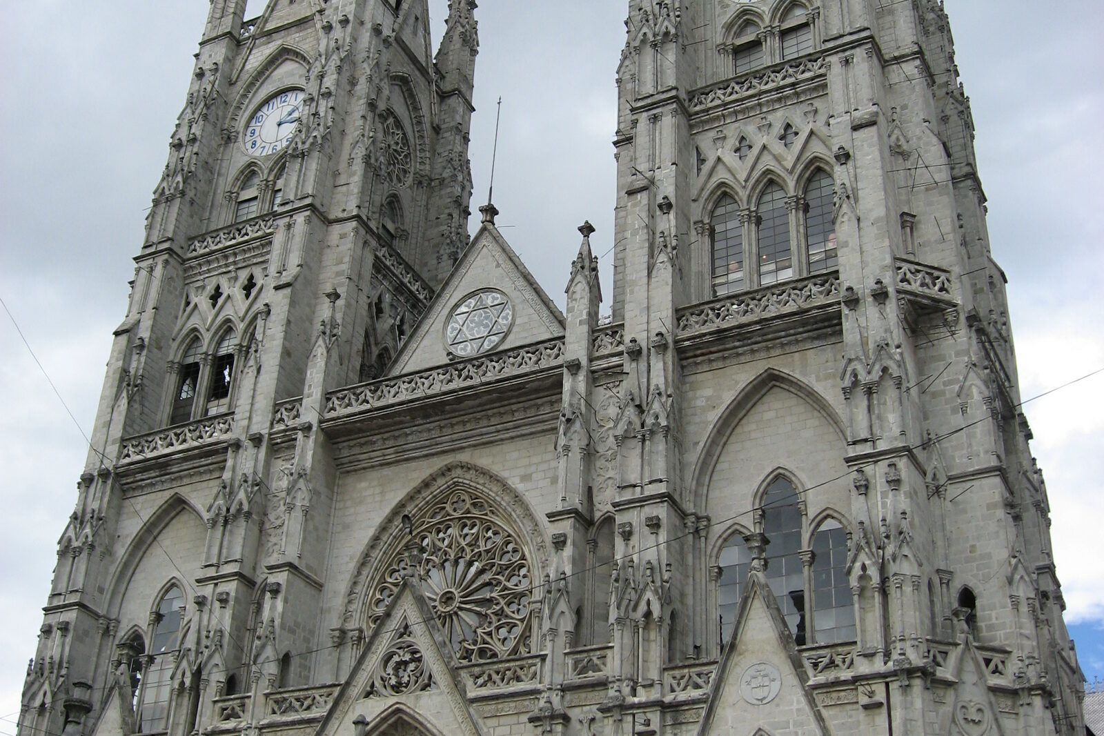
Basilica of the National Vow History Basilica of the National Vow: story on the “Historic Quito: churches, plazas, and La Ronda” route Here, a state religious promise becomes a dispute over the right to speak on behalf of the country, and a long construction project funded by private donations.
Calle Leonardo Tejada History Calle Leonardo Tejada: story on the “Guápulo: Down from Quito to the Sanctuary” route The final stop links the name on the sign to the brothers’ joint work restoring the main altar.
Camino de Orellana History Camino de Orellana: story on the “Guápulo: Down from Quito to the Sanctuary” route The descent will connect today’s route into Guápulo with the expedition that set out from here beyond the Andes and broke apart at the rivers.
Church of the Society of Jesus History Church of the Society of Jesus: story on the “Historic Quito: churches, plazas, and La Ronda” route The gilded interior becomes the setting for the story of how church testimony turned a laywoman’s death into voluntary martyrdom.
Cruz Loma Upper Station History Cruz Loma Upper Station: story on the “TelefériQo and the Pichincha Highlands” route This stop will connect the spur's name with a scientific dispute over the shape of the Earth.
Fray Antonio Rodríguez Museum History Fray Antonio Rodríguez Museum: story on the “Guápulo: Down from Quito to the Sanctuary” route The painted cycle shows how an account passed on to the brotherhood became visible proof of the local cult.
Guápulo Sanctuary History Guápulo Sanctuary: story on the “Guápulo: Down from Quito to the Sanctuary” route A small portable image will explain where the funds for the large church and its decoration came from.
La Ronda History La Ronda: story on the “Historic Quito: churches, plazas, and La Ronda” route A family restaurant concludes the route with the story of a house restored after the loss of its secret room.
Mirador de Guápulo History Mirador de Guápulo: story on the “Guápulo: Down from Quito to the Sanctuary” route Here you will see why the festival begins up high and how much neighborhood work is needed for the shared procession.
Páramo Trail History Páramo Trail: story on the “TelefériQo and the Pichincha Highlands” route Here, the compromise between tourism, community income, and conserving the water-gathering slope will become visible.
Plaza de Guápulo History Plaza de Guápulo: story on the “Guápulo: Down from Quito to the Sanctuary” route This open space shows where personal festival obligations became exchanges among families.
Plaza de San Francisco History Plaza de San Francisco: story on the “Historic Quito: churches, plazas, and La Ronda” route Documents about the blacksmith distinguish the real agreement for a family chapel from the famous legend.
Plaza Grande History Plaza Grande: story on the “Historic Quito: churches, plazas, and La Ronda” route The square will show why taking over several buildings made it possible to change the government without a battle—and why that did not save the conspirators.
Quito Metropolitan Cathedral History Quito Metropolitan Cathedral: story on the “Historic Quito: churches, plazas, and La Ronda” route This stop connects a church-state conflict with an investigation in which the evidence outlived the name of the criminal.
Swing in the Clouds History Swing in the Clouds: story on the “TelefériQo and the Pichincha Highlands” route A simple structure will show what became of the plan for a large entertainment complex.
TelefériQo Departure Station History TelefériQo Departure Station: story on the “TelefériQo and the Pichincha Highlands” route Here you will understand how the line’s design determined the course of the nighttime rescue operation.
Trailhead to Rucu Pichincha History Trailhead to Rucu Pichincha: story on the “TelefériQo and the Pichincha Highlands” route The final stop will show how the cable car changed the old route across the range.
Volcano Platform History Volcano Platform: story on the “TelefériQo and the Pichincha Highlands” route The signboard will help explain why Pichincha’s two peaks bore mixed-up names for so long.
Abya Yala Museums Avenida 12 de Octubre Streets and squares Avenida 24 de Mayo Streets and squares Avenida Juan Montalvo Streets and squares Avenida Patria Streets and squares Avenida Pichincha Streets and squares Basilica of La Merced Sacred sites Calle Antonio Elizalde Streets and squares Calle Ascencio Gandara Streets and squares Calle Benalcázar Streets and squares Nearest audio-route stop: Church of the Society of Jesus — 110 m in a straight line, route Historic Quito: churches, plazas, and La Ronda
Calle Bolívar Streets and squares Nearest audio-route stop: Plaza de San Francisco — 100 m in a straight line, route Historic Quito: churches, plazas, and La Ronda
Calle Briceño Streets and squares Calle Caldas Streets and squares Calle Cuenca Streets and squares Nearest audio-route stop: Plaza de San Francisco — 90 m in a straight line, route Historic Quito: churches, plazas, and La Ronda
Calle Don Bosco Streets and squares Calle Esmeraldas Streets and squares Calle Espejo Streets and squares Nearest audio-route stop: Quito Metropolitan Cathedral — 100 m in a straight line, route Historic Quito: churches, plazas, and La Ronda
Calle Galápagos Streets and squares Calle Guayaquil Streets and squares Calle Jerónimo Carrión Streets and squares Calle Joaquin Pinto Streets and squares Calle José Antepara Streets and squares Calle José Marti Streets and squares Calle Lizardo García Streets and squares Calle Los Ríos Streets and squares Calle Mejía Streets and squares Calle Morales Streets and squares Calle Nicolás Jiménez Streets and squares Calle Olmedo Streets and squares Calle Oriente Streets and squares Calle Rocafuerte Streets and squares Nearest audio-route stop: La Ronda — 130 m in a straight line, route Historic Quito: churches, plazas, and La Ronda
Calle Sucre Streets and squares Nearest audio-route stop: Church of the Society of Jesus — 100 m in a straight line, route Historic Quito: churches, plazas, and La Ronda
Calle Valparaíso Streets and squares Calle Venezuela Streets and squares Casa del Alabado Pre-Columbian Art Museum Museums Nearest audio-route stop: Plaza de San Francisco — 90 m in a straight line, route Historic Quito: churches, plazas, and La Ronda
Cathedral of Quito Sacred sites Nearest audio-route stop: Church of the Society of Jesus — 70 m in a straight line, route Historic Quito: churches, plazas, and La Ronda
Church of Our Lady of Guápulo Sacred sites Nearest audio-route stop: Guápulo Sanctuary — 60 m in a straight line, route Guápulo: Down from Quito to the Sanctuary
Church of Saint Frinci Sacred sites Church of San Agustín Sacred sites Church of Santa Clara de San Millán Sacred sites Church of Santa Teresita Sacred sites Church of the Society of Jesus Sacred sites Nearest audio-route stop: Church of the Society of Jesus — 10 m in a straight line, route Historic Quito: churches, plazas, and La Ronda
Cinemateca Nacional del Ecuador Museums City Museum Museums Coliseo General Rumiñahui Museums Convent of San Diego Museums El Carmen Alto church Sacred sites Estadio Olímpico Atahualpa With children Iglesia de El Carmen Bajo Sacred sites Iglesia de El Sagrario Sacred sites Nearest audio-route stop: Quito Metropolitan Cathedral — 40 m in a straight line, route Historic Quito: churches, plazas, and La Ronda
Iglesia de María Auxiliadora Sacred sites Iglesia de San Blas Sacred sites José Luis Recalde Velodrome With children La Capilla del Hombre Museums La Magdalena Church Sacred sites La Vicentina Streets and squares Monasterio de Santa Clara Sacred sites Nearest audio-route stop: Plaza de San Francisco — 80 m in a straight line, route Historic Quito: churches, plazas, and La Ronda
Museo Ecuadoriano de Ciencias Naturales Museums Palacio del Antiguo Círculo Militar Museums Palacio Gangotena History Nearest audio-route stop: Plaza de San Francisco — 150 m in a straight line, route Historic Quito: churches, plazas, and La Ronda
Panopticon Museums Parque El Ejido Parks Parque La Alameda Parks Parque La Carolina Parks Plaza de San Blas Streets and squares Plaza de Santa Clara Streets and squares Nearest audio-route stop: Plaza de San Francisco — 120 m in a straight line, route Historic Quito: churches, plazas, and La Ronda
Plaza de Santo Domingo Streets and squares Nearest audio-route stop: La Ronda — 60 m in a straight line, route Historic Quito: churches, plazas, and La Ronda
Plaza del Teatro, Quito Streets and squares Plaza Huerto San Agustín Streets and squares Puerta de La Circasiana History Sucre National Theater Museums Teatro Bolívar Museums Templo de La Dolorosa Sacred sites Tercer Milenio Museums Virgin of El Panecillo History Vulqano Park History Nearest audio-route stop: TelefériQo Departure Station — 140 m in a straight line, route TelefériQo and the Pichincha Highlands
 Guide On Map