 Guide On Map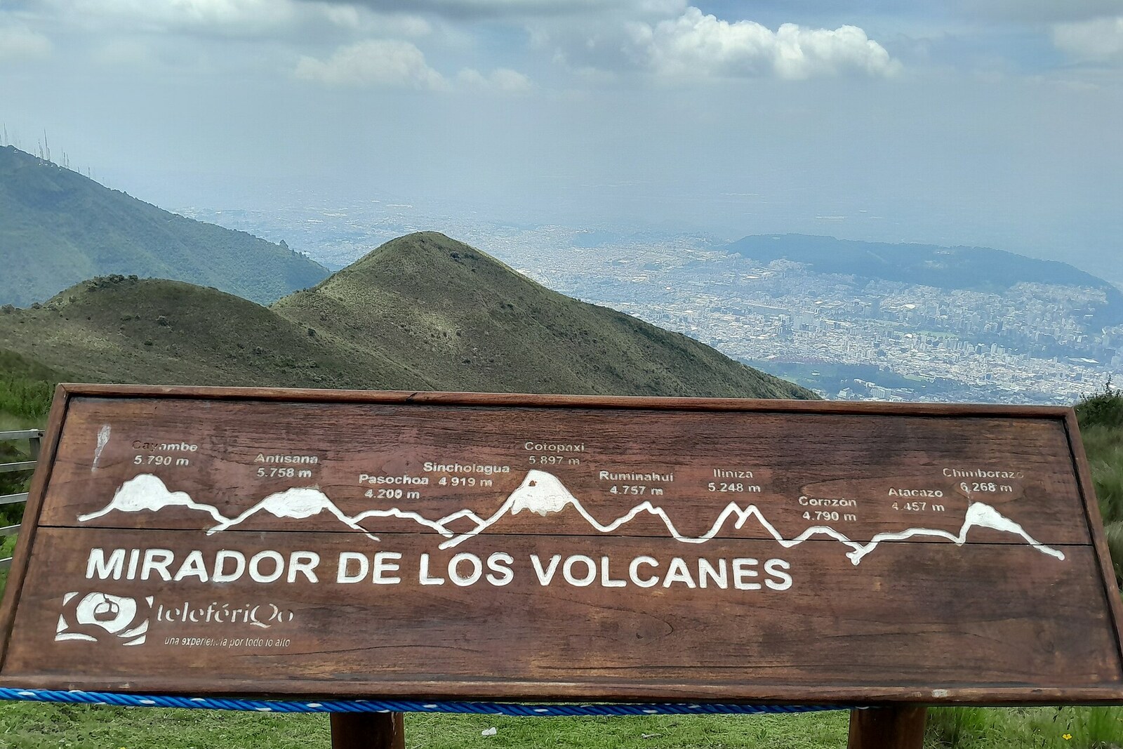
Look around first
What to notice
- Wooden signboard with names and elevations
- Rucu Pichincha
- Mountain peaks to the west
The story of the place
West of Quito, the Pichincha massif does not reveal itself as a single peak: nearer rocks block the more distant ridges, and the crater slips out of view. Rucu Pichincha, the older of the two mountains, has long been inactive; its younger neighbor, Guagua Pichincha, lies farther west and holds a broad vent with sulfur emissions. The wooden sign translates this nearly merged silhouette into separate peaks, elevations, and distances.
At the wooden signboard with names and elevations, people try to distinguish one peak from another. That is exactly why this platform was created. In the early twenty-tens, city specialists and employees of the municipal water company marked out a trail from Jerusalem Ravine to Cruz Loma. They called it the Humboldt Route, connected it to the cable car’s upper station, and placed the signboard here to show the volcanoes as the famous traveler had studied them.
In eighteen oh two, Alexander von Humboldt, a Prussian naturalist who studied the connections among Andean volcanoes, climbed the Pichincha massif three times. He needed not a general view of the mountains, but precise elevations, rock types, and crater structures: an error in a name would have attached the measurements to the wrong peak. However, he took the names Rucu and Guagua from the records of Charles Marie de La Condamine’s earlier geodetic expedition. There, they had been switched.
On April fourteenth, Humboldt climbed the real Rucu Pichincha, but recorded it as Guagua Pichincha. Judging by his diary, it was the only peak in the Ecuadorian Andes that he actually reached. Six weeks later, the naturalist approached the crater of the real Guagua Pichincha from the southeast and called it Rucu. He reached the rim and a rock projecting above the vent, but did not reach the summit itself: it remained about an hour’s journey farther north.
The switch changed the meaning of what he saw. In Kichwa, “ruku” means old, and “guagua” means child. Rucu Pichincha is the older rocky peak, without an active crater. Guagua Pichincha is younger; it was there that Humboldt described a broad vent and sulfur emissions. This meant that his “old” volcano was young and active, while the “child” was old and extinct. Later researchers corrected the mistake by matching the names not with the headings in his diary, but with the terrain and his own descriptions.
From here, the reason for the confusion is especially clear. Rucu Pichincha stands closer to Quito; Guagua lies farther west, and its crater is hidden from the city. The wooden signboard on the Volcano Platform does the job that the eighteenth-century records failed at: it fixes the correct name to the correct mountain.
Useful on site
The open platform is accessible during TelefériQo operating hours; visibility depends on clouds and rain.
Checked: June 29, 2026. Check the official source before visiting.Do not approach the unprotected edge for a photo, and do not expect the open view to last for long. If a thunderstorm approaches, head to the station.