 Guide On Map
TelefériQo and the Pichincha Highlands
From the lower station through Cruz Loma to the trail toward Rucu Pichincha
Guide On Map on your phone
Open the walk like a regular app
It takes about 10 seconds to install. No app store needed.
The whole path
Route map
About the walk
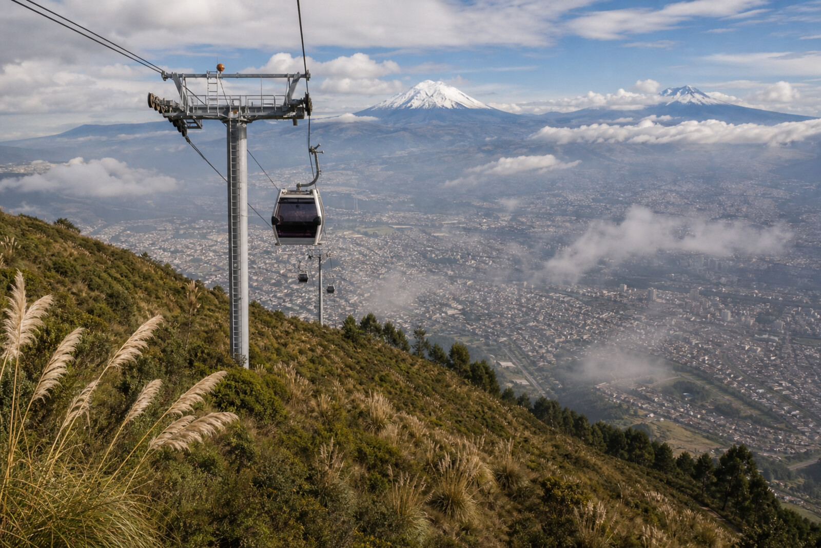
You will begin at the lower station and rise above two ravines toward Cruz Loma. Behind the glass, Quito will drop away, and once you step out of the cabin, the city’s edge will give way to páramo—tough grass, low shrubs, and Pichincha’s open slope.
From there, the route runs from the upper station to the volcano signboard, the swings on the eastern slope, and a narrow trail that keeps people in a single lane. At its end begins the climbers’ route toward Rucu Pichincha.
This is not simply a story about a beautiful view. You will find out why passengers once spent a night above the slope, why a cross stood on the ridge, how two peaks traded names, and why a tourist trail became an ecological compromise. The answers will appear where you can check them against the terrain, the signboard, or the workings of the station.
After this walk, you will see Cruz Loma as a boundary between a city attraction, water-gathering páramo, and an old mountain route.
Why this order
The lower station comes first because the line begins here, and the cabin carries you to a place named after an old geodetic marker. Near the upper station, a platform with a wooden signboard helps distinguish the mountains, one of which the final stretch will approach. From the signboard, the route heads to the eastern slope and the swings: after the broad view of Pichincha, you will see an attraction left over from another idea for developing Cruz Loma. The path then returns behind the station and continues along a narrow páramo trail. Here, the entertainment area gives way to community land, and the strip beneath your feet shows why visitors are kept on one path. The trail leads to a sign at the edge of the complex—the point where this walk ends and an independent route toward Rucu Pichincha begins.
Those who want to see Quito from above and understand how the surrounding slope works Those interested in mountain routes without climbing to the summit Those who enjoy stories of engineering, scientific mistakes, and changing landscapes
Those looking for a walk only through the historic center Those who are not comfortable in open high-altitude terrain Those expecting to reach the summit within this route
Before you go
Before setting out, check whether the cable car is running and what the weather is like at the upper station: conditions in the city say nothing about wind or visibility on the slope. Bring a warm layer, a windproof jacket, water, sun protection, and shoes that hold firmly on wet ground. Do not plan this route on an empty stomach, and do not try to make up for lost time by walking fast straight after the ascent. The swings and other activities at the top may be run separately—decide on site whether you want them. Continuing toward the summit of Rucu Pichincha requires separate preparation, a check of conditions, and a proper mountain plan.
When to go
Leave room for waiting for the cabin, easing into the altitude at the top, and the journey back. Take the first section more slowly than usual: at altitude, even a short climb feels different. The best pace is set not by sunset or the number of photos, but by how you feel, the visibility, and the state of the trail. If you have a headache, nausea, unusual weakness, or worsening shortness of breath, do not continue; begin your descent.
Backup plan
If the slope is hidden by dense cloud or the trail has turned muddy, stay near the upper station, the chapel, and the nearest equipped platforms. The panorama may vanish, but the stories of Cruz Loma and Pichincha still make sense without a distant view. Skip the páramo section and the approach toward Rucu Pichincha in strong wind, thunderstorms, poor visibility, or if you begin to feel worse. Do not try to justify a paid ascent with a risky continuation: a safe margin of time and getting back down matter more than completing every stop.
Route conditions
Elevation. Ascent — 447 m; descent — 23 m
OpenStreetMap extract of June 18, 2026: database data, not a check on the ground. Data © OpenStreetMap contributors, ODbL licence
Walk plan
Open in maps ↗- 1
TelefériQo Departure Station
Here you will understand how the line’s design determined the course of the nighttime rescue operation. - 2
Cruz Loma Upper Station
This stop will connect the spur's name with a scientific dispute over the shape of the Earth. - 3
Volcano Platform
The signboard will help explain why Pichincha’s two peaks bore mixed-up names for so long. - 4
Swing in the Clouds
A simple structure will show what became of the plan for a large entertainment complex. - 5
Páramo Trail
Here, the compromise between tourism, community income, and conserving the water-gathering slope will become visible. - 6
Trailhead to Rucu Pichincha
The final stop will show how the cable car changed the old route across the range.
Route features
Everything you need stays in the browser
Progress, saves and your trip plan are stored on this device.
Add Guide On Map to your home screen so the walk opens outside the browser.
How we handle sources, maps and corrections: our editorial standards