 Guide On Map
Valparaíso: the Port, Cerro Alegre, and Cerro Concepción
From La Matriz Church through Sotomayor Square to Paseo Dimalow
Guide On Map on your phone
Open the walk like a regular app
It takes about 10 seconds to install. No app store needed.
The whole path
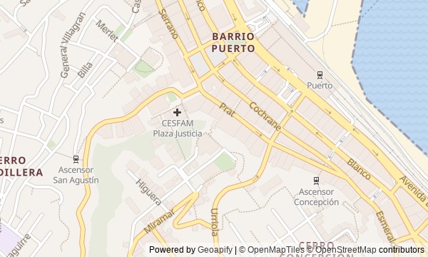
Route map
About the walk
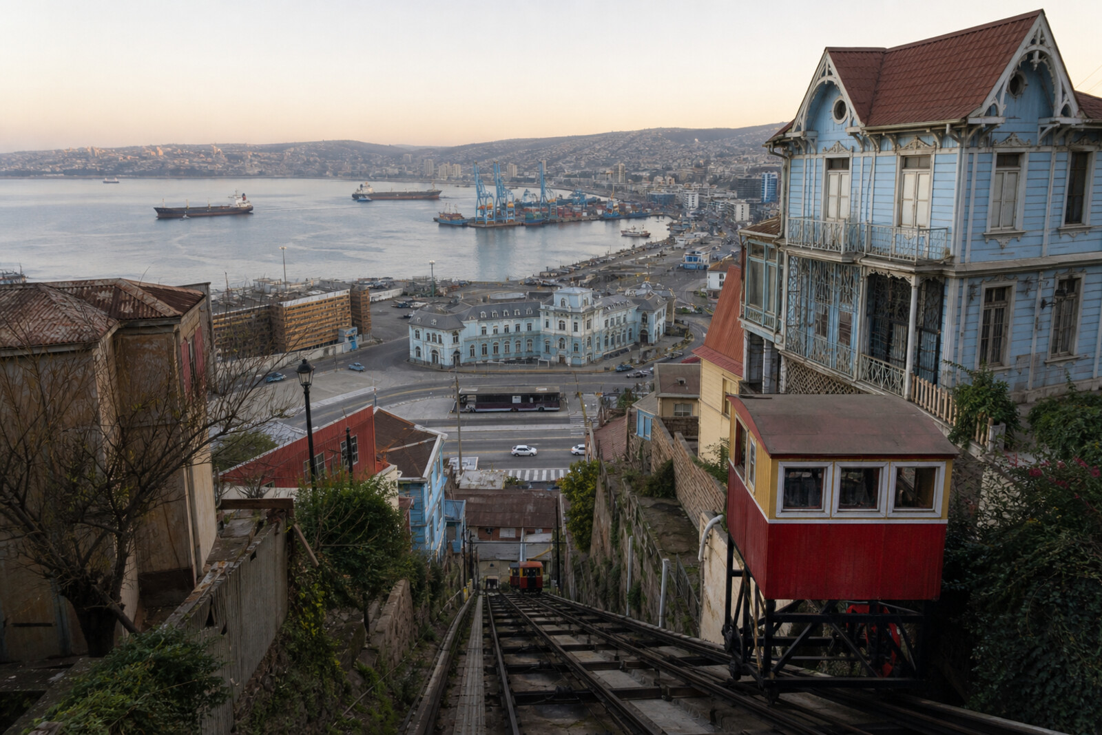
You will begin at La Matriz Church, in the old port district, where narrow streets meet at the former shoreline. Then you will cross the commercial quarters to the navy's ceremonial square, ride Ascensor El Peral up to the terraces of Cerro Alegre, and continue to Cerro Concepción. Below, there will be shops, stone facades, and networks hidden beneath them. Above, ascensores, retaining walls, mansions, and a church without a steeple. Along the way, questions will come up: why did locals vote at church doors, why did a public balcony need an enormous wall beneath it, and why does the cathedral have only side entrances left? The story will unfold through documents, human calculations, and details visible on the spot, without the postcard version of a “city on hills.” After the walk, you will be able to explain why Valparaíso is arranged in layers: the port and business streets below, homes above, and between them paid rails, stairways, and passages given to the city.
Why this order
The order follows the way Valparaíso is built: first you will make sense of the tight grid by the old shoreline, then climb to where people connected to the port lived. At La Matriz Church, you will see the city's starting point; nearby Echaurren Square will show how growing trade ran into the old layout. From there, Serrano Street leads through the commercial district straight to Sotomayor Square, while the street's name prepares the naval story of the monument in the square. Behind the Chilean Navy High Command building lies the lower station of Ascensor El Peral: after the ceremonial center, the everyday purpose of the ascensores becomes clear. The car takes you to Paseo Yugoslavo, where transport, a retaining wall, and a public terrace are physically joined; Baburizza Palace beside it continues the story of private capital through a house and its collection. The road then follows the hill's edge to Paseo Gervasoni and a second successful ascensor. Next, St. Paul's Anglican Church shows the community for which Cerro Concepción was built up. The final crossing along Almirante Montt Street to Paseo Dimalow and Ascensor Reina Victoria closes the route with another link between homes above and the business grid below.
Those who enjoy urban history through human decisions Those who want to connect the port, hills, and ascensores into one picture Those who value documents, visible traces, and precise answers
Those looking only for viewpoints without long stories Those not ready for climbs and stairways between hills Those expecting an easy walk without stories of disaster and war
Before you go
Set out in daylight and choose shoes with a secure grip: even when the ascensores are running, there will still be slopes, steps, and uneven sidewalks. Before the walk, check the status of Ascensor El Peral and Ascensor Reina Victoria—these historic lines may be temporarily suspended. Access to La Matriz Church and St. Paul's Anglican Church depends on services and events, so the route should still work with an exterior visit. Plan a visit to Baburizza Palace separately, and check the museum schedule in advance; even without going inside, its architecture and position above the port still make the stop meaningful. In the lower port district, stay on busy streets and do not linger after dark.
When to go
Allow 2,5–3 hours for the whole route at an unhurried pace. A visit to Baburizza Palace will take roughly another 45–60 minutes; ascensor closures or walking uphill instead of riding will also add to the total time.
Backup plan
If Ascensor El Peral is closed, walk up to Paseo Yugoslavo using an accessible city ascent, or reroute the vertical crossing through the area around Ascensor Concepción. Do not try to pass through closed stations or service areas. If Baburizza Palace is closed, view it from the street and continue the route: the house's story can still be read in its turret, massing, and position beside the paseo. If Ascensor Reina Victoria is not running, finish the story at the upper station and descend by ordinary pedestrian streets, choosing a well-lit and busy route.
Route conditions
Surface. Paved — 1.5 km (data covers 75% of the route)
Stairs. Flights: 5, 266 m in total
Access. Wheelchair — no; stroller — limited (stairs)
Facilities. Toilets — 2
Elevation. Ascent — 54 m; descent — 38 m
OpenStreetMap extract of July 7, 2026: database data, not a check on the ground. Data © OpenStreetMap contributors, ODbL licence
Walk plan
Open in maps ↗- 1
La Matriz Church and Santo Domingo Square
Here you will find the city's point of origin and the first example of a public decision preserved in a place name. - 2
Echaurren Square
The square shows how the port’s cramped conditions turned a private building project into a civic dispute. - 3
Serrano Street (formerly La Planchada)
Here, commercial façades stand above networks whose failure destroyed several houses. - 4
Sotomayor Square
The square will connect the name of the neighboring street with the city’s main site for naval ceremonies. - 5
Ascensor El Peral
The ride will show how residents’ daily route became a private transport calculation. - 6
Paseo Yugoslavo (formerly Paseo Americano)
The terrace shows how protecting one house gave the city a public walkway. - 7
Baburizza Palace
The museum separates the history of the donated collection from that of the house, which had to be bought back separately. - 8
Paseo Gervasoni
Here, the second funicular will show how quickly a paid ascent became a profitable part of the city. - 9
Cerro Concepción and St. Paul's Anglican Church
The church’s façade preserves a trace of a religious prohibition and the way it was circumvented. - 10
Paseo Dimalow and Ascensor Reina Victoria
The finale will bring the funicular, bridge, and passage together into a single route of daily travel between the flat city and the hill.
Route features
Everything you need stays in the browser
Progress, saves and your trip plan are stored on this device.
Add Guide On Map to your home screen so the walk opens outside the browser.
How we handle sources, maps and corrections: our editorial standards