 Guide On Map
Merchant Hoi An: from Tran Phu Street to the Hoai River
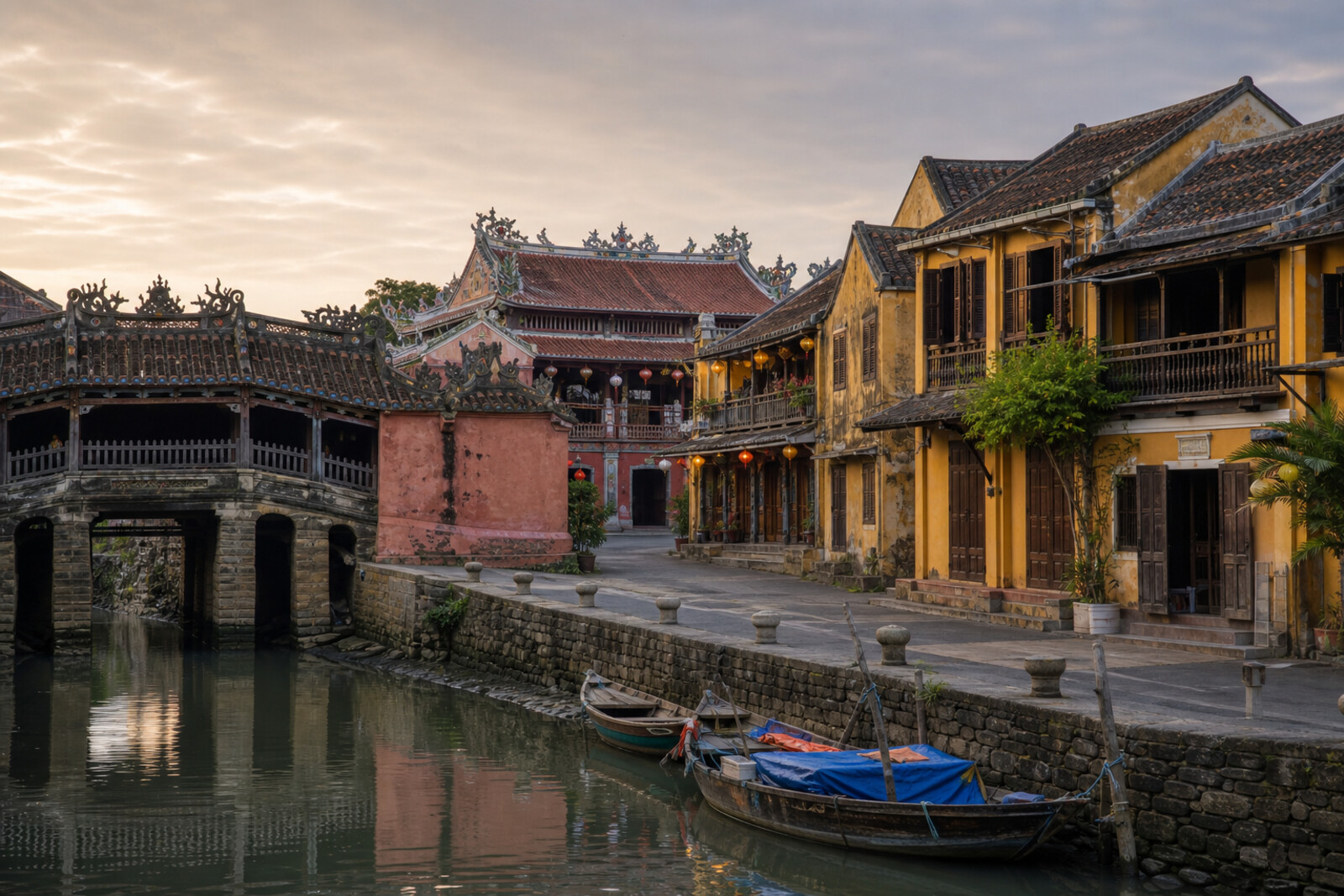
From the Japanese Covered Bridge through the trading quarter to An Hoi Bridge
Guide On Map on your phone
Open the walk like a regular app
It takes about 10 seconds to install. No app store needed.
The whole path
Route map
About the walk
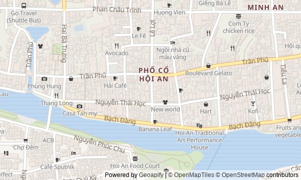
You will begin at the Japanese Covered Bridge and head east along Tran Phu Street, where Chinese hometown association halls, merchants' houses, and a museum in a former shop stand side by side. Then you will turn toward the market and descend to the Hoai River. The route ends at An Hoi Bridge, across from the old town.
The yellow facades will remain in the background. Instead, you will take the port apart through its working pieces. Who paid for shared buildings? What happened to a house when boats no longer reached its back door? Why has a covered well survived near the market? The answers will emerge from inscriptions, hatch covers, altars, ceramics, and the line of the shore.
The story will be calm and precise. It will separate legend from what is written in stone, and return decisions to merchants, craftspeople, and residents. By the end of the walk, you will be able to read Hoi An as the plan of a former port: from immigrant quarters through warehouses and the market to the water that shaped their work.
Why this order
At the Japanese Covered Bridge, you will begin with the boundary between 2 trading quarters, while the neighboring Cantonese Assembly Hall shows how migrants organized mutual support within their own community. Farther along Tran Phu Street, Duc An House reveals how a shop and family rooms served as a private network of connections after the public hall. The move to Tan Ky Old House continues the shop-house theme, adding a back door to the river and the fate of a family business after the water became shallow. The Museum of Trading Ceramics brings you back to Tran Phu Street and shows how a former trading house became a place for archaeological traces of that same commerce. Next, Fujian Assembly Hall widens the scale again, from one house to a hometown association and its maritime shrine. The eastern end of Tran Phu Street leads to the market, where trade depended on nearby villages, land, and daily supplies. From the market, the descent to Old Market Wharf restores the lost link between the rows of stalls and the river. Then the road along Bach Dang Street leads to An Hoi Bridge: crossing to the other bank completes the route where residents of a former sandbar created a new street and a connection to the old town.
Those who want to understand how an old trading town worked Those interested in merchants' houses and Chinese hometown associations Those who enjoy stories supported by inscriptions, objects, and archaeology
Those expecting a survey of only the most ornate facades Those who do not enjoy entering courtyards, houses, and museum spaces Those looking for a short route without detailed stories
Before you go
The route's main meanings unfold inside the bridge, the assembly halls, Tan Ky Old House, and the museum, so check locally before setting out which monuments are open that day and how admission works. Do not leave every interior for the evening: religious and museum spaces may stop admitting visitors before the streets quiet down. For shrines, wear clothing that covers your shoulders and knees; speak softly at altars and do not touch offerings. Bring water and rain protection, but keep your hands free for narrow passages and stairs. It is best to visit the market without large bags and without stopping in the middle of working aisles. A boat ride and lantern release are not necessary to understand the route.
When to go
Start in the morning if you want to catch the market at work and visit interiors before the evening crowds. For softer light, choose the second half of the day, but check access to the houses, museum, and halls first, then leave the waterfront for the end.
Backup plan
In heavy rain, keep to the main sequence along Tran Phu Street and make the short descent to Tan Ky Old House: the covered bridge, assembly halls, museum, and accessible house interiors will provide nearly the full story without spending long by the water. After the market, follow only the upper part of Bach Dang Street. During flooding, do not descend wet steps or go onto lower platforms or beside boat hulls; view the working side of the houses from a safe sidewalk. You can finish the final story at the approach to An Hoi Bridge, where both banks are visible. If wind, thunderstorms, or barriers make the waterfront difficult, do not try to bypass closures; return through the inner streets of the old town.
Route conditions
Surface. Paved — 1.1 km (data covers 74% of the route)
Facilities. Toilets — 7; drinking water — 1
Elevation. Ascent — 5 m; descent — 6 m
OpenStreetMap extract of July 3, 2026: database data, not a check on the ground. Data © OpenStreetMap contributors, ODbL licence
Walk plan
Open in maps ↗- 1
Japanese Covered Bridge
Here you will learn how a trading crossing survived a change of communities and acquired several meanings at once. - 2
Cantonese Assembly Hall
This stop will show how merchants shared risk, expenses, and care for people far from home among those from the same place. - 3
Duc An House
Here, the house’s commercial layout explains why the family shop suited secret meetings and the storage of documents. - 4
Tan Ky Old House
The house will link family trade with the river and show how silting changed an entire business. - 5
Museum of Trading Ceramics
Here, archaeological finds and a restored house will connect vanished seaborne cargoes with the work of restorers. - 6
Fujian Assembly Hall
This stop explains how maritime risk led a merchants’ native-place association to establish a permanent shrine and a shared house. - 7
Hoi An Central Market
The market will show how local trade occupied a new site and continued after large seagoing vessels had left. - 8
Old Market Wharf
Here, a river entrance to the city will connect everyday trade with a military episode from 1949. - 9
An Hoi Bridge and the Hoai River Embankment
The final stop will show how residents of the opposite bank replaced a sandbar with a street, a bridge, and a new urban neighborhood.
Route features
Everything you need stays in the browser
Progress, saves and your trip plan are stored on this device.
Add Guide On Map to your home screen so the walk opens outside the browser.
How we handle sources, maps and corrections: our editorial standards