 Guide On Map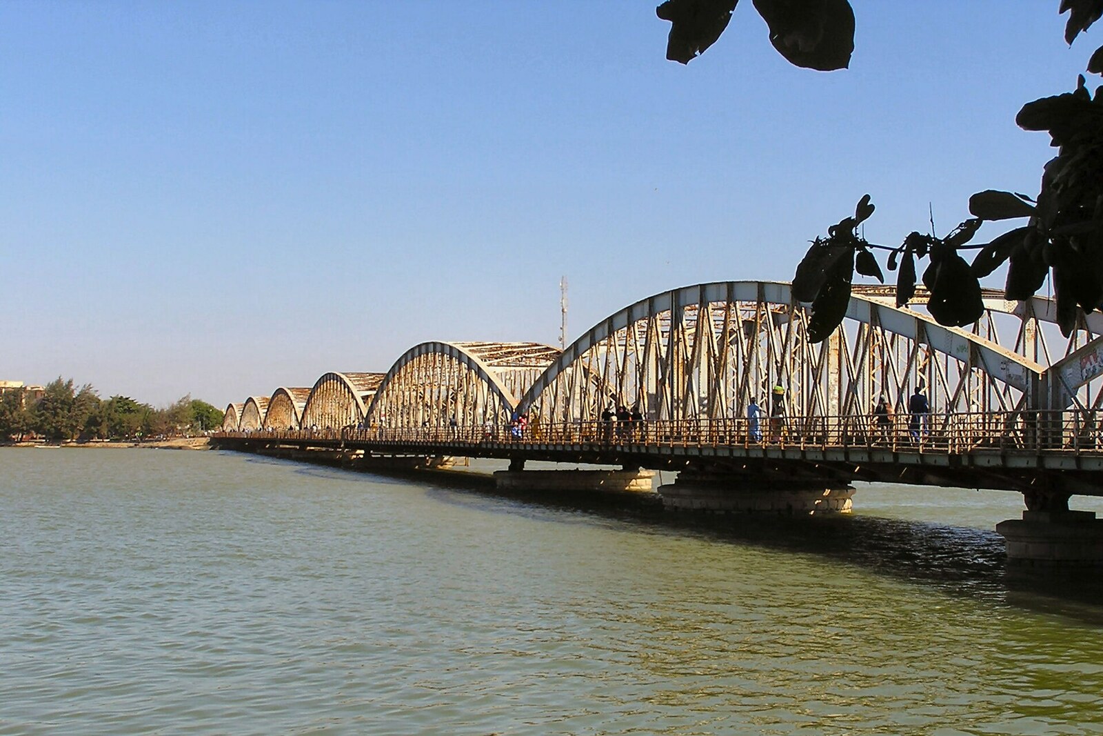
Look around first
What to notice
- Seven metal spans
- Swing span
- Stone piers
The story of the place
Seven steel spans on stone piers carry the road between Saint-Louis Island and the district of Sor; one of them swings aside, leaving the river navigable for vessels. Before the permanent crossing, there was a pontoon deck here, which was moved apart for ships, but when the railway arrived on the Sor shore, it could no longer bear heavy carts. People and goods traveled from the trains to the island along this route: the port, trading houses, and institutions remained here. The present bridge replaced that temporary crossing, though it inherited its name.
Gustave Eiffel did not build this bridge. The company that continued his work took part in the competition—and lost. Ndar’s Iron Threshold, as Saint-Louis is called in Wolof, resulted from a decision made here against the opinion of Parisian engineers.
Before it, ferries connected the island with the mainland district of Sor. In eighteen sixty-five, Captain Robin, acting temporarily as governor, secured the construction of a pontoon bridge: forty iron pontoons supported a wooden deck, and three pontoons had to be moved aside to let ships pass. An imperial decree named this crossing Faidherbe Bridge.
Louis Faidherbe was a French military engineer and colonial governor of Senegal. He expanded French control into the interior of the country and rebuilt Saint-Louis: draining the shores, laying out streets, creating quays and crossings. But the first bridge was completed under Robin, in the year of Faidherbe’s final departure. The present structure appeared later still and simply inherited its predecessor’s name.
When the railway from Dakar reached Sor, the old deck could no longer cope. It was about four meters wide; heavy carts were no longer allowed onto it. Passengers and goods from the trains still had to be carried to the island, where the port, trading houses, and institutions remained.
In eighteen ninety-one, Governor Henri-Félix de Lamothe proposed that the General Council of Senegal borrow five million francs for debts and urgent public works. The council allocated the largest share—one million eight hundred eighty thousand—to a metal bridge. This was a colonial loan, to be repaid from its budget, not a gift from Paris.
Of five applications, two reached the final. The technical commissions preferred the proposal by Levallois-Perret, Eiffel’s former firm. Robert, head of the colonial public works service, pressed for another decision. He and the councilors who supported him considered the bridge by Nouguier, Kessler and Company more suitable in appearance; the rivals’ prices were identical. A majority of the council voted for Nouguier. The Parisian choice was rejected, Eiffel’s firm was left without the order, and its competitor received the contract.
Work began in eighteen ninety-four. Three years later, steel arches linked Sor with the island. At the first opening, the governor-general’s wife cut the ribbons, officials walked onto the swing span, and it swung open, clearing the way for the military vessel Ardent. Thus the bridge fulfilled both tasks at once: people and goods gained a permanent route to Ndar, while ships retained passage along the river.
The confusion with Eiffel did not arise from nothing. The engineer Émile Nouguier had previously worked with Gustave Eiffel and took part in creating the first design of the Eiffel Tower. And when, from two thousand eight to two thousand eleven, all seven metal spans of the bridge were remade to their former appearance, the new sections really did come from the factory of the company then called Eiffel. Before us are the recreated steel arches and swing span of the design with which the General Council of Senegal once rejected the design of Eiffel’s former firm.
Useful on site
open around the clock as an urban crossing; view from the sidewalk
Checked: June 24, 2026. Check the official source before visiting.Listen from the safe side of the passage and do not linger on the roadway.