 Guide On Map
Saint-Louis Island: Bridges, Squares, and Waterfronts
From Faidherbe Bridge across the island to Mustapha Malick Gaye Bridge
Guide On Map on your phone
Open the walk like a regular app
It takes about 10 seconds to install. No app store needed.
The whole path
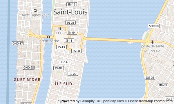
Route map
About the walk
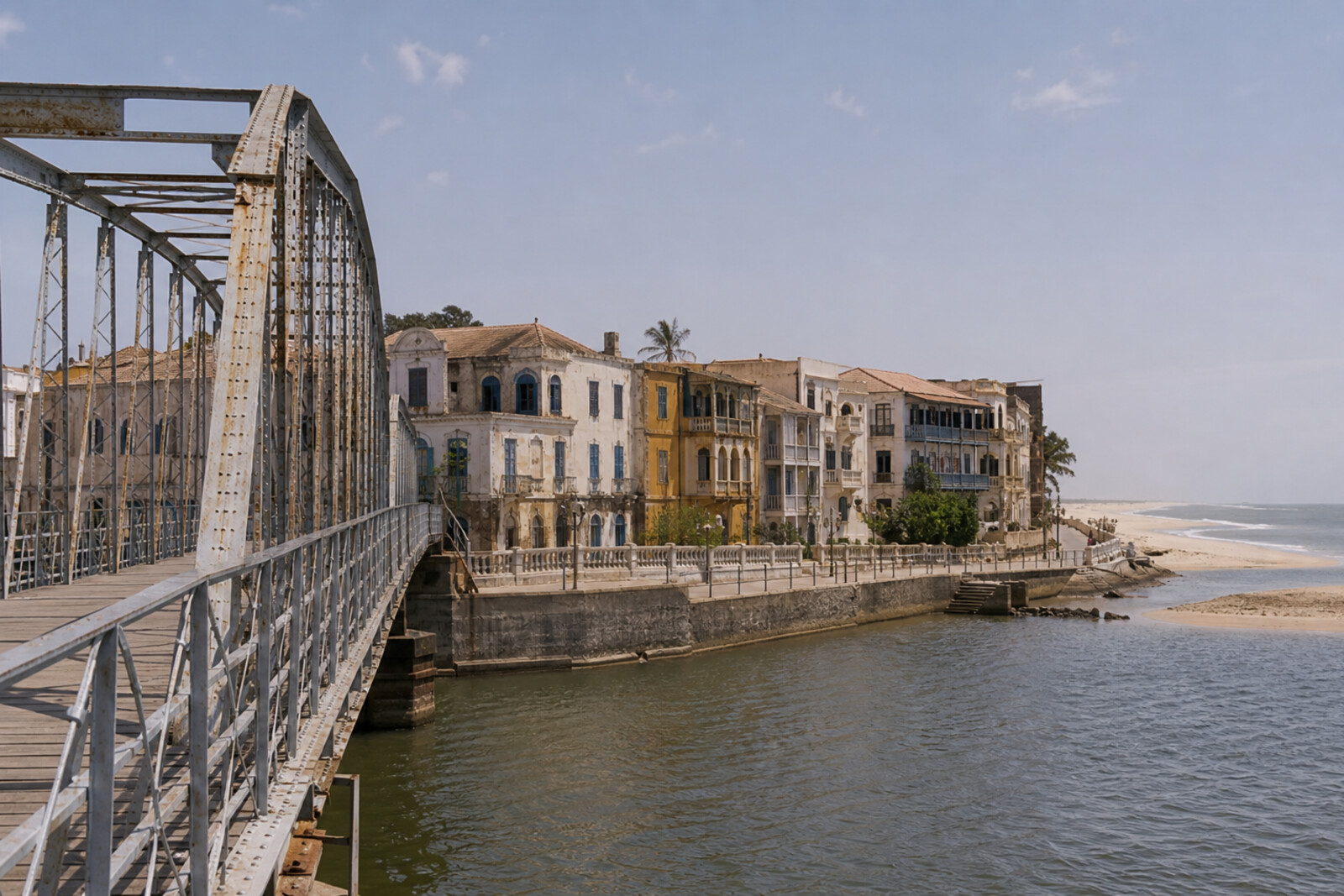
You will enter the island over a metal bridge and follow the eastern quays. Then you will cross the square in front of the former governor's residence, descend into the Catholic neighborhood, and circle the southern tip. The finale will bring you to a concrete crossing to the sand spit between the river and the Atlantic Ocean.
You will see warehouses, barracks, a palace, a church, and a museum center. Together, they reveal the story of an island for which people kept finding new work. Behind the familiar bridge lies a lost competition. An evening city walk has an official pedestal. One empty warehouse keeps paying for someone else's scholarships, and a museum inventory fails to match what is inside the cabinets.
The story will compare official records with tradition and separate what was built from what was merely attributed. After the walk, you will be able to cross Saint-Louis from Sor to Langue de Barbarie and explain why decisions at the island's two crossings diverged from those made in Paris.
Why this order
Faidherbe Bridge will first take you where the main flow of people and goods was headed: to the warehouses of Quai Roume. From the trading shore, you will walk to the square before the palace. There, it becomes clear who governed the port city and how an official parade ground passed into the everyday use of its residents. Crossing the square ends at the palace itself, where administrative power appears not in a monument but in a specific decision to expel. Next comes Saint-Louis Church in the southern Catholic neighborhood: a community response in a city where the main spaces long belonged to the fort and the administration. From the church, the road reaches Quai Henri Jay, where you will see how the southern shore lost its trading role but gained a public one. Continuing along the water brings you to an archive center that preserves another urban resource: photographs and documents. From the southern tip, all that remains is to follow the western shore to Mustapha Malick Gaye Bridge. After the stone island, the route ends at the crossing to a shifting sand spit.
Those who want to understand how island Saint-Louis works Lovers of urban history, archives, and engineering stories Those who prefer a coherent route along the water
Those looking for a walk without colonial history Those who want a route focused only on interiors Those who do not enjoy a dense documentary narrative
Before you go
Wear comfortable shoes and prepare for open sun, wind, and uneven surfaces by the water. The bridges, quays, square, palace, and church can all be meaningfully explored from outside; government and private buildings should not be treated as freely open for entry. Plan a visit to the Centre de Recherche et de Documentation du Sénégal (CRDS) separately, and check access for your chosen day in advance. Repair or reinforcement work may be underway on the waterfronts, so do not go beyond barriers or approach a crumbling edge for a photo. Bring water, but keep your hands free: the route invites you to stop often and look at details above and below eye level.
When to go
Choose the morning or the latter part of the day, when the sun is gentler and it is easier to linger on the open quays. Allow about 2 hours and 20 minutes for the route without visiting the exhibition; with the Centre de Recherche et de Documentation du Sénégal (CRDS), photographs, and unhurried pauses, it can take up to 3 hours.
Backup plan
If the Centre de Recherche et de Documentation du Sénégal (CRDS) is unavailable, view it as an external archival anchor and spend more time with the southern facades, the shoreline, and the view toward Guet Ndar. If the passage is closed or traffic is heavy by the final bridge, do not try to force your way to the spit: end the walk at the island's southern tip, where you can compare the stable grid of Ndar with the shifting strip beyond the water. If wind or rain makes the quays unsafe, shorten stops at the very edge and stay on the city sidewalks.
Route conditions
Surface. Paved — 3.1 km; unpaved — 722 m (data covers 98% of the route)
Access. Wheelchair — limited; stroller — limited
Elevation. Ascent — 14 m; descent — 15 m
OpenStreetMap extract of July 9, 2026: database data, not a check on the ground. Data © OpenStreetMap contributors, ODbL licence
Walk plan
Open in maps ↗- 1
Ndar’s Iron Threshold
Here you will find out why the famous crossing was assigned someone else’s engineering biography. - 2
Quai Roume
This stop will connect the layout of the warehouse district with money, roads, and changing trade routes. - 3
Square of Two Names
Here you will see how an official parade ground became a place for daily gatherings and festive processions. - 4
Palace, Fort, and Two Rak'ahs
This stop makes it possible to compare colonial protocol with a prayer preserved by religious tradition. - 5
A Cathedral Above Salt Water
Here, the history of construction brings together parishioners’ donations, the labor of craftsmen, and the effects of salt-laden moisture. - 6
The South Quay That Changed Its Line of Work
This stop explains how an unsuccessful trading shore came to be associated with scholarships and assistance for blind people. - 7
Archive at the Edge of the Island
Here you will learn how staff turned unsorted negatives into a city photo archive. - 8
Crossing to shifting ground
The finale will link the history of the crossing with the market, the fishing district, and the movement of the sandy shore.
Route features
Everything you need stays in the browser
Progress, saves and your trip plan are stored on this device.
Add Guide On Map to your home screen so the walk opens outside the browser.
How we handle sources, maps and corrections: our editorial standards