 Guide On Map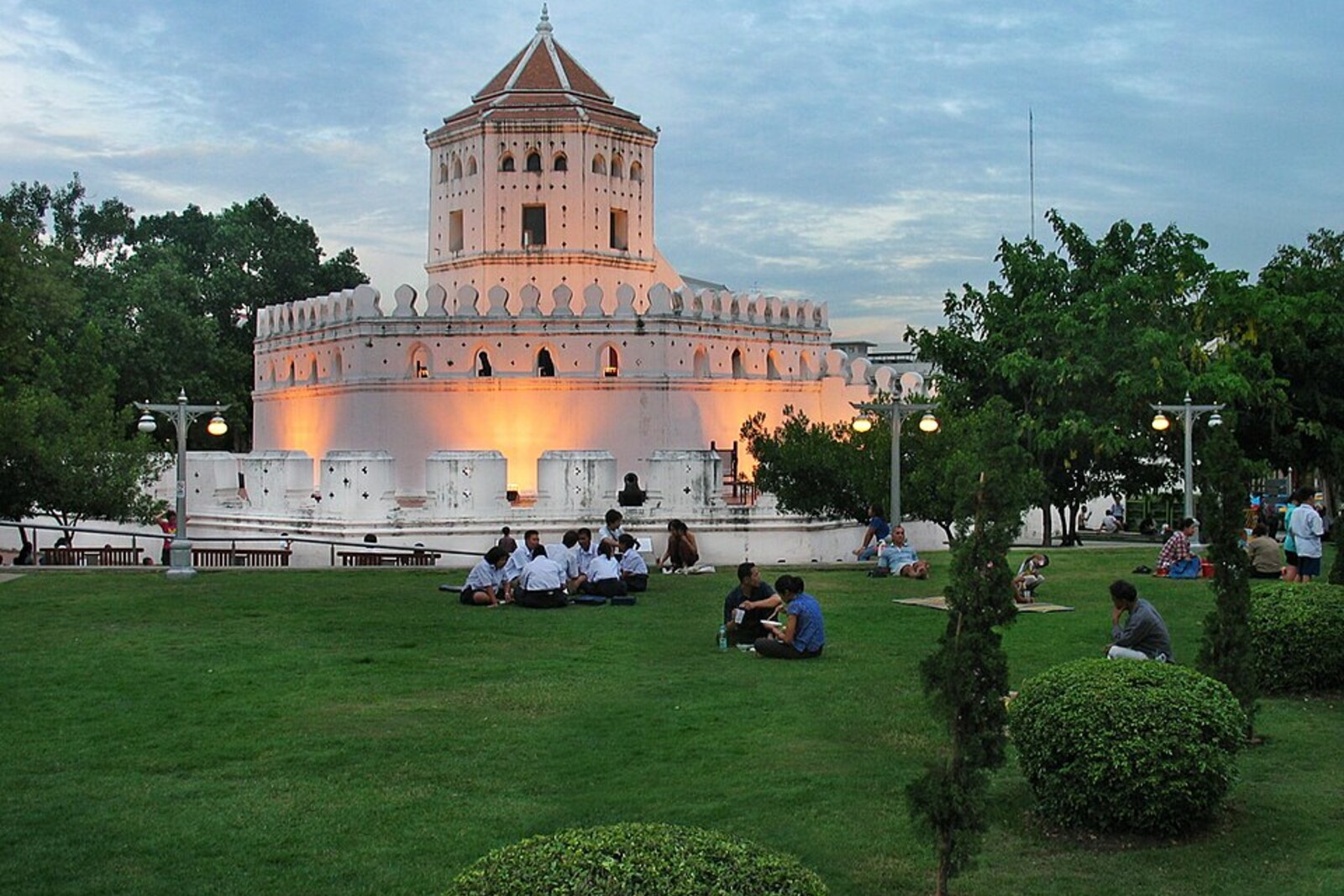
Look around first
What to notice
- Massive lower tiers
- Gun positions
- Roofed white tower
- Fragment of the city wall
The story of the place
Khlong Bang Lamphu flows into the Chao Phraya River here, and the fortification walls once converged on this water from two sides. Phra Sumen protected the northwestern corner of the royal city: the river stopped approaches from the west, while the canal closed the defense along the northern and eastern sides. Below, the heavy brick tiers and gun positions are still visible; weapons and gunpowder were kept inside, while lookouts stood watch above. Restorers restored the white roofed tower from an old photograph, while the lower part of the fort and the short section of wall survive from the former fortifications.
In seventeen seventy-eight, the Siamese commander Chao Phraya Chakri led troops against Vientiane. King Taksin ordered him to subdue the Lao principality, squeezed between stronger neighbors. The campaign ended with the capture of the city the following year. The princely family, artisans, and many captives were taken to Siam.
Three years later, Chao Phraya Chakri took the throne as Rama the First. He moved the capital from Thonburi, which stood on the opposite bank of the Chao Phraya River, to the river's eastern side. Fifteen years earlier, a Burmese army had destroyed Ayutthaya, so the new king hurried to surround his court with walls before the next major invasion.
In seventeen eighty-three, Rama the First ordered an outer moat dug, a city wall built, and fourteen forts placed along it. Phra Sumen occupied the northwestern corner of the fortifications, right where Khlong Bang Lamphu joins the Chao Phraya River. The river protected the city from the west, the canal from the north and east, and this fort held the junction of the two water barriers. Guns were placed between the crenellations, weapons and black powder were stored in the inner rooms, and the upper tower served as an observation post.
The main workforce was made up of Vientiane prisoners of war. A separate record counts five thousand Lao mobilized to dig foundations, lay the wall, and build the forts. Their overseers were assigned sections of work, Siamese residents fired new bricks, and some of the material was brought by river from ruined Ayutthaya. Rama the First also ordered its old walls dismantled so that an enemy could not use the ruins as fortifications again.
For the Lao builders, this was not the ordinary obligation of a free community member, limited to part of the year. Prisoners of war were considered royal slaves; such dependence could last a lifetime and pass to their children. The same commander who led an army to Vientiane now forced people taken from there to protect his new capital with brick. The chronicles did not record their names. After the construction, Lao captives were resettled in Bangkok and surrounding provinces, attached to royal services and workshops; it is now impossible to trace the fate of those particular five thousand individually.
The city wall ran for about seven kilometers. The guns of Phra Sumen never had to be aimed at an enemy besieging the city. Later, almost all the forts were dismantled for roads and government buildings. Two remained: Phra Sumen and Mahakan Fort.
The name Phra Sumen does not belong to the commander. This is the Thai name for sacred Mount Meru, the center of the world in Buddhist and Hindu cosmology. Rama the First gave this name to the defensive tower of the new royal capital, but the “mountain” itself arose from the labor of people brought here after the conquest of another capital.
By the twentieth century, the roofed upper tower had disappeared. In nineteen eighty-one, restorers from the Fine Arts Department reconstructed it from an old photograph from the time of Rama the Fifth. The roof and the white tower above are their reconstruction; the massive lower tiers, gun positions, and adjoining fragment of wall preserve the structure laid by the Vientiane captives. Of the five thousand builders, only a number remains in the documents. Of their work, a brick fort at the mouth of the canal.
Useful on site
Exterior viewing of the fort in the park area; access inside/to the platforms depends on current signs and security.
Checked: June 28, 2026. Check the official source before visiting.Do not count on going inside: the fort's purpose and layout are clearly legible from the outside.