 Guide On Map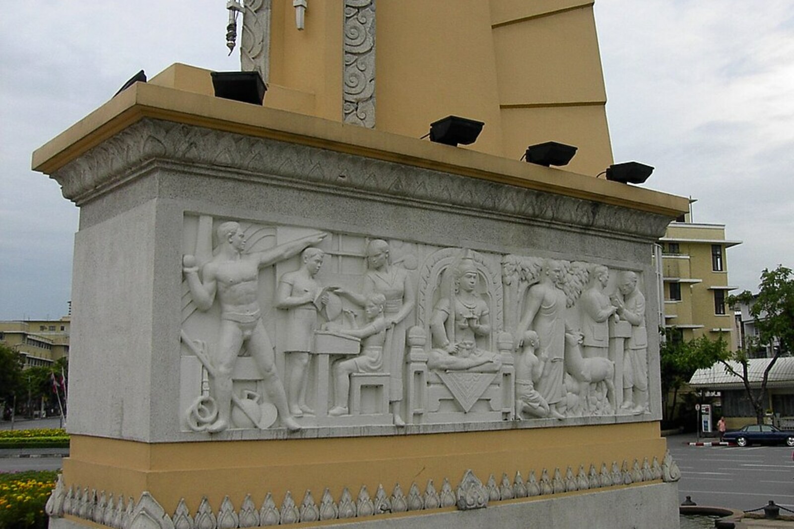
Look around first
What to notice
- Bronze constitution on golden bowls
- Four wings
- Bas-reliefs at the base
The story of the place
Ratchadamnoen Avenue was laid out as a road for royal processions between the Grand Palace and Dusit Palace. Later, a broad strip along the street was cleared: homes and shops disappeared, replaced by an arterial road with a traffic circle and multistory development. At the center of the circle stand four tall wings, each twenty-four meters high; at their base are bas-reliefs of military and civilian figures. The former are shown marching and fighting, the latter studying and working.
Above the roadway rises a bronze image of a constitution, folded like a traditional Thai manuscript and placed on two golden bowls. The coup to which the monument is dedicated did not take place here.
On June twenty-fourth, nineteen thirty-two, a small secret group of officers and civilian officials called itself the People's Party (Khana Ratsadon). They sought a constitution and an end to the absolute monarchy in Siam—the name Thailand had at the time. The conspirators included artillery major Plaek Phibunsongkhram. Army service gave him a profession, a salary, and a future; failure would turn a career officer into a rebel against the king.
At dawn, the conspirators assembled troops at the Royal Plaza under the guise of exercises, detained influential princes, and announced that the country's government was passing to a constitutional administration. The king was at a seaside residence at the time. Having received the ultimatum, he agreed to a constitution and retained the monarchy. The coup was almost bloodless; a parliament and a new system of government appeared. This is precisely what is called democracy here.
Seven years later, Phibunsongkhram was already prime minister and decided to cement his group's victory in the center of Bangkok. For the monument, he chose not the square where the coup had taken place, but Ratchadamnoen Avenue. The street's name means “royal procession”: King Rama V laid it out between the Grand Palace and the new palace residence, Dusit Palace. The People's Party monument in the middle of this road changed the meaning of the entire ceremonial route.
The people living along the avenue paid for the decision. The government compulsorily bought their plots, cleared a strip tens of meters wide, and demolished old homes and shops. In their place came a widened arterial road, a traffic circle, and new multistory buildings. On June twenty-fourth, nineteen thirty-nine, the foundation stone was laid; exactly one year later, Phibunsongkhram opened the monument.
He ordered the date of the coup written directly into the structure's dimensions. Each of the four wings rises twenty-four meters; originally, seventy-five embedded cannons stood around them—the final two digits of the year two thousand four hundred seventy-five in the Buddhist calendar. That is nineteen thirty-two in the European calendar.
The bas-reliefs preserve the version of events chosen by the prime minister. The military figures on them march, fight, and defend the country; the civilians work, study, and receive the fruits of change. Phibunsongkhram himself lost office in nineteen forty-four, and after the coup of nineteen forty-seven the People's Party lost its former position. What remained at the circle was the narrative he commissioned: soldiers act on the sides, and above them lies the bronze constitution.
Useful on site
An open city monument at a traffic interchange; viewing is only possible from outside and from safe crossings.
Checked: June 28, 2026. Check the official source before visiting.View the monument from the sidewalk or a permitted crossing point: traffic around the circle is heavy.