 Guide On Map
Bellavista and San Cristóbal Hill: from the city's threshold to the summit
From Plaza Baquedano (Plaza Italia), through Bellavista, to the sanctuary on San Cristóbal Hill
Guide On Map on your phone
Open the walk like a regular app
It takes about 10 seconds to install. No app store needed.
The whole path
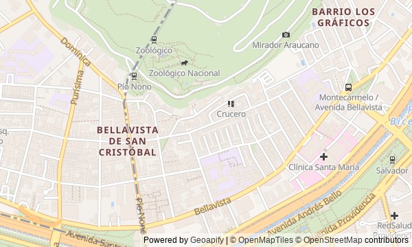
Route map
About the walk
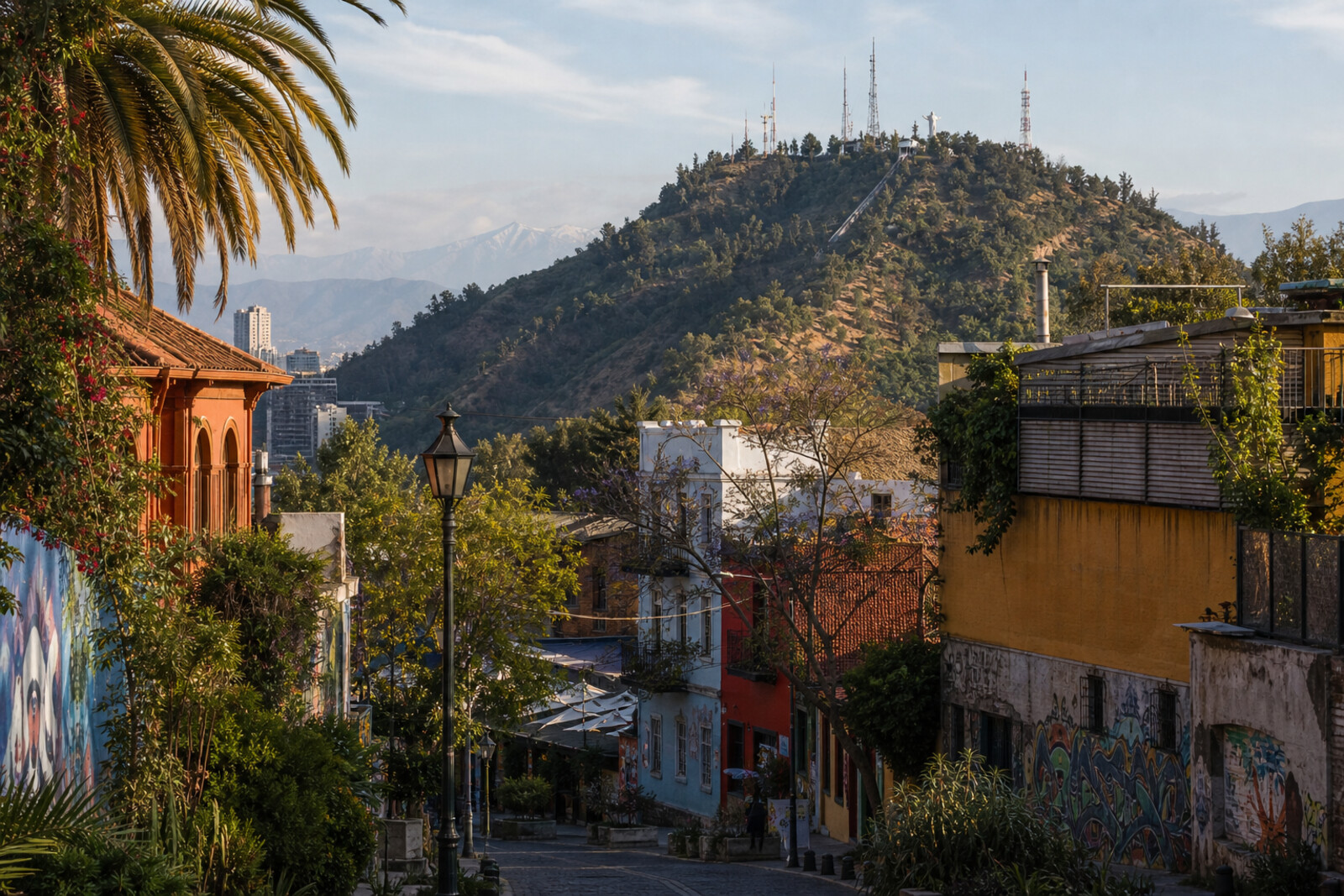
You will begin at Plaza Baquedano (Plaza Italia), where old central Santiago meets the road east. Across the Mapocho River, the route enters Bellavista: a university façade, a long street, low houses at the foot of the slope. Then you will come to a home that once concealed a relationship between two people, and to a stone station at the park entrance. Before the climb, the route returns you to former printing courtyards, then a car carries you up to the checked floor of an old dance terrace. The ending lies higher still, on an esplanade beneath an enormous statue.
The stories hold on to things: two monuments, a moved bridge, sandbags, boards laid over flooded rooms. They will not lecture you. Instead, they show how private ventures became places for the city.
After the walk, you will be able to explain why Bellavista begins with two names for one square and ends with a road that once had to be laid for forty-two heavy crates.
Why this order
Plaza Baquedano (Plaza Italia) sets the city's threshold, and the neighboring bridge carries the route across the Mapocho River into Bellavista. Beyond the bridge, Pío Nono Street connects the university side with the foot of San Cristóbal Hill; a turn off it leads to La Chascona, where the slope first becomes part of the story. The next stop is therefore the architectural entrance to the hill: the lower station of the Santiago Funicular. Before climbing, the route returns along Pío Nono Street to Patio Bellavista. Here, two ways of remaking a neighborhood sit side by side: opening a public park and turning closed industrial courtyards into passageways. Returning to the station and rising to Terraza Bellavista replaces the street-scale view with one from above. From the preserved dance-floor surface, the road continues to the Sanctuary of the Immaculate Conception, for which the first heavy access road was laid to the summit.
Those who care about the connection between city history and a specific place Those who prefer human stories to a survey of dates Those ready to combine streets, a museum, and a climb up a hill
Those looking for a walk without changes in elevation Those who want to stay only in the historic center Those who do not want to retrace one section of Pío Nono Street
Before you go
The full route measures about 6,04 km, though the funicular ride significantly shortens the walking portion. Check park and lift availability in advance: maintenance, weather, or restrictions may change the final stretch.
Plan a visit to La Chascona separately from the walk itself—museum entry and waiting will take additional time. Individual venues at Patio Bellavista keep their own hours.
Bring water, sun protection, and shoes with reliable grip for the climb. Before setting out, check air quality and visibility: they shape the experience at the two upper stops.
When to go
2–4 hours. The shorter option means seeing La Chascona from outside and taking the funicular; the full version requires time for the museum, possible waiting for transport, and unhurried stops at the top.
Backup plan
If the lift or the upper part of the park is closed, finish the walk at the lower station: the first five stops form a complete story of roughly 1,5–2 hours.
Choose the walking route to the summit only along an officially open path, in suitable weather and with enough water and time. If conditions are uncertain, do not replace a closed funicular with an improvised climb.
Route conditions
Elevation. Ascent — 273 m; descent — 14 m
OpenStreetMap extract of June 18, 2026: database data, not a check on the ground. Data © OpenStreetMap contributors, ODbL licence
Walk plan
Open in maps ↗- 1
Plaza Baquedano (Plaza Italia)
Here, the route will explain why the official and colloquial names went to different bronze figures. - 2
Pío Nono Bridge and Pío Nono Street
The crossing links a student episode, the fate of the old bridge, and the origin of Bellavista's main street. - 3
La Chascona House Museum
A personal story explains the staircases, separate sections, and the transformation of a secret refuge into a permanent home. - 4
Santiago Funicular, Pío Nono Station
This stop links the transformation of private slopes into a public park with the engineering test of the new lift. - 5
Patio Bellavista
Here you will see how former printing properties were joined into an open pedestrian quarter. - 6
Terraza Bellavista
The surviving floor will bring you back to a vanished dance floor at the summit and to a young musician’s first major contract. - 7
Sanctuary of the Immaculate Conception on San Cristóbal Hill
The finale will show the place at the summit for which the dismantled statue was hauled up and the road was laid.
Route features
Everything you need stays in the browser
Progress, saves and your trip plan are stored on this device.
Add Guide On Map to your home screen so the walk opens outside the browser.
How we handle sources, maps and corrections: our editorial standards