 Guide On Map
Old Québec: From the Cliff to the River
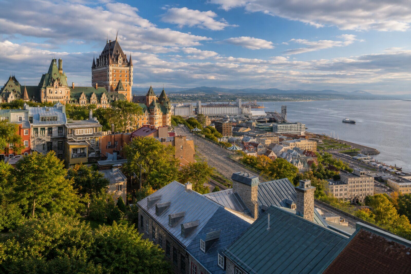
From Dufferin Terrace through Upper Town to the Petit Champlain district
Guide On Map on your phone
Open the walk like a regular app
It takes about 10 seconds to install. No app store needed.
The whole path
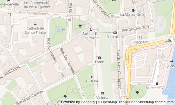
Route map
About the walk
You will begin at the edge of Cape Diamond, above the St. Lawrence River, then descend from Upper Town into Lower Town. A broad wooden promenade will give way to hotel towers, a military square, and a cathedral. Then you will pass beneath a stone arch and find yourself among an old market, a small church, and a commercial street at the foot of the cliff.
You will piece together Quebec City's history through obstacles, mistakes, and private decisions. You will ask what about a royal bust angered merchants. Why the present arch looks older than it is. How shop owners managed to buy an entire district. First you will notice an object or an action, then learn what followed from it. The stories will be calm and precise, without ceremonial rhetoric.
By the end, you will understand why Quebec City preserved walls above and a commercial street below—and what part was played by the people those things got in the way of.
Why this order
From the terrace, you will begin at a height where former military land became a public promenade, then go straight to the hotel that turned this elevation into the image of Old Québec. Beyond Château Frontenac, you will reach Place d’Armes: Upper Town's real defenses will stand beside a façade made to resemble an old fortress. At the neighboring cathedral, you will learn which colony those defenses were held for. After the cathedral, you will follow the historic connection between the city's two levels: on the steep descent, it will become clear why the gates hindered those carrying goods uphill. Below, the road will lead to the market square, where commerce clashed with a royal symbol. On the same square, you will move from a merchants' protest to the residents' shared vow, and the Petit Champlain district will end the route with the decision of those who worked and lived in Lower Town.
Those who want to explore Old Québec from top to bottom Those who care about human decisions behind familiar façades Those who enjoy dense historical stories without ceremonial rhetoric
Those looking for a walk only along level streets Those who want to limit themselves to panoramas and photographs Those uninterested in the history of defense, trade, and urban rebuilding
Before you go
Wear shoes with reliable grip: the main transition follows a noticeable slope that can become slippery after rain or in cold weather. The entire story can be followed from the street, so a locked church door does not disrupt the walk. Access to the archaeological remains beneath the terrace is a separate visit and may depend on the season; check in advance if you want to go down to the excavations. The interiors of the cathedral and Notre-Dame-des-Victoires Church may also be unavailable during services or outside visitor hours.
When to go
Choose daylight so you can clearly see the river, the curve of the descent, and the details of the dense buildings. Morning is usually better for quietly taking in the squares, while late light brings out the cliff and the roofs of Lower Town more vividly. Do not schedule the walk too tightly before your next commitment: the panorama, descent, and commercial streets each set a different pace.
Backup plan
If the steep descent is inconvenient, finish the upper section at the cathedral, return to the terrace, and use the funicular after checking its operation and payment terms on site. In Lower Town, begin at Place Royale, then view the church from outside and finish in the Petit Champlain district. In bad weather, do not linger at the exposed edge of the terrace and take particular care on sloping sections; simply skip closed interiors without changing the sequence of outdoor stops.
Route conditions
Surface. Paved — 781 m (data covers 61% of the route)
Stairs. Flights: 4, 87 m in total
Access. Wheelchair — no; stroller — limited (stairs)
Facilities. Toilets — 9; drinking water — 3
Elevation. Ascent — 23 m; descent — 65 m
OpenStreetMap extract of July 9, 2026: database data, not a check on the ground. Data © OpenStreetMap contributors, ODbL licence
Walk plan
Open in maps ↗- 1
Dufferin Terrace
This is where the story begins of how the city’s residents adapted the military edge of the cliff for peaceful life. - 2
Château Frontenac
The hotel links the tourist image of the old city with a closed wartime meeting. - 3
Place d’Armes
This stop will show how ordinary townspeople were turned into a reserve for the defense. - 4
Basilica-Cathedral of Notre-Dame de Québec
Here, the history of a restored colony leads to the lost burial place of its founder. - 5
Côte de la Montagne
The descent will explain why the main link between the city’s two levels became a conflict between defense and movement. - 6
Place Royale
Here you will see why a symbol of royal power could become an obstacle to the market. - 7
Notre-Dame-des-Victoires Church
This stop connects the church's name with two attempts to capture Quebec City. - 8
Rue du Petit-Champlain
The finale will show how the tenants kept the houses and the choice of neighboring shops for themselves.
Route features
Everything you need stays in the browser
Progress, saves and your trip plan are stored on this device.
Add Guide On Map to your home screen so the walk opens outside the browser.
How we handle sources, maps and corrections: our editorial standards