 Guide On Map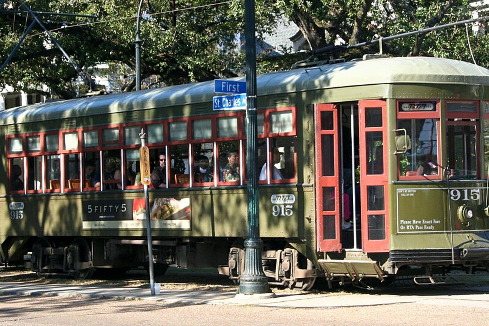
Look around first
What to notice
- Grassy strip
- Streetcar tracks
- Green cars
- Oak plantings
The story of the place
A grassy strip with streetcar tracks runs down the middle of St. Charles Avenue. It appeared before the broad avenue, the oaks, and most of the mansions. In the early nineteenth century, the narrow Nyades Street ran here, while the surrounding land remained former plantations.
In eighteen thirty-one, the land investors Laurent Millaudon, John Slidell, and their partners bought McCarty Plantation, about eight kilometers upriver on the Mississippi River. They planned to divide it into lots and build a new suburb—Carrollton. Their money was invested in land, but the lots could become expensive only if buyers had a convenient route to New Orleans.
To make that happen, the investors created a railroad company and hired Charles Zimpel—a surveyor who earned his living by drawing city plans and laying out routes. Zimpel received two connected tasks: to lay out Carrollton's streets and run a railroad to those streets. The same plan turned the plantation into saleable blocks and showed how future residents would travel to the city. Zimpel routed the line along Nyades Street—on what is now St. Charles Avenue.
The investors hurried to open service. The locomotives and cars ordered from England did not arrive in time for the opening of the first section, so the company bought a horse-drawn car from another railroad and began carrying passengers before the work was finished. On September twenty-sixth, eighteen thirty-five, steam trains began running between New Orleans and Carrollton. The following year, they departed every two hours, seven days a week. To give passengers a reason to travel to the terminus, the owners built a hotel there and laid out an amusement garden.
The bet on transportation worked. In eighteen forty-one, Carrollton had only thirty-six houses; a decade later, one thousand four hundred seventy people already lived there. Between Carrollton and New Orleans, the owners of the former plantations divided the land into blocks, while developers extended new streets toward the railroad. First, the tracks made the nearby lots convenient places to live; then they made them expensive.
In eighteen eighty, narrow Nyades Street was widened into a grand avenue. Mansions, broad roadways, and oak plantings appeared around an already operating line. That is why the streetcar runs down the center of the avenue: city authorities did not insert it later between the houses—the houses and the avenue itself were built on either side of Zimpel's railroad.
The name had changed even earlier, in eighteen fifty-two. St. Charles is St. Charles Borromeo, the sixteenth-century Archbishop of Milan. He was considered the heavenly patron of the Spanish King Charles the Third, who reigned when Louisiana passed from France to Spain. The avenue's name recalls the Spanish monarch, although its present layout was created by American land speculators and the Prussian engineer they hired.
By the middle of the twentieth century, New Orleans streetcar companies were replacing rail routes with buses. In nineteen sixty-four, even the line on Canal Street was closed. A city association of streetcar supporters failed to save it, but gathered enough support to preserve the route on St. Charles Avenue. In nineteen seventy-three, the line was added to the National Register of Historic Places.
The current green cars were not built in the era of the first steam locomotives: the Perley Thomas model entered service in nineteen twenty-three and nineteen twenty-four. The route itself is older than the cars. Beneath the oaks, it still runs where Zimpel laid the tracks through Nyades Street toward Carrollton's lots.
Useful on site
The street and stops are open around the clock; the streetcar is an active city route.
Checked: June 28, 2026. Check the official source before visiting.Stay a safe distance from the tracks and do not impede boarding: this is active public transportation, not a museum exhibit.