 Guide On Map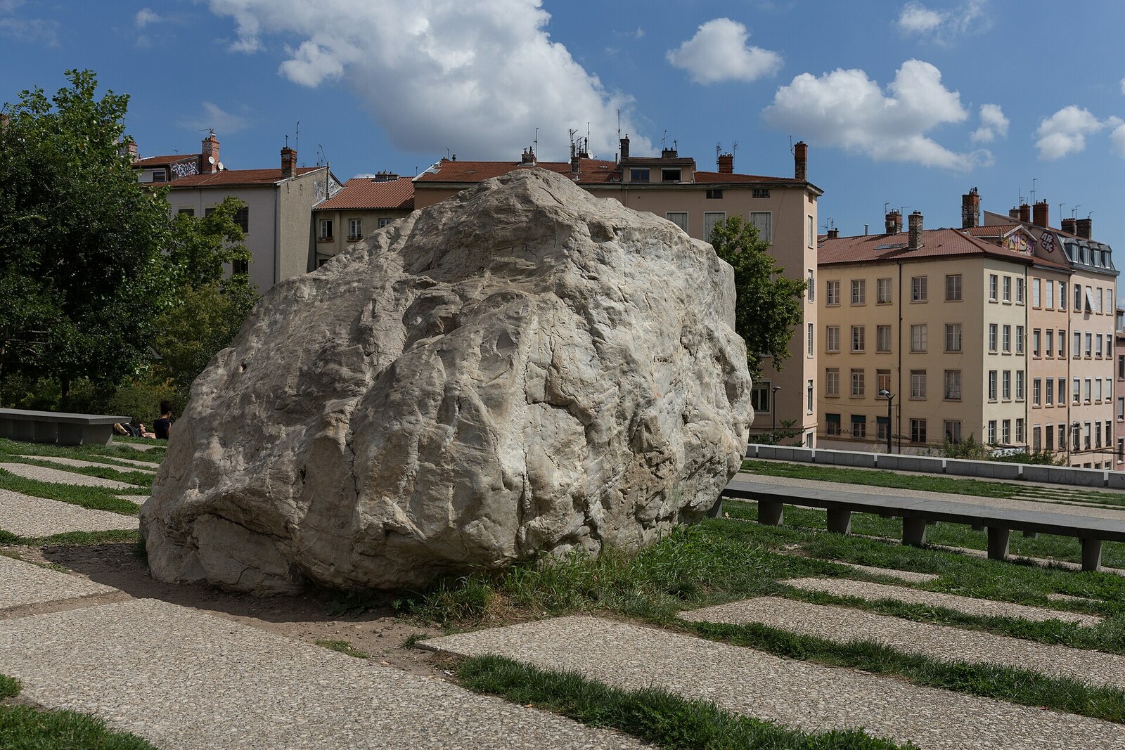
Look around first
What to notice
- Metaquartzite boulder
- Edge of the esplanade
The story of the place
Gros Caillou means “Big Stone” in French. The name appeared only after one boulder—the largest and hardest—was selected from several and put on display above Lyon. In the earliest documents, it still appears without a nickname: simply the new glacial boulder of Croix-Rousse.
It was reached because of competition for passengers. In the eighteen eighties, the entrepreneur Antonin Poyet sought the right to build a second funicular railway in Croix-Rousse. The first such railway had opened from the Rue des Thermes side, but its lower station was still fairly high up the slope. Poyet proposed a more convenient ascent from Place Croix-Paquet and a fare of five centimes—half as much as his competitor's. The existing company tried to block the project: the new tunnel threatened it with the loss of part of its revenue. The municipal council nevertheless chose the proposal of the engineer Augustin Ouzan-Chapon, and Poyet gathered investors and obtained the right to operate the line.
The workers had to cut through the slope beneath streets and residential buildings. In one place, they struck semi-liquid ground that wooden shoring could barely hold in place. In the upper cutting, they were allowed to use gunpowder to break up the rock. There, among the excavated material, several glacial boulders were discovered in eighteen ninety.
A popular story claims that the present Gros Caillou halted construction of the first funicular railway as early as eighteen sixty-one: the workers supposedly could not break it up and had to pull it out whole. Two discoveries are being confused here. A huge limestone boulder was indeed found during construction of the first line, but it was not put on display—the builders turned it into the base of a bridge pier. The stone before you was found almost thirty years later, during construction of the second railway.
In that time, scientists had managed to convince officials that such boulders could not be used up as ordinary building material. The geologists Albert Falsan and Ernest Chantre saw large boulders being broken up to pave roads and burned in kilns for lime. To them, these stones were surviving markers of an ancient glacier: they made it possible to reconstruct the boundary of the ice where earthworks had already destroyed the loose moraine. After appeals from scientists, the Minister of Public Instruction ordered the remaining large boulders to be preserved in eighteen seventy-nine. That is why the hardest boulder was selected from the new find, and the municipality decided to put it on display.
The stone was placed on an artificial base at the eastern end of Boulevard de la Croix-Rousse, beside the upper station of the railway then under construction. The boulevard was laid out on the site of fortifications that, until Croix-Rousse was annexed to Lyon in eighteen fifty-two, divided the two cities. From here, the Rhône plain opened out, and geologists could literally have the boulder face the Alps again. The composition of the rock pointed to Haute-Maurienne or Haute Tarentaise: a glacier carried this metaquartzite at least one hundred seventy-five kilometers about one hundred forty thousand years ago.
On the twelfth of April, eighteen ninety-one, Antonin Poyet's inexpensive funicular opened nearby—such lifts in Lyon were called “ficelles,” or ropes. Later, its tunnel and steep route were converted for what is now Lyon Metro Line C. In two thousand eight, Gros Caillou was moved about thirty meters and removed from its old pedestal to make way for an underground parking garage and a new esplanade. The present boulder lies at the edge of the square, while beneath the slope runs the route during whose construction it was extracted from the ground.
Useful on site
Open urban space at 196 Boulevard de la Croix-Rousse; take care at the edges of the esplanade and near the roadway.
Checked: June 28, 2026. Check the official source before visiting.Do not climb onto the boulder: its shape and rock, foreign to the local slope, are best viewed from the ground. In the open space, allow for wind and wet pavement.