 Guide On Map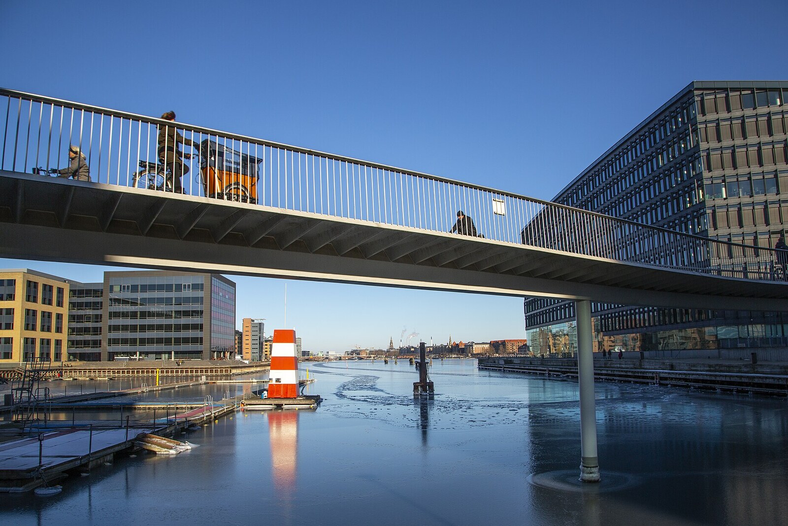
Look around first
What to notice
- The orange curved path
- Supports in the water
- The pedestrian waterfront promenade beneath the elevated structure
- The junction with Bryggebroen
The story of the place
The orange path on supports by the water serves as a separate elevated structure for cyclists: it runs for two hundred thirty meters and leads to Bryggebroen. The waterfront promenade below was left for pedestrians, so the two flows no longer share one narrow passage. The curve was not added for decoration: a computer model helped determine the turns and reduce the number of expensive supports in the harbor. The structure's Danish name combines the words for a bicycle inner tube and a snake, accurately describing its silhouette.
After Bryggebroen opened, the bicycle route across the harbor ran into a staircase by the Fisketorvet shopping center. About twelve thousand people cycled through here every day on their way to work and school. To continue between Bryggebroen and Dybbølsbro, they had to make a detour around the shopping center or dismount and haul their bicycles up the steps. Below, they came out onto a narrow waterfront promenade with sharp turns, where pedestrians used the same passage.
In two thousand ten, the municipality commissioned Dissing+Weitling to replace the stairs with a small ramp. It was to bring cyclists down from about six meters above the waterfront to the water. A descent that was too steep would speed them up before the pedestrian zone, so the slope had to be stretched out.
Poul Ove Jensen, head of the bridge department, proposed changing the brief itself. He had taken part in designing Bryggebroen and wanted the new path to lead directly to its beginning, without an intermediate descent to the waterfront. Jensen's opinion carried weight: he had previously been responsible at the firm for the Great Belt Bridge project. But his proposal turned a modest ramp into a separate elevated structure that required additional funding.
A group of architects was assigned to develop the options. Anna Schepper was the youngest among them. She later recalled that, as a junior architect, she allowed herself to take a risk: instead of a short, straight ramp, the team drew a long route to Bryggebroen. They called it Option D. The descent was one and a half times longer and noticeably gentler.
At first, the architects kept this elevated structure straight. That made it easier to stay within budget: every support in the harbor was expensive. But Schepper and her colleagues calculated another option, the curved D Two. A computer model made it possible to change the radii of the turns and reduce the number of supports in the water. This option required much more design work, and the team added it to the presentation alongside the more cautious proposal. The municipal clients chose that one.
On June twenty-eighth, two thousand fourteen, Denmark's first crossing intended only for cyclists opened. Pedestrians remained below and received the entire waterfront promenade, while cyclists no longer had to carry their bicycles up the stairs. On an ordinary weekday, about eleven and a half thousand trips were made along the new path; in a count the following year, twenty thousand seven hundred were already recorded in one day.
The orange curve over the water is that very risky D Two option that the junior architect added to the presentation. The Danish name Cykelslangen also preserves this story in the bridge's present form: cykelslange is the word for a bicycle inner tube, while slange means snake. Here, the inner tube has uncoiled into a two-hundred-thirty-meter path and linked the staircase to the beginning of Bryggebroen.
Useful on site
Open bicycle connection; pedestrians are more comfortable viewing it from the lower waterfront.
Checked: June 26, 2026. Check the official source before visiting.Do not step onto the bike lane for a photo; it is safer to view the structure's shape from below or from the side.