 Guide On Map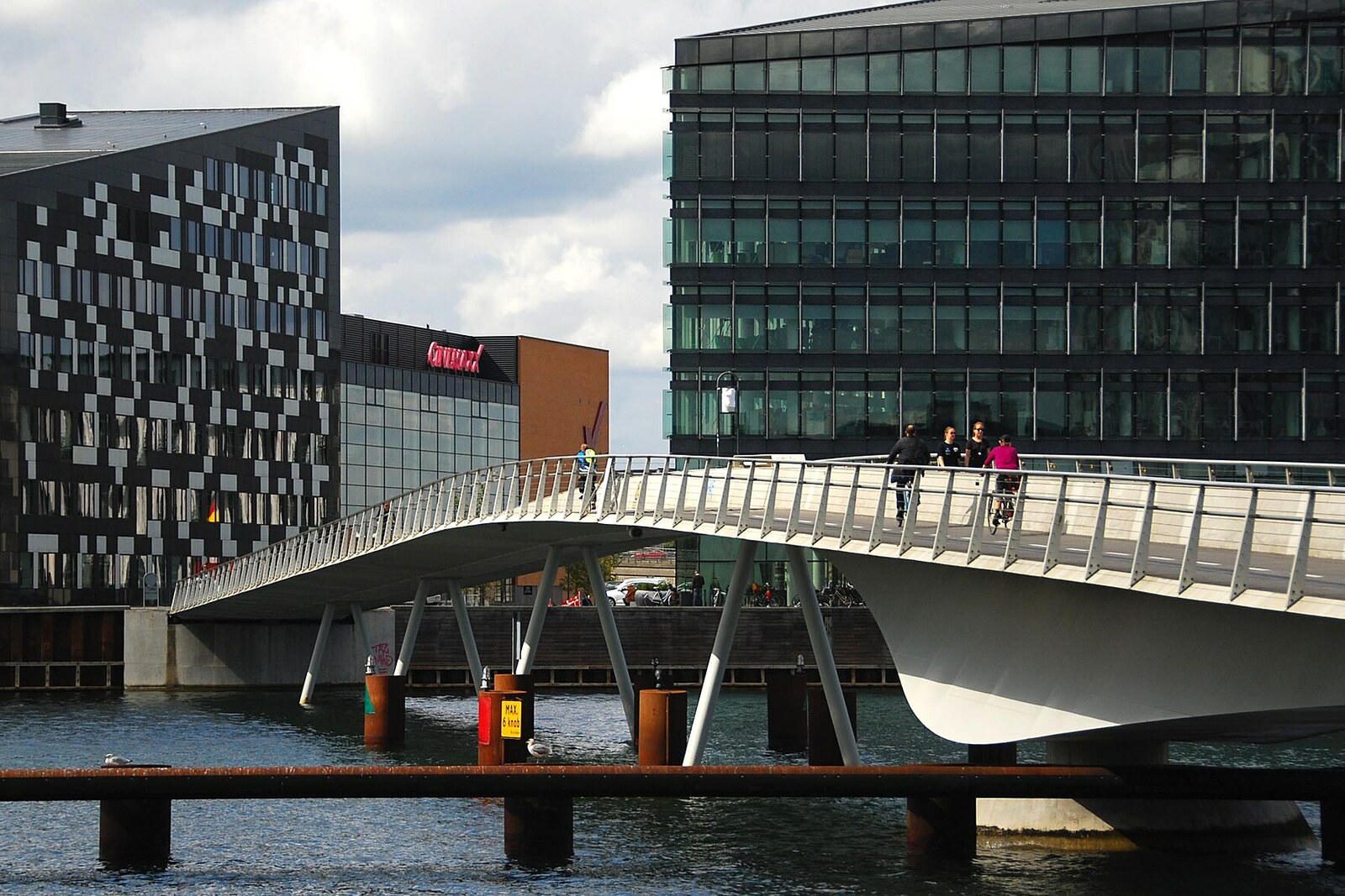
Look around first
What to notice
- Steel span
- Rise toward the western shore
- Havneholmen Square
- Orange overpass nearby
The story of the place
The name Bryggebroen was chosen even before the bridge opened. In the autumn of two thousand five, the newspaper Politiken asked readers to come up with a name for the new crossing and received more than two hundred suggestions. The editors declared the most literal option the winner, and the city commission approved it: brygge means quay in Danish, and broen means bridge. It connected Islands Brygge and Kalvebod Brygge, so in Russian its name can be rendered as the Bridge of Quays.
It took several years to reach the point of building this crossing, because the city was not going to pay for it alone. In the summer of two thousand four, municipal officials reached an agreement with several major landowners on both sides of the harbor. They were developing former industrial sites with housing and office buildings: a convenient route to Dybbølsbro station, the shopping center, and Amager made their land more accessible. The owners committed to contributing seventeen million five hundred thousand kroner over ten years, while the city would cover the rest. That was how Copenhagen began building its first new bridge across the harbor in half a century.
While the bridge was being assembled, the owners of Havneholmen refined their building plans. Underground garages and construction sites occupied the entire tip of the peninsula where the crossing was meant to arrive; part of the construction site even had to extend into the water. In the spring of two thousand six, municipal engineers discovered that the nearly completed bridge ran into a fenced-off construction site. The planned approach across Havneholmen vanished from the drawings along with the available land.
The city council had two options left. It could spend about another two million kroner, finish the structure, and keep it closed until two thousand nine. Or it could add seven million nine hundred thousand and route people between the construction sites along a temporary path. The council chose the second option.
From the bridge's western end, they built wooden decking along the water, then laid a shared path four and a half meters wide and installed barriers to separate pedestrians and cyclists from construction equipment. The crossing opened in September two thousand six. Until the end of the following year, people stepped from the new steel bridge onto temporary planks; then they were moved onto a crossing built over the canal, and the final route appeared along with the neighborhood.
The wooden decking and the corridor between the fences have long since disappeared. What remains is the very change in elevation that made this whole construction necessary: Bryggebroen's western end reaches Havneholmen about one and a half to two meters above the former edge of the quay. From the start, the engineers raised it to the level of the future square—the very square that did not yet exist when the crossing opened.
Useful on site
Open pedestrian-and-cyclist connection; stay in your lane during busy traffic hours.
Checked: June 26, 2026. Check the official source before visiting.Stay in your lane and do not linger in the middle of the passage, especially during busy traffic hours.