 Guide On Map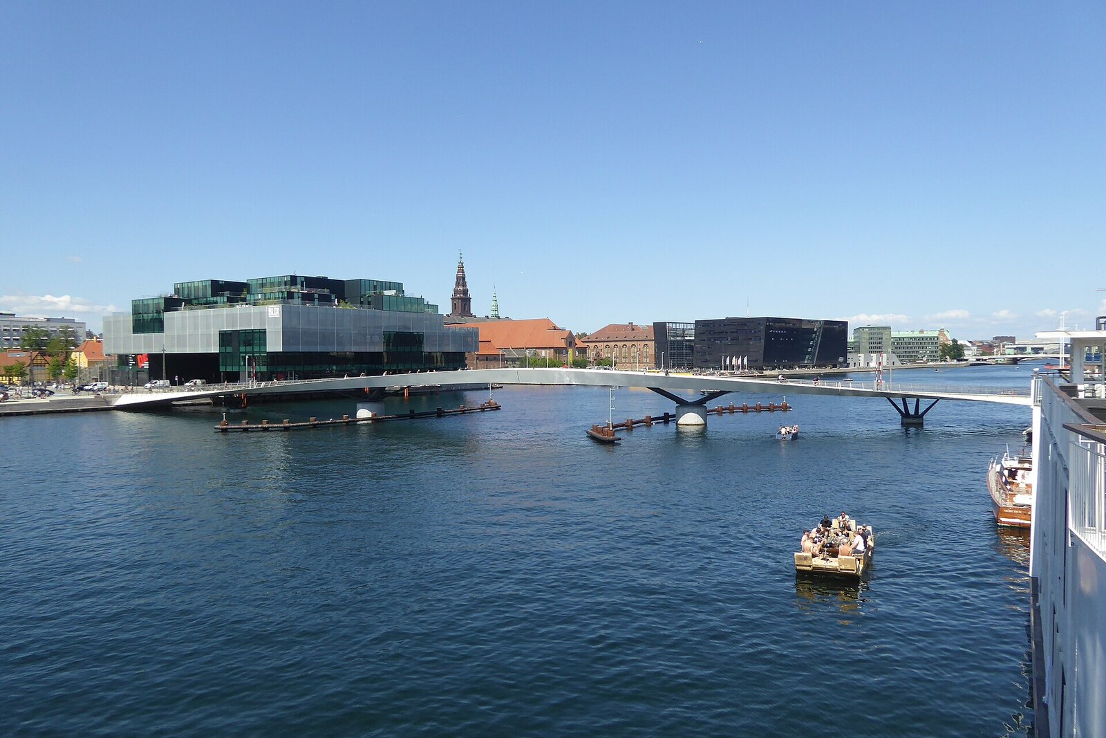
Look around first
What to notice
- The curved low deck
- The joint between the central spans
- The large Langebro to the south
- The red-and-white towers of the bathing facility in the distance
The story of the place
The slender curved line of Lille Langebro follows the route of a wooden bridge that Danish King Christian V ordered built here in sixteen ninety. The king needed a crossing for the garrison: soldiers were to move along the inner side of the fortifications and get from Rysensteen Bastion to Kalvebod Bastion without having their route interrupted at the harbour. The three-meter bridge was called Kalvebodbro—the Kalvebod Bridge.
In seventeen twenty-two, the weathered crossing was widened for horse-drawn carriages. The military called it the long communication bridge, while King Frederick IV used the shorter name Langebro—"long bridge." The name also caught on because this crossing really was longer than the northern Knippelsbro.
A century later, the bridge still belonged to the fortifications, although civilians were already allowed to use it for a fee. In eighteen oh five, the publisher Mathias Sibbern publicly asked why repairs were taking so long: while the decking was removed, every boat trip across the harbour cost several shillings.
Johan Kjær answered him—a keeper of the barrier gate with an interest in preserving the previous order at the crossing. He made his living from this place: he collected the crossing fee, rented out bathing cabins, and carried people across the water. Kjær reminded Sibbern that Langebro had been built for soldiers and that civilian traffic was permitted only with the military's consent. The complaint did not speed up the repairs. Boats continued to wait by the bridge, maintaining communication between the shores for a small fee.
This crossing disappeared at the beginning of the twentieth century. Copenhagen planners wanted to direct traffic straight onto the new wide boulevards, and in nineteen oh three they moved Langebro about one hundred twenty meters farther south. A large road bridge was later built in its present location. Langebrogade, the street on the opposite shore, ended at the water for one hundred sixteen years where the old crossing had once begun.
In twenty nineteen, pedestrians and cyclists regained the former line between the bastions. Engineers from Buro Happold and architects from WilkinsonEyre made the bridge low and gently curved, while preserving the shipping channel. Small vessels pass beneath the deck, while for larger ones the two central spans swing aside. When the bridge closes, hydraulic cylinders concealed inside draw its halves together, turning them into a rigid single span.
At first, the name was the project's nickname. After an open competition, the city commission approved it officially: Lille Langebro means "little Langebro." The large Langebro remains farther south, on the line of the boulevards, while the little one has taken the old site of the military crossing.
Useful on site
Open pedestrian and bicycle bridge; traffic is temporarily stopped when sections are opened for vessels.
Checked: June 26, 2026. Check the official source before visiting.When a vessel passes, the bridge may temporarily open apart; stay behind the barrier and wait for the signal.