 Guide On Map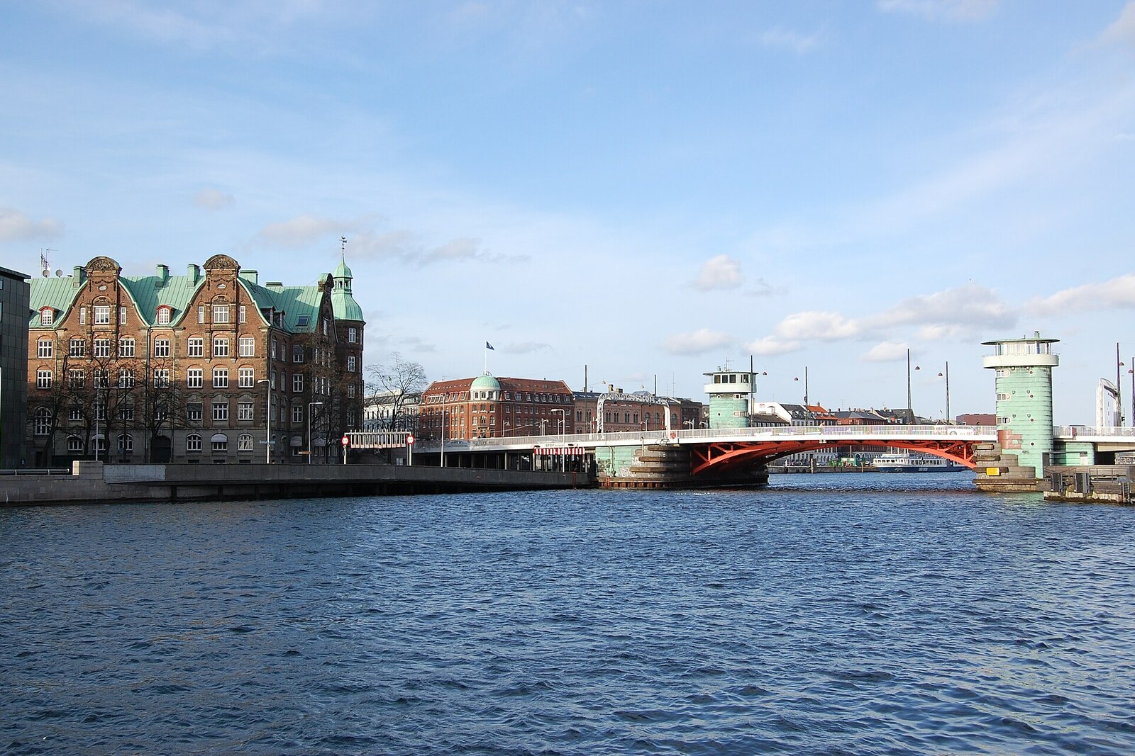
Look around first
What to notice
- Copper towers
- Steel lifting span
- Harbor on both sides of the bridge
The story of the place
The copper towers at the edges of the steel span identify a bridge that has to make way for shipping. Mechanics and the bridge crew once worked inside, while the person in charge of opening the bridge decided when the road across the harbor would yield to the water. The present structure opened in nineteen thirty-seven, replacing the earlier wooden crossings.
Hans Knip was ferrying people across the harbor by boat before a bridge appeared here. The crossing was his work: Amager lay on the other shore, and Christianshavn did not yet exist.
In sixteen eighteen, the Danish king Christian IV began building a new fortified town in the Amsterdam style and ordered it linked to Copenhagen by a wooden bridge. Knip's boats acquired a land-based competitor. But the bridge could not be turned into a solid dam: ships with masts passed through this part of the harbor. The builders left lifting spans, and every captain now needed someone to let the ship through.
In sixteen thirty-three, Knip bought the former customs house at the Christianshavn end of the bridge. Eight years later, he was entrusted with overseeing the crossing. As keeper, he raised and lowered the span and watched the traffic; as a harbor official, he collected a fee from passing vessels. The man whose boats had been replaced by the bridge settled in the house beside that bridge and began deciding when the road would yield to the water.
Knip died in sixteen forty-seven. After his death, the house continued to be called Knippenshus—Knip's house. In documents, the bridge itself was long listed as Christianshavns Bro, but townspeople called it Knippensbro, meaning Knip's bridge. In the nineteenth century, the pronunciation became distorted into the present-day Knippelsbro. The name is sometimes mistakenly linked to the Danish word for “club”; there is neither a club nor a military nickname behind the bridge—it is the surname of the boatman and keeper.
The current steel bridge opened in nineteen thirty-seven. Its copper towers were built for the successors to Knip's trade: inside were rooms for the bridge crew, mechanics, and a control room from which the person in charge directed the opening of the bridge. The spans are now raised remotely, and there are no permanent attendants in the towers.
Knip's house has not survived, the wooden bridge was dismantled, and the former crossing approached Christianshavn along a different line. What remains is the name of the man who first carried people across the water here and then opened a way through the bridge for ships.
Useful on site
The bridge is open around the clock; it opens for vessels on a schedule.
Checked: June 28, 2026. Check the official source before visiting.View the mechanism from the sidewalk and watch for cyclists. When the bridge-opening signals sound, do not approach the barriers.