 Guide On Map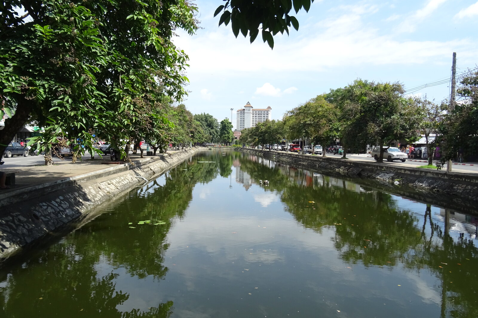
Look around first
What to notice
- Water channel
- Grassy slopes
- Remains of the brick wall
- Roads along the banks
The story of the place
The East Moat preserves one side of the water rectangle that enclosed old Chiang Mai. Water from Doi Suthep was brought in at the northwest corner and directed toward the southeast corner, so it could flow downhill within the city. During the rainy season, the channel received excess runoff and also supplied neighboring settlements with water. The brick wall has almost disappeared, but the line of the fortification is still visible between the grassy slopes, with roads now running alongside it.
In seventeen ninety-one, Kawila held the title of ruler of Chiang Mai, but he could not hold the city itself. The ruler of Lampang, appointed to restore the northern capital, brought people to the ruined walls and led them away again a month later. The chronicle gives the reason plainly: there were too few people to rebuild a large city.
After wars, famine, and epidemics, the residents left Chiang Mai. Forest grew among the houses. The moat still marked the square of the old capital, but there was no one to defend it. A wall about one and a half kilometers long on each side required diggers and masons; guards required fighters; and all of them required farmers able to grow rice.
Kawila therefore lived not here, but in Pasang, a fortified settlement forty kilometers to the south. He began with three hundred soldiers and several hundred men from nearby villages. Pasang stood amid fertile lands by the Ping and Li rivers; from there, help could come from Lampang, or people could retreat there in case of attack. But Pasang could not become a permanent capital. Kawila was not descended from the old Mangrai dynasty, and the return of Chiang Mai itself was the strongest confirmation of his right to rule the north.
Volunteers alone were not enough. Kawila called back residents who had hidden after the war in forests and neighboring valleys, while his detachments went for people in settlements to the north and beyond the Salween River. Families were taken away by force. In Lan Na, this policy was expressed in a formula: “Vegetables are put into baskets, people into cities.” For Kawila, each family brought in meant a cultivated field, a repaired stretch of wall, and one more defender. For those resettled, it meant a home they had not chosen.
Only after several years of such preparation did Kawila decide to return. On March ninth, seventeen ninety-seven, he entered Chiang Mai ceremonially. People cleared the neighborhoods, restored monasteries and fortifications. Less than a year later, Burmese troops surrounded the city from four sides, including along this eastern moat. Kawila held the defense until detachments from Siam and Vientiane came to help and lifted the siege in the spring of seventeen ninety-eight. After that, the residents no longer left Chiang Mai as an entire city.
Kawila restored the old water line rather than digging it anew. The ground inside the walls slopes from northwest to southeast. Water from Doi Suthep was brought into the moat at the northwest corner and directed along both sides toward the southeast corner at Katam. Ditches carried away excess water during the rainy season and supplied neighboring settlements with water. On the east, the moat both received runoff and blocked the approach to the wall.
The brick wall along most of the eastern side has disappeared, and roads have been laid along both banks. The water rectangle has preserved the scale of the fortification for which Kawila lacked people in seventeen ninety-one, and which those people defended seven years later.
Useful on site
Open as part of the city street and moat embankment.
Checked: June 15, 2026. Check the official source before visiting.Listen from a safe section of sidewalk, and cross the roadway only at a designated crossing.