 Guide On Map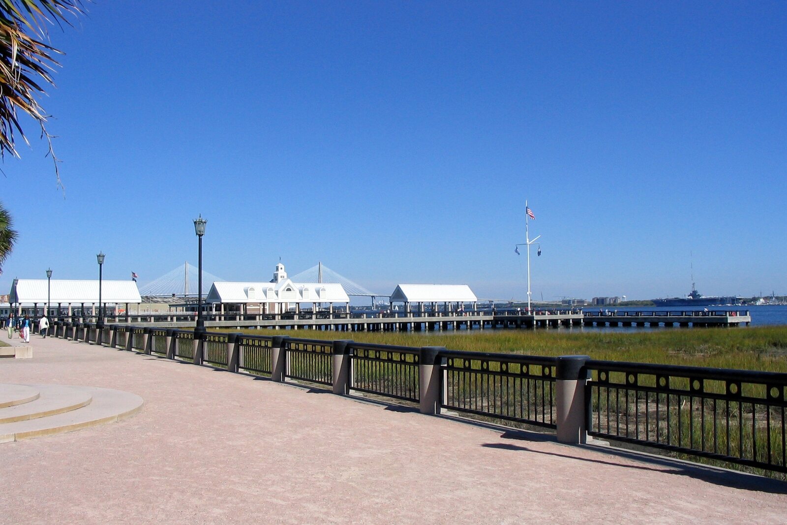
Look around first
What to notice
- Paths that continue the lines of the streets
- Pedestrian piers
- Swings above the river
- Low walls beside benches
The story of the place
The Cooper River shore is arranged so that city streets do not run into the water: their direction is continued by paths to pedestrian piers. The street along the shore was given over to pedestrians for four blocks, while the decks over the water were kept for walking and fishing, not for vessels. Swings hang right by the river, and low walls run beside the deep benches, convenient for resting your feet on. Here you can spend time above the harbor without going out onto it in a boat.
Until the middle of the twentieth century, cargo and passenger vessels docked here. In June nineteen fifty-five, a fire destroyed one of the steamship terminals. The companies closed the piers, and for nearly a quarter of a century, burned pilings, overgrown areas, and gravel parking lots remained along the waterfront.
In the late nineteen seventies, a private developer bought the land. He planned to build high-rise residential and commercial buildings and fence off the shore. Apartments and shops were meant to generate income; the city would gain new taxes and get rid of the abandoned site. The project was supported precisely as a profitable deal.
Joseph P. Riley Jr., elected mayor of Charleston in nineteen seventy-five, spoke out against it. He worked to ensure that the last open stretch of the Cooper River waterfront in the city center remained accessible to everyone. This required persuading the Charleston City Council to forgo future taxes, buy the expensive land, and take on the costs of maintaining the park. Opponents reminded people that idle people linger in parks and that their upkeep never pays for itself.
Riley arranged a land swap, sought grants, and raised funding. In nineteen seventy-nine, the city acquired the land. The design was entrusted to the team of landscape architect Stuart Dawson. He extended the lines of city streets with pedestrian paths to the water and closed four blocks of Concord Street along the future park to cars. The piers were given a different purpose: vessels were not meant to dock there. Riley wanted to give a person without a boat of their own the chance to go out over the water and sit where port facilities had once stood.
Construction did not begin until nineteen eighty-eight. The following autumn, Hurricane Hugo damaged the not-yet-open park by about one million dollars. Workers restored what had been destroyed, and in May nineteen ninety, the park nevertheless welcomed its first visitors. People began walking here, fishing, sitting on swings above the river, and taking children beneath the streams of the fountains.
Riley even intervened in the dimensions of the furniture. At his insistence, the benches were made a quarter deeper than before and placed beside low walls so that a seated person could stretch out their legs. Many years later, he was walking here with a journalist, saw a young man resting his sneakers on such a wall, and stopped in delight: the man was using the park exactly as intended.
Toward the end of Riley's forty years of service, the Charleston City Council gave the park the name of the man who had not allowed this shore to be closed off by gates. Its official name is now Joseph P. Riley Jr. Waterfront Park. Near the northern fountain, his name and the words spoken at the opening are carved into that very low wall on which it is convenient to rest your feet.
Useful on site
Open city park; the pier, fountains, and individual areas may temporarily close because of construction work, weather, and events.
Checked: June 29, 2026. Check the official source before visiting.This is a long outdoor stop: use the shade, but account for the sun, wind, and reflections from the water.