 Guide On Map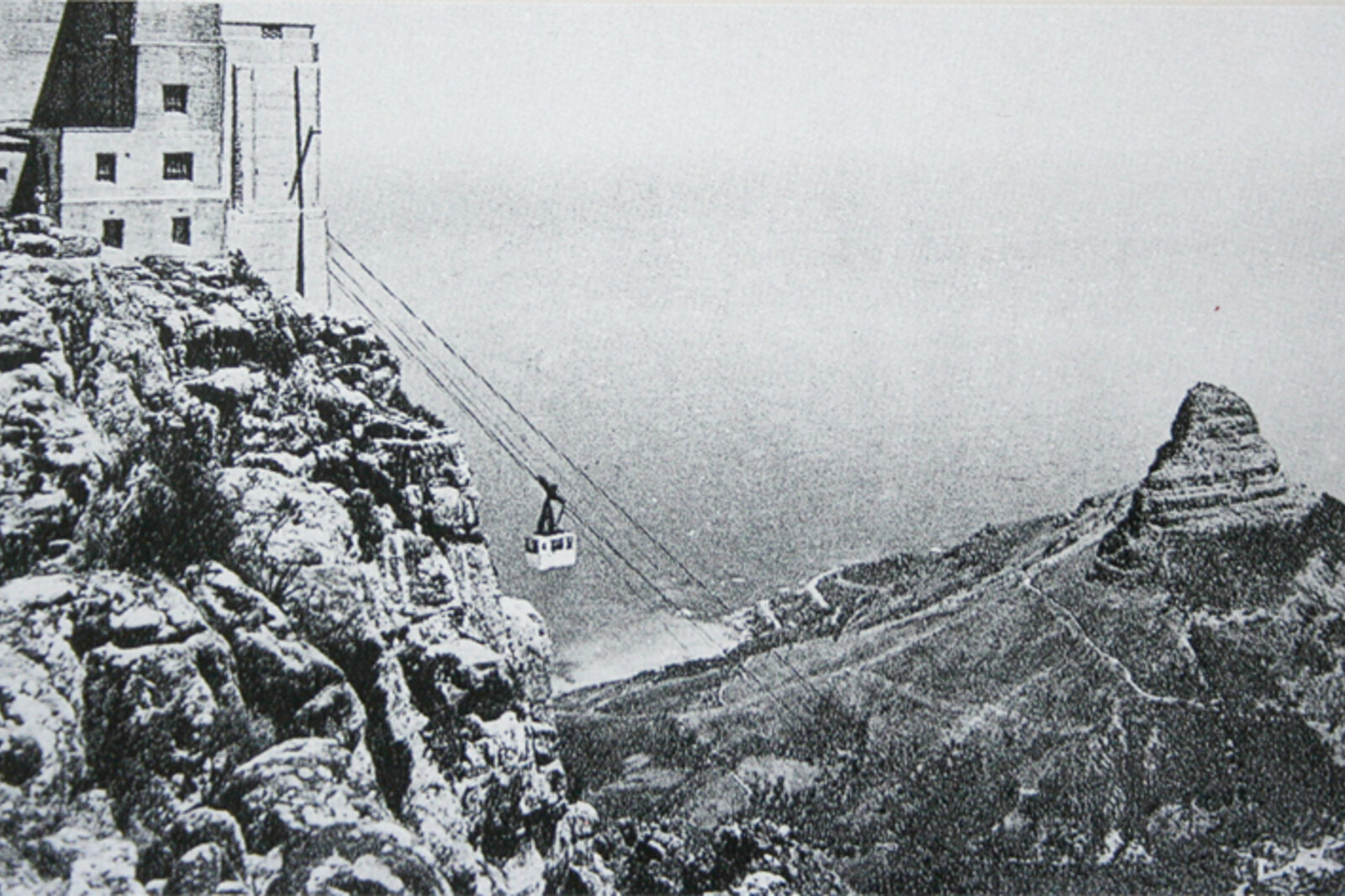
Look around first
What to notice
- Rock outcrops on either side of the ravine
- Rusted parts in a stone slab
- Concrete blocks
- Remains of the upper platform
The story of the place
The hiking trail follows the line of the former cableway on the western slope of Table Mountain. Rusted parts in a stone slab mark its intermediate station, while concrete blocks on the plateau remain from the upper platform. Cement, granite, and dismantled machinery were hauled up the cable; from there, freight was transferred to a narrow railway leading to the reservoir. The line crossed fourteen spans, and after the work ended, it disappeared along with the construction settlement.
The rock outcrops on either side of the ravine resemble castle gates. That is where the name Kasteelspoort—“Castle Gates”—comes from. At the end of the nineteenth century, these gates led to a construction site that was almost impossible to supply from the coast.
Cape Town did not have enough water. Engineers had already diverted part of the flow of the Disa River to the city through a tunnel in the Twelve Apostles, but without a reservoir the supply depended on the season. In eighteen ninety-two, the municipality commissioned Thomas Stewart, a young Scottish engineer who had just opened his own practice, to build a dam. His livelihood depended on municipal contracts, and his first major independent job would either establish his reputation or end it at the very beginning.
The future dam could be reached along Pipe Track and then by climbing through Kasteelspoort. People, provisions, and small tools could pass this way, but barrels of cement, granite facing blocks, and heavy machinery could not. At first, porters carried the loads up themselves. It was far too slow.
Stewart built an aerial cableway from Victoria Road in Camps Bay to the edge of the plateau. It was completed in eighteen ninety-three—thirty-six years before the famous passenger cableway to Table Mountain opened. The line ran for about one thousand six hundred meters, climbed six hundred sixty-five meters in elevation, and was supported by fourteen spans. An open freight car ran along the cable. A normal load weighed about half a ton; in place of freight, it could hold two workers.
At the top, materials were transferred to a narrow-gauge railway and carried across the plateau to Woodhead Dam. Machinery was delivered dismantled and assembled on the mountain. But the two-person freight car could not carry about five hundred people up to the construction site every morning. Stewart ordered an entire settlement to be built beside the works. Scottish stonemasons and quarrymen lived there alongside local workers, cut sandstone for the wall, and received their wages at a mountain post office where a bank operated.
The dam was completed in eighteen ninety-seven. The post office closed on the first of April, the construction settlement was dismantled, and the reservoir began supplying the city. Before long, there was not enough water again. Stewart gathered the former crew, restored the cableway, and used it to build the next mountain reservoirs. The success of this work turned a novice consultant into one of South Africa's leading hydraulic engineers.
The cableway is gone. Rusted parts protrude from a stone slab at the former intermediate station, while concrete blocks and remains of the upper platform survive above. The hiking trail follows the same corridor: freight was received below, lifted here above the slope, and then carried by rail to the dam. Where the ascent through Kasteelspoort now ends, the builders' road to work began.
Useful on site
Open mountain trail; stay on the main route and do not climb unclear side paths.
Checked: June 28, 2026. Check the official source before visiting.The remains of the upper station are higher up and may be indistinguishable from Pipe Track. The ascent through Kasteelspoort is a separate mountain route, not a required part of this walk.