 Guide On Map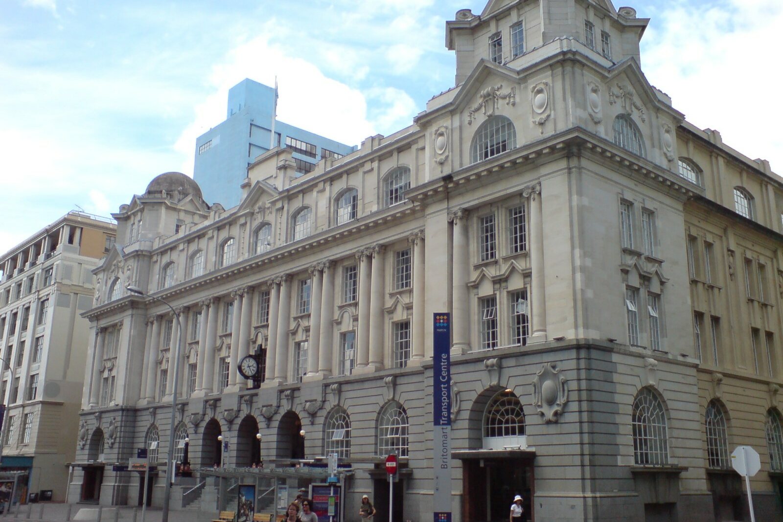
Look around first
What to notice
- White stone facade
- Turrets of the former Chief Post Office
- Basalt stream line
- Welcome mat pattern
The story of the place
The square is paved with more than one hundred thirty-seven thousand pieces of basalt. A dark line leads from Queen Street to the harbour, joining waves and the pattern of a welcome mat made from New Zealand flax. The reclaimed land hid the mouth of Waihorotiu Stream here; it now runs beneath the street in a culvert. Behind the square, the white stone building with turrets remains, and its central hall now admits Waitematā Station passengers through ticket machines and fare gates.
By late October nineteen eighteen, a quarter of Auckland’s three hundred thirty Post and Telegraph Department employees were already laid up with influenza. The white building in front of the square housed the Chief Post Office, with the central telephone exchange inside. Women telephone operators connected subscribers by hand and tried to keep the city’s communications from coming to a halt.
Calls were allowed only for urgent business. At the switchboard, doctors’, hospitals’, and priests’ lines were marked with red discs, and police and funeral homes’ with black ones. Both colors were often needed that autumn: the epidemic claimed more than a thousand lives in Auckland and its suburbs. Some patients called while already delirious; operators had not only to connect them to the right number but also to talk with those who had no one left beside them.
The healthy telephone operators worked double shifts for a whole month. They were paid one shilling for each extra hour and driven to and from work by car—a rare privilege for a woman employee of the time, received along with the daily risk of infection. By the end of November, the number of employees falling ill began to decline. In nineteen nineteen, Post and Telegraph employees were given an extra week of leave for this work, and those who had not left their posts throughout the epidemic received another three days.
The Chief Post Office had opened just six years earlier. The Postal Department chose a reclaimed site at the very end of Queen Street: the port wharves, railway, and tram terminus were nearby. People came here to send letters, collect pensions, keep savings, and use the telephone. The white stone facade marked the institution through which residents’ money, messages, and everyday business passed.
The post office closed the building in nineteen ninety-two. Three years later, the city council bought it, and in two thousand three opened the main entrance to the railway station inside. The manual switchboards and the red and black discs disappeared. The facade, turrets, and central hall remained; it now contains the ticket machines and fare gates of Waitematā Station.
The square received its name in two thousand twenty. It was proposed by representatives of Ngāti Whātua Ōrākei, one of the local Māori communities. “Te Komititanga” means mixing or merging. Train, bus, and ferry passengers meet here, but the name also points to two streams of water. Beneath Queen Street, Waihorotiu Stream runs in a culvert. Before the shoreline was reclaimed, it emptied here into Waitematā Harbour.
Māori women artisans carried this merging into the paving. Using more than one hundred thirty-seven thousand pieces of basalt, they created the stream’s line from the south, the harbour’s waves from the north, and, in the middle, the pattern of a welcome mat made from New Zealand flax. On an ordinary day, the square serves as a passage between the station, bus stops, and ferries; during city events, concerts, festivals, and screenings are held here. At the southern edge, the basalt line runs toward Queen Street, above the channel that no longer exists at the surface.
Useful on site
Waitematā Station: Mon–Thu 05:00-23:00, Fri 05:00-01:15, Sat 05:45-01:15, Sun 05:45-23:00; the square is open as a public space.
Checked: June 28, 2026. Check the official source before visiting.Look at the facade and paving from the square; you do not need to enter the station for this story.