 Guide On Map
Auckland waterfront: port, ferries, and industrial traces
From Te Komititanga through Viaduct Harbour to the silos of Tank Farm
Guide On Map on your phone
Open the walk like a regular app
It takes about 10 seconds to install. No app store needed.
The whole path
Route map
About the walk
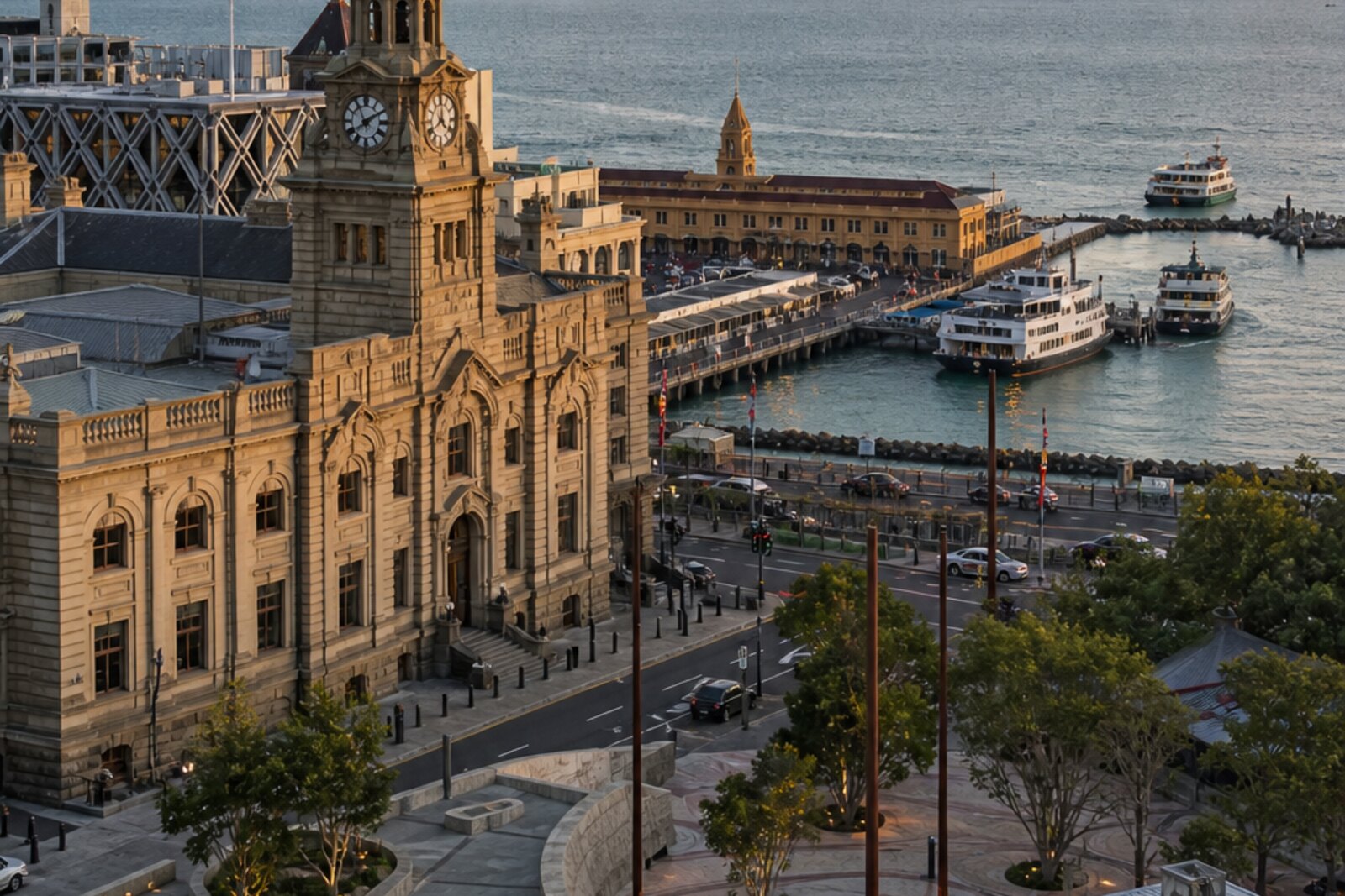
You will start at Waitematā Station, in the square above a hidden stream. Then you will head for the ferries and walk west along the basins of Viaduct Harbour. Beyond the drawbridge, Wynyard Quarter begins, and the walk ends at the concrete silos of the former Tank Farm.
This is not a grand harbour survey, but a look through its working layers. A post office and telephone exchange. A ferry facade. A museum wharf. A fishing harbour, bridges, rails, and cement hoppers.
The story has documents, mechanics, and small human decisions. Why did telephone operators need colored disks? How did a meeting by the ferries end up in a court case? How did a ship's mast get stuck beneath a half-closed bridge? The answers will appear on the spot, without museum ceremony.
After the walk, you will recognize the Auckland waterfront by what people usually miss: a streambed beneath stone, old spans, rails that lead nowhere, and cement towers by a public shore.
Why this order
The route begins where, at the former edge of the harbour, the post office, railway, and city stream met. From here it makes sense to head to the Ferry Building: the end of Queen Street turns the city's flow into ferry traffic. Farther on, the museum wharf continues the maritime thread through vessels and the work of craftspeople. Nearby Viaduct Harbour shows the port system for which its basin and old lifting bridge were built. The next crossing replaces cargo infrastructure with pedestrian infrastructure and carries you into Wynyard Quarter. Beyond it, the silos complete the route: beside the former tracks, it becomes clear why the western harbour needed a wharf, railway, and large cement stores all at once.
Those interested in urban history through human episodes Those who enjoy ports, vessels, and industrial architecture Those who want to walk through central Auckland along the water
Those expecting a tour of the city's main postcard sights Those uninterested in technology and urban infrastructure Those who prefer walks without weighty historical subjects
Before you go
Almost the entire story can be experienced from outside, without entering buildings. Plan a visit to the New Zealand Maritime Museum, its exhibitions, or an outing on its museum vessel separately: it is an addition, not a required part of the route. At active ferry berths, do not block passengers' way and watch for service barriers. Te Wero Wynyard Crossing opens for vessels, so a short delay at the bridge is a normal part of the walk. The waterfront is exposed to wind and rain; a waterproof outer layer and shoes that are comfortable on wet decking will help.
When to go
Choose daylight hours: the waterfront is quieter in the morning, while later in the afternoon there is more activity by the water. In bad weather, allow time for brief shelter stops.
Backup plan
If the bridge is temporarily open, wait for the operator's signal and the walkway to reopen without going beyond the barriers. If the closure lasts longer, finish the walk at Viaduct Harbour and leave Wynyard Quarter and Silo Park for another time—you will still hear a complete first part of the story. In heavy rain, you can shorten the stops to the former Chief Post Office, the Ferry Building, and an exterior look at the museum, using cover only where it is available rather than lingering at entrances or in passenger flows.
Route conditions
Surface. Paved — 1.3 km (data covers 76% of the route)
Facilities. Toilets — 14; drinking water — 17
Elevation. Ascent — 7 m; descent — 8 m
OpenStreetMap extract of June 23, 2026: database data, not a check on the ground. Data © OpenStreetMap contributors, ODbL licence
Walk plan
Open in maps ↗- 1
Te Komititanga and the former Chief Post Office
Here you will see how the post, the city’s communications, the railway, and a hidden stream came together at the edge of the harbour. - 2
Ferry Building at the end of Queen Street
A court case will open up a social history for which the busy ferry terminal has no commemorative plaque. - 3
New Zealand Maritime Museum
The story of how a working scow was built explains why the museum was conceived at once as a collection, a workshop, and a harbor. - 4
The Harbour of the Unrealized Viaduct
Here, the crew of a radio ship tried to pass through the basin’s only exit in defiance of the police. - 5
Te Wero Wynyard Crossing
Repairs to the temporary bridge will show how much city life has come to depend on a short route across the water. - 6
The Silos of the Former Tank Farm
The engineer’s return will show how an industrial site became a public space without losing its old equipment.
Route features
Everything you need stays in the browser
Progress, saves and your trip plan are stored on this device.
Add Guide On Map to your home screen so the walk opens outside the browser.
How we handle sources, maps and corrections: our editorial standards