 Guide On Map
Wellington Cable Car and Wellington Botanic Garden ki Paekākā
From Lambton Quay through Kelburn to Bolton Street
Guide On Map on your phone
Open the walk like a regular app
It takes about 10 seconds to install. No app store needed.
The whole path
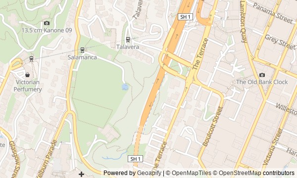
Route map
About the walk
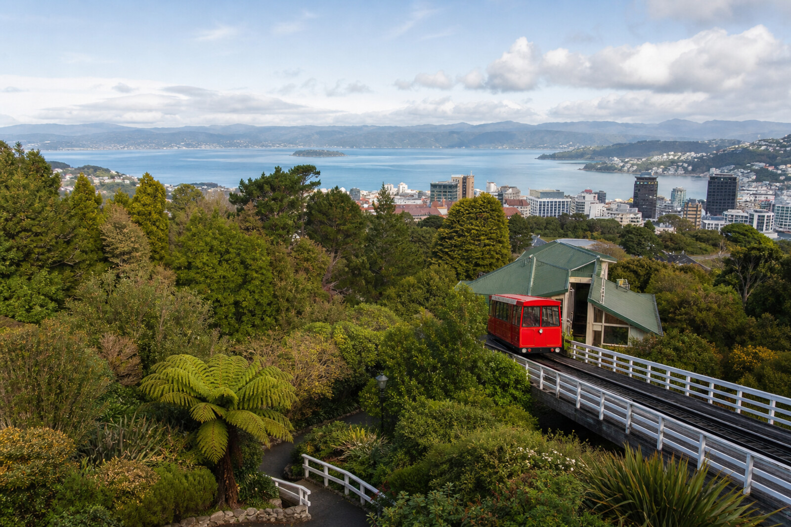
You will begin on Lambton Quay, in a narrow passage between shops, and ride the red Wellington Cable Car up to Kelburn. On the ridge, the harbor, the city, and the rails climbing the steep slope come into view. Nearby are old cars, the machinery room, and an observatory beneath its dome. Then the route turns downhill: through conifer shade, a rose garden, a glasshouse, and a cemetery cut through by a motorway.
The story follows people who had to argue with their superiors, wait for decades, hide a mistake, or read worn-away letters by flashlight. You will find out why an expensive plot was separated from a newspaper purchase, why a woman driver insisted on trousers and a tie, and what happened after the roses were sprayed incorrectly. The answers appear only when you reach the places themselves.
By the end, you will connect a narrow terminal, an experimental forest, and a bridge above the highway into one story of how Wellington climbed into the hills and preserved the traces of that journey.
Why this order
First, you enter the tight terminal on Lambton Quay: without this lower point, the climb toward the built-up hills makes little sense. The car brings you to the Kelburn platform, where you can immediately see the slope you have traveled, the rails, and the center below. The neighboring Cable Car Museum is only a few steps away: after riding in a working car, you can make sense of the preserved machines and the earlier drive system. Behind the museum, on the same ridge, stands Space Place at Carter Observatory—the height gained by transport becomes a place to watch the sky as well. From Carter Observatory, you enter the garden and begin descending among old experimental plantings; after the wooded stretch, the transition to the formal circle of the rose garden is especially clear. The glass facade at the edge of the flowerbeds continues the garden's story through a public gift. From there, a path through Anderson Park leads to Bolton Street, where the green descent meets the Wellington Urban Motorway and ends near the city center.
Those who want to combine a city view, engineering, and a garden walk People who prefer human stories to a list of sights Those who enjoy a route that is mostly downhill
Those who dislike hilly paths and long descents Those looking for a route entirely indoors Those planning to limit themselves to the Wellington Cable Car ride alone
Before you go
Before setting out, check the current opening status of the Wellington Cable Car, Cable Car Museum, and Space Place at Carter Observatory: plan a visit to the astronomy center separately if you want to catch a program or enter the dome. In 2026, Begonia House is closed for renovation, and Picnic Cafe may have temporary project closures, so do not rely on either as an essential indoor stop or a guaranteed place to eat. Wear shoes with reliable grip: after rain, garden paths and descents can be slippery. Wind protection is useful at the upper station, even when the center is warm.
When to go
2–3 hours
Backup plan
If the Wellington Cable Car is not running, do not try to preserve the whole itinerary mechanically: begin at an accessible entrance to Wellington Botanic Garden ki Paekākā and follow the walking section from the upper sites to Bolton Street, checking the garden map. In strong winds, spend less time at the viewpoint and shift the focus to Cable Car Museum and Space Place at Carter Observatory, if they are open. In rain, stick to the main paths, avoid sodden side trails, and, if needed, end the walk after the rose garden. If Begonia House or Picnic Cafe is closed, view them only from outside and do not linger near work areas.
Route conditions
Surface. Paved — 1.4 km; unpaved — 8 m (data covers 39% of the route)
Stairs. Flights: 1, 49 m in total
Access. Wheelchair — no; stroller — limited (stairs)
Facilities. Toilets — 3
Elevation. Ascent — 118 m; descent — 99 m
OpenStreetMap extract of June 18, 2026: database data, not a check on the ground. Data © OpenStreetMap contributors, ODbL licence
Walk plan
Open in maps ↗- 1
Wellington Cable Car Terminal on Lambton Quay
Here you will see why the route up the hill began with a small plot in one of the city’s most expensive blocks. - 2
Kelburn Viewing Platform
The line panorama will become the backdrop for a dispute over who was allowed to operate its new cars. - 3
Cable Car Museum
The old cars and drive show what was saved after the line was completely rebuilt. - 4
Space Place at Carter Observatory
The observatory adds another story of a long wait on the same city ridge to the route. - 5
The Trail in Forest Shade (Botanic Garden)
On the slope, you will see the result of an experiment for which plants were once chosen for their practical usefulness. - 6
Lady Norwood Rose Garden
Behind the rose garden's formal layout lies the story of a gardening mistake that people preferred not to publicize. - 7
Begonia House and Picnic Cafe
The glass complex shows what became of a private gift the city had awaited for many years. - 8
Bolton Street Cemetery
The finale will link the green descent with the motorway and the work of volunteers who deciphered fading inscriptions.
Route features
Everything you need stays in the browser
Progress, saves and your trip plan are stored on this device.
Add Guide On Map to your home screen so the walk opens outside the browser.
How we handle sources, maps and corrections: our editorial standards