 Guide On Map
Singapore by the Water: from Padang to Gardens by the Bay
From National Gallery Singapore, past the mouth of the Singapore River, to Supertree Grove
Guide On Map on your phone
Open the walk like a regular app
It takes about 10 seconds to install. No app store needed.
The whole path
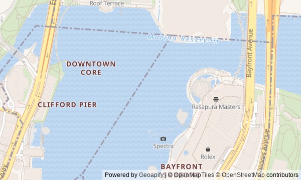
Route map
About the walk
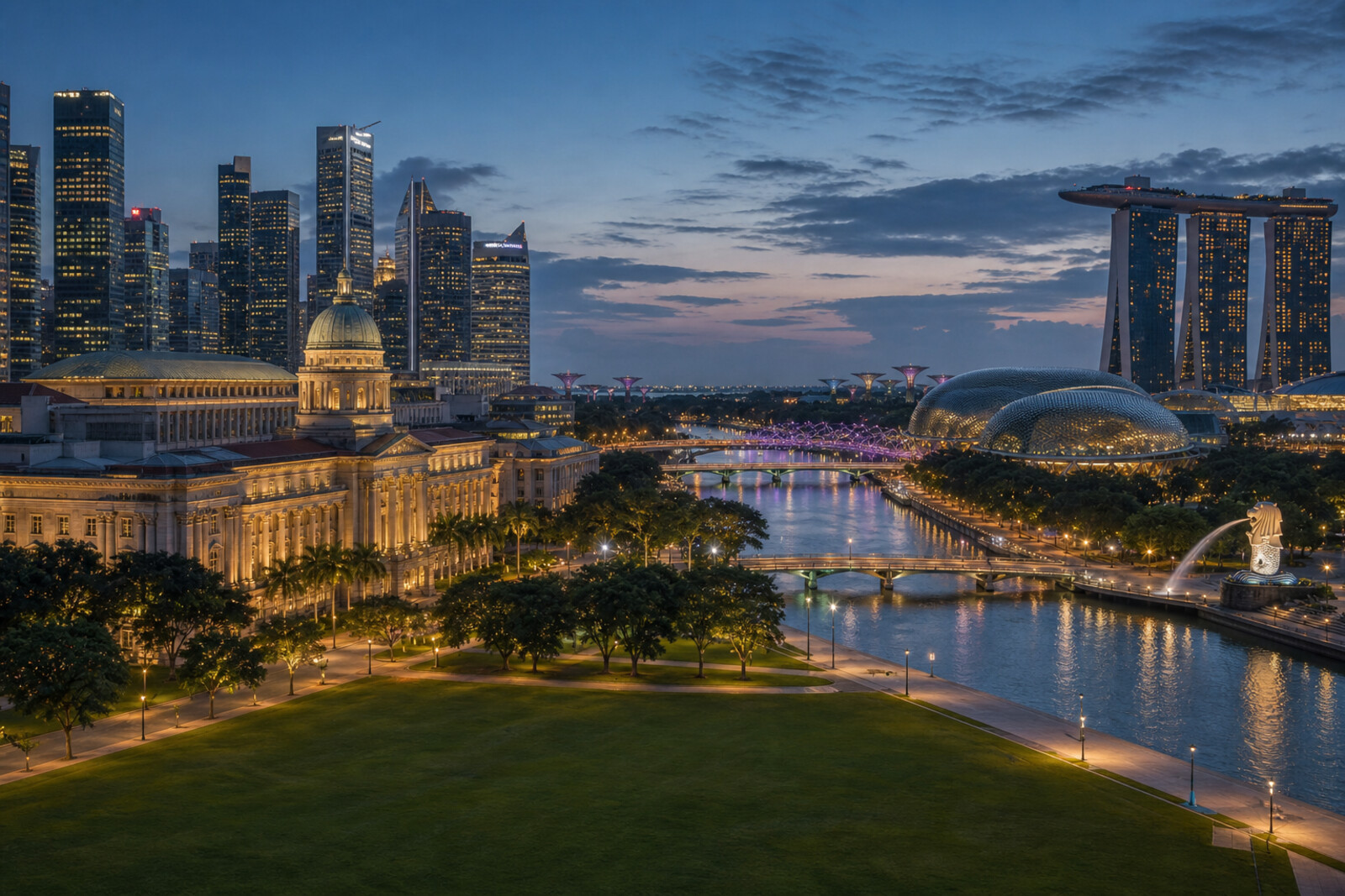
You will walk from Padang and the formal facades of the Civic District to the mouth of the Singapore River, then continue along Marina Bay and finish beneath the canopies of the Supertrees.
At first, the route will stay close to former government buildings, the theatre, and the old river crossing. Then colonial stone will give way to open water, theatre domes, a steel spiral, and a garden on reclaimed land.
You will come across details that do not fit on a postcard. Why did a composer argue over eight bars? Why are there still restrictions for cattle at the bridge? What made the city send its symbol sailing?
The story will unfold through decisions, mistakes, and the work of ordinary people—without a polished success story. By the end, you will be able to pick out in the Marina Bay panorama the old mouth of a trading river, the reclaimed waterfront, and the places where Singapore’s national symbols were created.
Why this order
Padang will be the starting point because this is where political history is tied to an open square and buildings of power. The neighboring theatre will continue the story with the creation of the anthem; from there, it is only a few steps to the Empress Place Building, where the struggle was already for real authority. A new layer begins at the riverfront: Cavenagh Bridge links the administrative bank with commercial Fullerton. From here, the river mouth leads to the Merlion—a new symbol beside the old river entrance. Then the pedestrian crossing near Esplanade Bridge takes you to a place transformed along with the waterfront and its former street trade. Further along the water, the route reaches Helix Bridge and reveals the engineering side of the same remaking of the shore. Beyond the bridge, the route enters reclaimed land and ends in Supertree Grove, where a former car park was turned into a shared city space.
Those who want to understand the Marina Bay panorama, not just photograph it. Fans of urban history that can be traced through buildings, bridges, and the shoreline. Those interested in the ordinary people behind national symbols and major construction projects.
Those looking for a walk only through the old colonial district. Those who want an architectural overview without political and engineering history.
Before you go
Almost the entire route is outdoors, so bring water, sun protection, and a light rain jacket: shade is uneven, and the weather by the bay changes quickly. Entry to National Gallery Singapore, Asian Civilisations Museum, theatre spaces, and paid attractions at Gardens by the Bay is not included in the walk itself—check their conditions and book separately if you want to go inside. At Padang, Marina Bay, and the gardens, stages, barriers, or temporary detours may appear during city events. Helix Bridge remains part of the route, while access to elevated walkways in the gardens may depend on the weather.
When to go
Start in the late afternoon so you can take in Padang, the facades, and the monuments in natural light, reach the Merlion closer to sunset, and cross Helix Bridge after the lights come on. If you are planning a museum visit, allow time for it before the main walk or choose only one; otherwise, it is easy to miss the garden finale before dark.
Backup plan
In the heat, take one longer break at National Gallery Singapore or Asian Civilisations Museum, then return to the same sequence of stops. If you are running out of energy at the Merlion, finish the historical part at Esplanade – Theatres on the Bay and save the bridge and gardens for another evening. During a thunderstorm, do not linger in open spaces, viewing platforms, or elevated walkways; wait it out in an accessible public indoor space. If Bayfront or Gardens by the Bay are closed off, follow official signs: reclaimed waterfronts, canals, and service areas offer no safe unofficial shortcuts.
Route conditions
Surface. Paved — 2.5 km (data covers 77% of the route)
Stairs. Flights: 2, 48 m in total
Access. Wheelchair — no; stroller — limited (stairs)
Facilities. Toilets — 20; drinking water — 3
Elevation. Ascent — 55 m; descent — 61 m
OpenStreetMap extract of June 18, 2026: database data, not a check on the ground. Data © OpenStreetMap contributors, ODbL licence
Walk plan
Open in maps ↗- 1
Padang and National Gallery Singapore
Here, the end of the occupation becomes a public scene that can be reconstructed from the field, the staircase, and the former buildings of power. - 2
Victoria Theatre and Concert Hall
A song commissioned for a single ceremonial evening will show how difficult it was to agree on the voice of a new state. - 3
Asian Civilisations Museum and Empress Place
The open space before the former offices will help you see the difference between a post in the colonial system and real power. - 4
Cavenagh Bridge and Fullerton
The crossing and the former post office show how a commercial city outgrew the infrastructure built for it. - 5
Merlion Park
A family's work on a tourist emblem becomes a story of a major relocation for the sake of a single unobstructed view. - 6
Esplanade Waterfront
The new cultural complex makes it possible to trace the fate of people whose workplaces disappeared during the redevelopment of the waterfront. - 7
Helix Bridge
A test with a real crowd will show how engineers checked the unusual structure before it opened. - 8
Supertree Grove at Gardens by the Bay
The finale will explain why the young garden immediately needed height and how city residents embraced the new place.
Route features
Everything you need stays in the browser
Progress, saves and your trip plan are stored on this device.
Add Guide On Map to your home screen so the walk opens outside the browser.
How we handle sources, maps and corrections: our editorial standards