 Guide On Map
Québec City’s Fortified Walls: Gates and the Citadel
From Place d’Youville along the western wall to Governors’ Promenade
Guide On Map on your phone
Open the walk like a regular app
It takes about 10 seconds to install. No app store needed.
The whole path
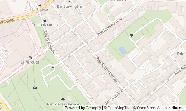
Route map
About the walk
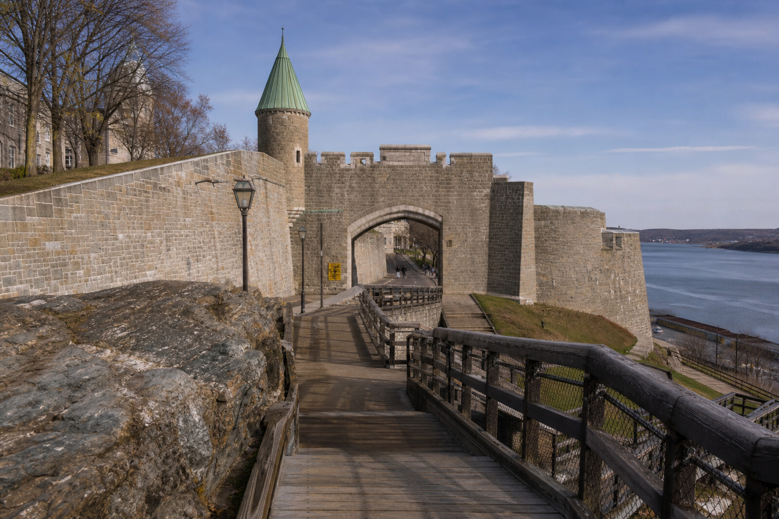
You will begin at Place d’Youville, pass through Saint-Jean Gate, and then follow the western wall—past Artillery Park, Kent Gate and Saint-Louis Gate, Esplanade Park, and the Citadel of Québec’s outer ramparts. The walk ends on wooden boardwalks above the slope of Cape Diamond.
This is not a walk through “old Québec City” in general, but along its shifting edge. Here, a stone arch will be taken apart for utility lines; decorative gates will close a breach made on purpose; and restorers will stop short of rebuilding a piece of fortress that never existed. Other questions will come up as well: why will a soldier’s surname appear beside a peaceful word? What will be decided on four sheets bearing the Citadel of Québec’s letterhead?
The story will be calm and specific. You will learn to distinguish genuine military traces from later reconstructions and urban compromises. By the end, you will understand why Québec City preserved its wall not in spite of the city’s movement, but through constant bargains with it.
Why this order
Place d’Youville introduces the outer side of the fortifications: the former strip in front of the wall, now facing Saint-Jean Gate. Passing beneath its arch shifts the story from the fate of the space to the fate of the passage itself. Just beyond the gate, McMahon Street follows the same wall to Artillery Park, where demolition for transport gives way to another dispute—what exactly counts as an authentic fortress. Returning to the western line and heading south brings you to Kent Gate. Once restorers decided against rebuilding a section that had never existed, the reason for erecting a deliberately decorative gate in the nineteenth century becomes especially clear. The next arch on the same line, Saint-Louis Gate, replaces that peaceful compromise with a real military passage and a scene of retreat. Beyond it, the open field of Esplanade Park shows where the garrison emerged from the gates for drill. From the parade ground, the route continues to the Citadel of Québec—a fortress intended for a final retreat. The last stretch along its outer edge leads to Governors’ Promenade: the defensive line ends as a public walkway laid between the Citadel of Québec and the slope.
Those who want to understand how a fortified city works Fans of military, urban, and architectural history Those interested in restoration debates and the fates of old structures
Those looking for a walk without stairs and climbs Those who care more about interiors than walls and open spaces Those who want only a short overview of Québec City’s postcard sights
Before you go
Wear shoes with reliable grip and prepare for wind: the open stretches by the wall and above the river feel cooler than city streets. Artillery Park is worth seeing from inside, but access to its buildings may depend on the season; check the current schedule with Parks Canada before you go. The Citadel of Québec remains an active military base, so interior visits must be planned separately and taken on an authorized tour—this route is designed primarily for viewing it from outside. Do not climb over barriers for a better angle, and save some energy for the stairs on Governors’ Promenade.
When to go
Set aside 2–3 hours for the full route: the stories are best heard without rushing, with pauses at the gates and viewpoints. A visit to the buildings at Artillery Park or a separate tour of the Citadel of Québec will add considerably to the walk, so it is easier to plan either one as a separate part of the day.
Backup plan
If the buildings at Artillery Park are closed, do not skip the stop: the redoubt, the barracks complex, and its connection to the wall can still be read from the accessible exterior. If there are restrictions at the Citadel of Québec, remain in the public areas and do not try to find an unofficial entrance—the main story is designed for the outside view. If the stairs or boardwalk on Governors’ Promenade are closed or slippery, end the route at an accessible point near the Citadel of Québec, or reach Dufferin Terrace by the usual open streets. Do not go around barriers on the slope: the drop and the weather matter more here than preserving the final stop at any cost.
Route conditions
Surface. Paved — 1 km (data covers 49% of the route)
Stairs. Flights: 4, 67 m in total
Access. Wheelchair — no; stroller — limited (stairs)
Facilities. Toilets — 2; drinking water — 6
Elevation. Ascent — 39 m; descent — 7 m
OpenStreetMap extract of July 9, 2026: database data, not a check on the ground. Data © OpenStreetMap contributors, ODbL licence
Walk plan
Open in maps ↗- 1
Place d’Youville
Here, the military strip in front of the wall would successively become a residential suburb, a market, and a public square. - 2
Saint-Jean Gate
This stop will show how urban transport first destroyed the old passage and then determined the form of the new one. - 3
Artillery Park
Here, one restoration project will make you decide what matters more: a coherent image of the past or traces of its different periods. - 4
Kent Gate
These gates were needed to reconcile preserving the wall with a new route through the city. - 5
Saint-Louis Gate
Here, the present decorative arch marks the site of a real fort entrance, toward which the defeated army was retreating. - 6
Esplanade Park
The military parade ground will reduce a vast imperial campaign to a single line beside a volunteer's surname. - 7
Citadel of Québec, from the outside
Beyond the military ramparts lies a place where the Allies agreed on the rules for secret scientific cooperation. - 8
Governors’ Promenade
The final stop concludes the route with a path conceived alongside the rescue of the walls, but built almost a century later.
Route features
Everything you need stays in the browser
Progress, saves and your trip plan are stored on this device.
Add Guide On Map to your home screen so the walk opens outside the browser.
How we handle sources, maps and corrections: our editorial standards