 Guide On Map
Fushimi Inari and the Sacred Mountain
From Inari Station through Senbon Torii to the ring of peaks
Guide On Map on your phone
Open the walk like a regular app
It takes about 10 seconds to install. No app store needed.
The whole path
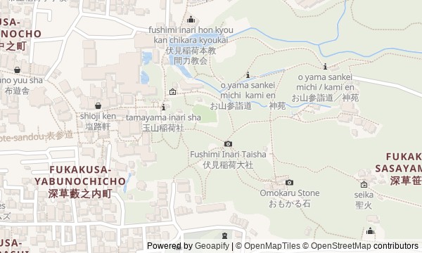
Route map
About the walk
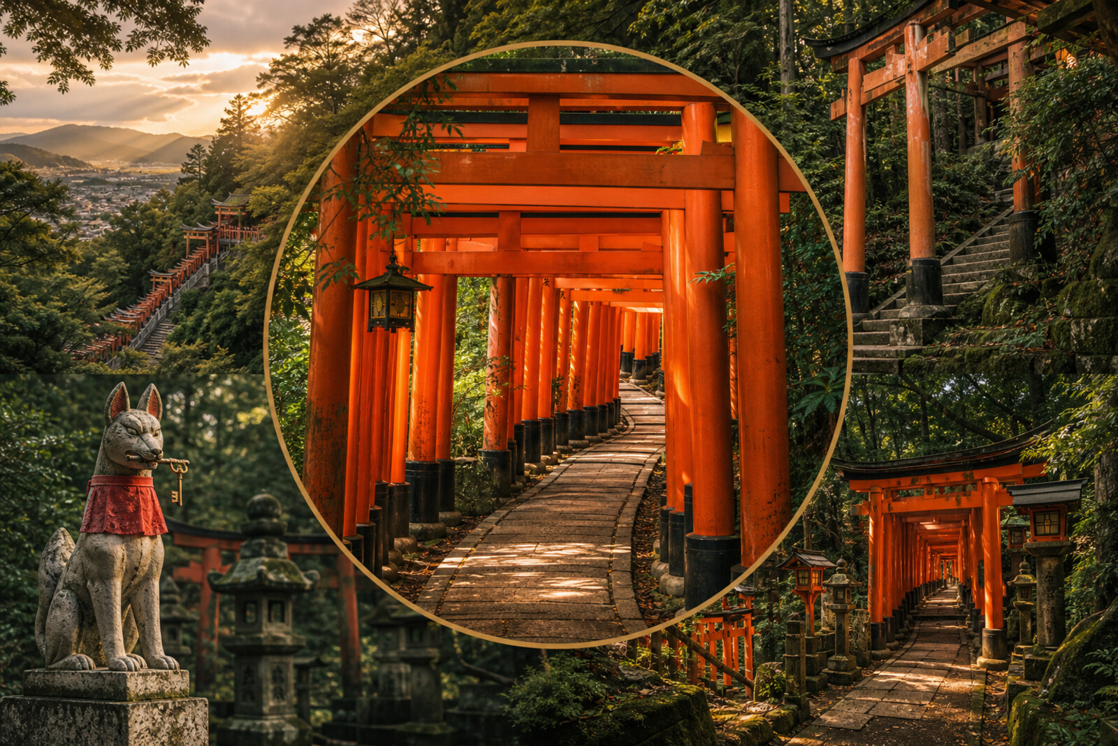
You will begin at Inari Station and walk straight to the Romon. Beyond it lie the Honden, two narrow corridors of Senbon Torii, and a pavilion facing the three peaks. From there, the road becomes a mountain path: it climbs to a crossroads with a teahouse, opens into a loop, and leads on through scarlet gates and stone otsuka.
This is not a postcard walk through Kyoto. You will see a working shrine as a place of long-held promises, family work, and arguments over what custom allows. Why has a tiny brick building survived beside the platform? What was found inside the old gates? Why did the owner of a new company wait several years for a place among the torii? The answers emerge along the way.
The story separates legend from document and stays close to inscriptions, buildings, and everyday details. After the climb, you will see Fushimi Inari Taisha not as a single red tunnel, but as a mountain where priests argued with custom, companies raised gates, and families left their names on stone.
Why this order
The station comes first because the shrine's torii is visible from the exit, and the railway shows where pilgrims begin their journey today. The Romon follows right after it as the shrine's first true threshold; only beyond it, at the Honden, does it become clear where the official rituals are centered. From the main hall, the route enters Senbon Torii: the buildings at the foot of the mountain fall behind, and the climb begins among private donations. The corridors lead directly to Okusha Hohaisho, where people worship the peaks before beginning the ascent. Then the trail reaches Yotsutsuji: four roads and a teahouse divide the approach from the mountain loop. The final stretch passes former shrine sites and stone otsuka, so the story of popular custom ends where that custom still exists.
Those who want to complete the whole mountain route, not just the torii corridors Those interested in vows, family stories, and shrine rules Those who enjoy a dense account built from documents and visible details
Those looking for a short visit without a sustained climb Those expecting an overview of Kyoto's major temples Those who prefer a level city route without stairs or mountain trails
Before you go
Choose shoes with reliable soles and bring water: after the lower section, the route becomes a mountain walk with steps and repeated forks. Do not plan the upper loop late in the day unless you are ready to return along a dark forest trail. At the torii, look for inscriptions on the backs of the pillars, but do not stop across a narrow passage for a photo. Stone altars, lanterns, and other ritual objects remain active sacred sites: do not sit on them, move offerings, or crowd people who are praying.
When to go
Allow 3–4 hours for the full route, including the stories, stops, and upper loop. The lower points go by quickly, but after Okusha Hohaisho, the steps, the climb to Yotsutsuji, and the many sacred sites around the ring of peaks slow the pace.
Backup plan
If the climb has taken more time or energy than expected, make Yotsutsuji your final stop and descend by the familiar route. By then, the main thread has already unfolded: you have gone from the railway through the main courtyard and the corridors of offerings to the place where the mountain itself is worshipped. Before deciding, rest, assess the remaining daylight and how you feel. Do not begin the upper loop because you feel the route will otherwise not count: its circular layout requires spare energy and attention at the forks.
Route conditions
Surface. Paved — 3.3 km (data covers 80% of the route)
Stairs. Flights: 28, 1.9 km in total
Access. Wheelchair — no; stroller — limited (stairs)
Facilities. Toilets — 8; drinking water — 1
Elevation. Ascent — 186 m; descent — 185 m
OpenStreetMap extract of June 18, 2026: database data, not a check on the ground. Data © OpenStreetMap contributors, ODbL licence
Walk plan
Open in maps ↗- 1
Inari Station
Here begins the route from Japan's first main railway to the old shrine at the foot of the mountain. - 2
Romon
A ruler’s gift of thanks leads into a world of requests, promises, and physical evidence. - 3
Main Hall (Honden)
The layout of the present shrine will result from military defeat, fire, and a long collection of donations. - 4
Senbon Torii
Here, one personal request will turn into an object that has taken its place among hundreds of other offerings. - 5
Okusha Hohaisho
This point takes the route from the buildings at the foot of the mountain to the legendary origins of worship of the mountain itself. - 6
Yotsutsuji Junction
Before the mountain circuit, you will come to a house where the pilgrimage road was both a family business and the setting of childhood life. - 7
The Inari Summit Trail
The final stretch connects former mountain shrine sites with thousands of private altars.
Route features
Everything you need stays in the browser
Progress, saves and your trip plan are stored on this device.
Add Guide On Map to your home screen so the walk opens outside the browser.
How we handle sources, maps and corrections: our editorial standards