 Guide On Map
Water of Leith Valley: Dean Village and Stockbridge
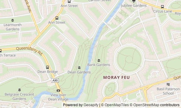
From Dean Bridge along the river to Circus Lane
Guide On Map on your phone
Open the walk like a regular app
It takes about 10 seconds to install. No app store needed.
The whole path
Route map
About the walk
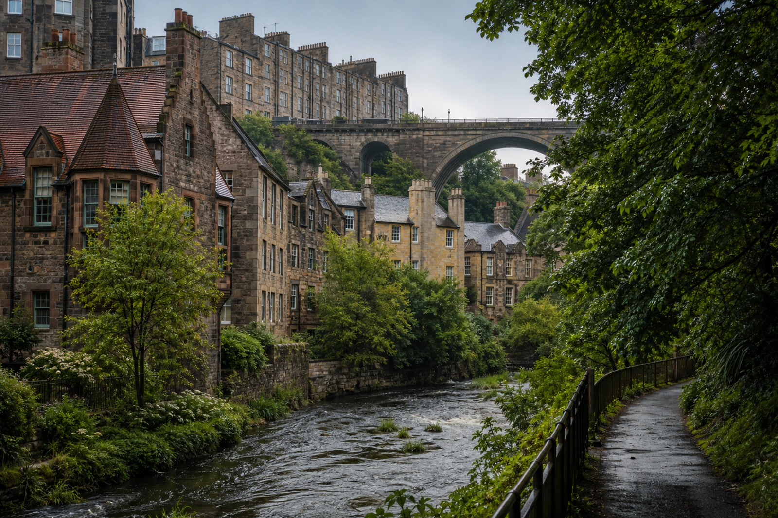
You will begin high above a deep valley, on a stone bridge, then follow an old road down to the river. Below, the city will become something else: in place of the grand façades of New Town, there will be mill buildings, a tight courtyard with a clock tower, and a path between the water and a steep slope.
Then you will walk downstream. An antique pavilion will appear through the trees, the bank will lead to the shops of Stockbridge and into a former service lane. In the story, a bridge will be built for houses that do not yet exist; tenants in a common hall will argue over women’s hours; and in the final lane, everything will begin with two yews outside one door. How these ideas turn out will not be clear in advance.
The story will stay calm and concrete: money, work, smoke, rules for tenants, and traces of old industry. By the end of the walk, you will be able to read the Water of Leith Valley as Edinburgh’s rough draft: a new city was laid out above, while by the water people kept remaking the space left behind to suit themselves.
Why this order
Dean Bridge first shows the valley from above and explains why the old descent had to be bypassed. Bells Brae then leads directly to the former crossing and the mill village the bridge left below. Near the former mills, Well Court appears—housing for people who worked in the valley—so the conversation about industry immediately becomes one about daily life and rules. From its courtyard, a footbridge takes you onto a path laid along those same industrial banks. Moving downstream, you will see the river turn from a working resource into a place for walks: first on the path itself, then at the healing pavilion. Further on, the river brings you to Stockbridge, where housing was still competing with an operating mill. The final climb from the bridge to Circus Lane moves that argument into a residential lane, which neighbors themselves would adapt to new city life.
Those who want to see Edinburgh’s quiet side by the water Fans of the history of work, housing, and urban change Those interested in bridges, courtyards, and former industrial banks
Those looking for a route only through Old Town and its main landmarks Those uncomfortable with steep descents, climbs, and riverside paths Those expecting interiors and museum galleries
Before you go
Choose shoes that are comfortable on cobblestones and the riverside path: after rain, there may be mud and slippery sections by the water. The route begins up high and then descends into the valley, so pace yourself and take your time on the slopes.
Well Court and Circus Lane are still residential places. Keep your voice down, do not look into windows, do not block doorways, and do not turn the courtyard or narrow lane into the setting for a long photo shoot.
Most sites are best understood from outside. Do not expect to enter the Well Court tower or the St Bernard’s Well pavilion without separately confirmed access.
When to go
Walk in daylight: it is easier to see the structure of the bridge, inscriptions in the stone, and traces of old riverside infrastructure. After heavy rain, allow more time for the stretch along the bank.
Backup plan
If the riverside path is closed, flooded, or seems unsafe, do not go around barriers or descend to the water away from the path. Return to the nearest open exit, check signs or a map, and continue along the upper streets toward Stockbridge; you can rejoin the route at the next permitted entrance.
In bad weather, shorten the riverside section but keep the sequence of city stops: Dean Bridge, Dean Village, an exterior view of Well Court, Stockbridge, and Circus Lane will still make for a clear story.
Route conditions
Surface. Paved — 2.1 km; unpaved — 788 m (data covers 95% of the route)
Stairs. Flights: 5, 53 m in total
Access. Wheelchair — no; stroller — limited (stairs)
Facilities. Toilets — 1
Elevation. Ascent — 35 m; descent — 51 m
OpenStreetMap extract of June 18, 2026: database data, not a check on the ground. Data © OpenStreetMap contributors, ODbL licence
Walk plan
Open in maps ↗- 1
Dean Bridge
From this height, the divide between New Town and the land that was meant to be developed becomes clear. - 2
Dean Village
Here, the story of five generations of millers ends, and a new life for the industrial buildings begins. - 3
Well Court
The courtyard shows how inexpensive workers' housing became a dispute over the rules of shared life. - 4
Water of Leith Walkway
This section will link the former industrial banks to a continuous urban route along the river. - 5
St Bernard’s Well
The pavilion is needed to separate the medical fashion from the reason people began coming here later. - 6
Stockbridge
At the bridge, the interests of a new residential development and a working grain mill will clash. - 7
Circus Lane
The finale will show how the everyday protection of one entrance became a shared project for the street.
Route features
Everything you need stays in the browser
Progress, saves and your trip plan are stored on this device.
Add Guide On Map to your home screen so the walk opens outside the browser.
How we handle sources, maps and corrections: our editorial standards