 Guide On Map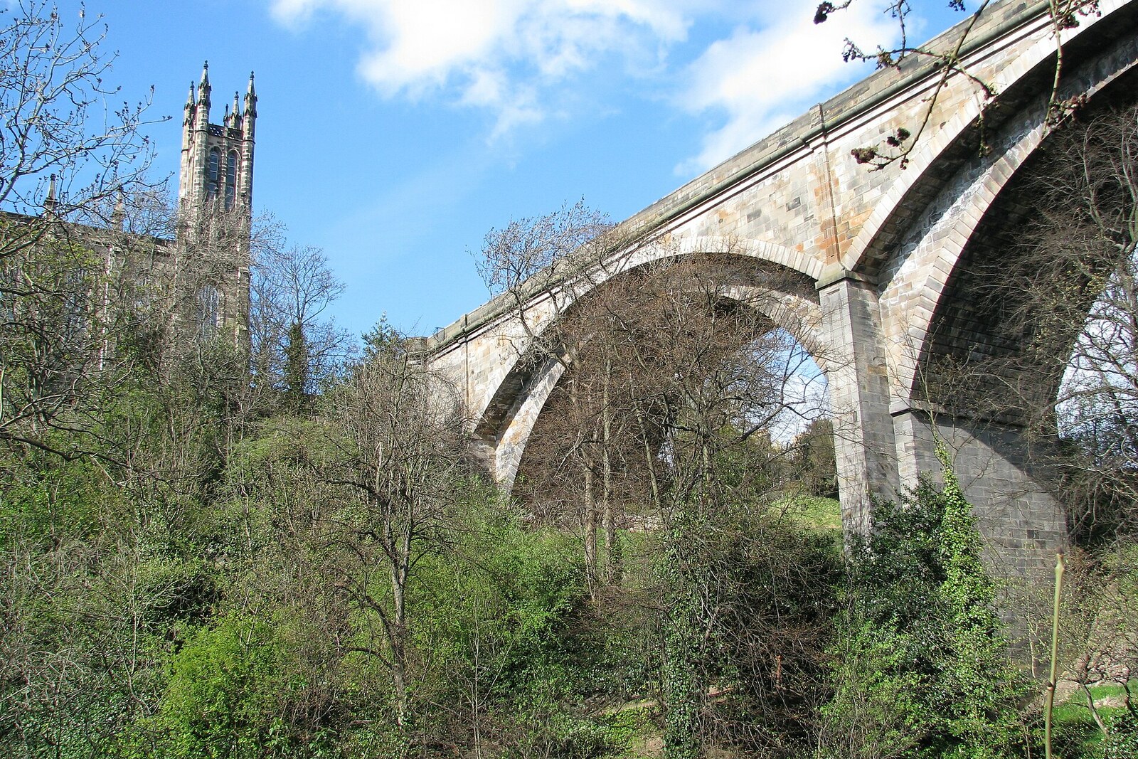
Look around first
What to notice
- Four stone arches
- Road above the gorge
- Descent of Bells Brae
- Old stone crossing below
The story of the place
Four stone arches carry the road thirty-two meters above the narrow river valley. Traffic now travels across the top without the long descent to the water, while the former route still goes down Bells Brae to the old stone crossing near the mills. This is how the narrow part of the valley stopped splitting the road to the northwest.
In eighteen twenty-six, John Learmonth, a wealthy carriage maker and land developer, acquired the Dean estate. Expensive districts of New Town were already being built on the opposite edge of the gorge. Learmonth wanted to lease his land for similar houses, but there was no direct road to it from the center.
The road to Queensferry descended Bells Brae to the Water of Leith, crossed a narrow single-span bridge near the mills, and then climbed back up. For loaded wagons, this detour with its steep slopes was a serious obstacle. As long as it remained, Learmonth’s plots were land beyond the ravine, rather than an extension of prestigious New Town.
Learmonth proposed taking a road directly across the gorge. The bridge was estimated to cost eighteen thousand five hundred fifty-six pounds, and he took on most of the expense. The Cramond Road Trustees, responsible for Edinburgh’s connection with the northwest, agreed to take part on two conditions: the project would be entrusted to the renowned engineer Thomas Telford, and no toll would be charged for crossing the bridge. Learmonth agreed to pay for a structure that any traveler could use: only in this way would his own land become accessible to buyers.
By eighteen thirty-one, the builders had completed four stone arches. The road ran thirty-two meters above the river, and through traffic no longer had to descend to the mill village. Learmonth’s expectation of rapid development, however, did not come true. Two years later, Edinburgh was on the verge of bankruptcy, and housebuilding almost stopped. The first plots in the planned district began to be developed only in the eighteen fifties. Learmonth died in eighteen fifty-eight, without seeing most of the houses for which he had paid for the bridge.
The name “Dean” refers to the locality itself. Old documents contain the forms “Dene” and “Denne”—a narrow valley. Queensferry Road still crosses it today on Telford’s bridge, while the former route remains below: it descends Bells Brae to the old stone crossing by the water.
Useful on site
The bridge is open to pedestrians and traffic around the clock; the viewing platform is freely accessible.
Checked: June 17, 2026. Check the official source before visiting.Stay on the sidewalk and be mindful of the traffic beside you. The bridge’s full structure is easier to see after descending, rather than over the high parapet.