 Guide On Map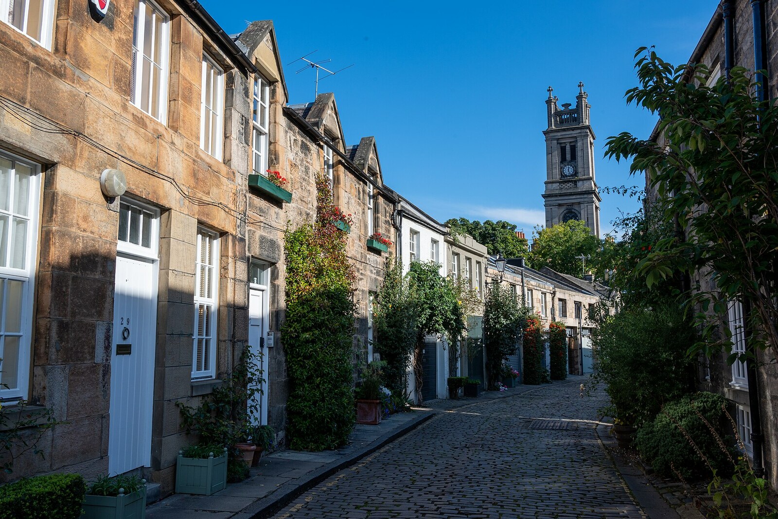
Look around first
What to notice
- Broad openings of former carriage houses
- Timber windows with small panes
- Scottish slate
- Plantings at the edge of the cobbles
The story of the place
The arc of wealthy houses at Royal Circus left behind it a narrow service lane that runs between their rear façades through two blind bends. Horses and carriages were brought in here through the broad openings on the lower floors; above, feed was stored and the people who served the grand houses lived. The former entrances can now be read in the façades, while yews and other plantings press almost right up against the cobbles. The “circus” in the name recalls not a fairground, but the circular plan of the neighboring grand arc.
The first shrubs on Circus Lane were not planted for a pretty photograph. Screenwriter and film producer Gareth Wardell later recalled that he was living then in a single room lent by a friend. He was over forty, had only enough money for a deposit, and found it hard to look for work without a permanent address. At number eleven, he found a cheap one-room space with a toilet—an old office on a run-down lane—and lived here for more than twenty years.
Circus Lane inherited its curve from Royal Circus, the grand arc of houses that architect William Henry Playfair designed in the early nineteenth century. “Circus” here means a circular layout, not a tent with performers. The lane was laid out behind the wealthy houses. Horses and carriages were kept here, and coachmen and servants lived here. That is why the broad lower openings of today’s houses once served as entrances to stables and carriage houses, while the spaces above were haylofts or living quarters.
By the time Wardell arrived, the carriages had disappeared, but the layout of the service lane remained. There was no pavement, and cars cut through between two blind bends. Once, a truck stopped right beside Wardell’s windows and blocked the exit. He then removed several cobbles on either side of the door and planted two yews. The shrubs left about half a meter in front of the entrance, where a car could no longer pull up close.
At first, a neighbor asked whether he had the right to touch the cobbles, then asked him to arrange the same protection outside her house. Other residents followed. Wardell chose separate plants for each façade, dug and planted them himself, and paid for the materials from his film earnings. The residents gave what they could: some a few pounds, some several hundred.
A residents’ association grew out of these requests. It raised money, negotiated with city services, and secured changes along the whole lane. Concrete streetlights were replaced with wall-mounted lights: the residents paid half the cost, and the city the other half. Timber windows with small panes, Scottish slate, and lost sections of sandstone were restored. Wardell persuaded the road authority to make the lane one-way; cars stopped meeting head-on on the narrow curve.
By two thousand ten, the former bypass lane was already being used as a backdrop for filming. Wardell moved away, but the residents continued planting in front of their houses. That is why the greenery here begins right at the edge of the cobbles: it occupies the same half meter that a man from number eleven once needed to ensure that a truck could no longer trap him at his own door.
Useful on site
The lane is open around the clock; it is a residential lane.
Checked: June 17, 2026. Check the official source before visiting.The lane is narrow, residential, and in places has no pavement: watch for traffic, keep doorways clear, and do not photograph people through windows.