 Guide On Map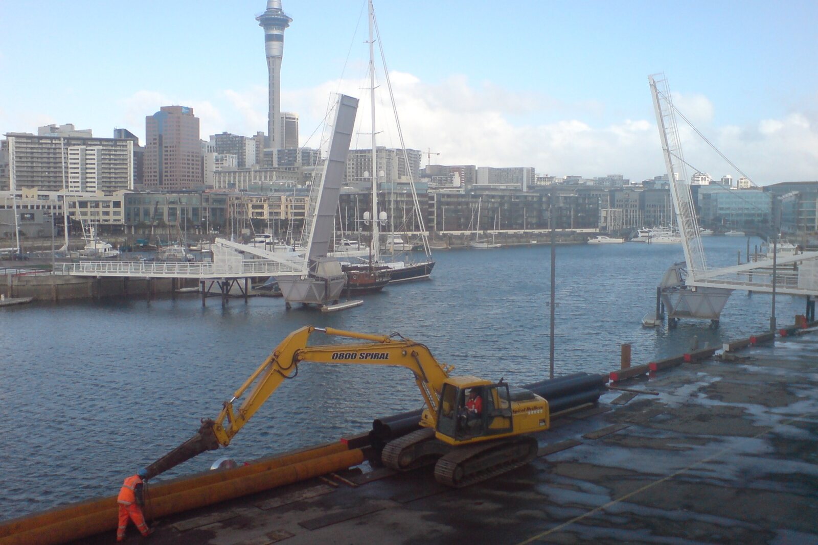
Look around first
What to notice
- Wide pedestrian deck
- Two central leaves
- Shipping channel
- Te Wero Island
The story of the place
Until recently, the western shore was a port and warehouse area that ordinary visitors could barely enter. To connect it with downtown, a bridge was assembled across the water, initially intended to serve only briefly; its nearly five meters of width leave room for both pedestrians and cyclists. In the middle, the deck divides into two movable halves: they are raised for a large vessel, while small boats pass beneath. The short crossing quickly became the main entrance to Wynyard Quarter from the Auckland waterfront.
At the beginning of a Māori welcoming ceremony, a warrior comes out to meet the guests. His task is to find out whether the strangers have come in peace. He places a token before their leader; the leader picks it up and thereby accepts the further meeting. This challenge is called a wero. A small reclaimed area at the eastern end of the crossing was named for it: Te Wero Island. In two thousand twenty-one, three participants in such a challenge did indeed lead guests from here to Karanga Plaza, whose name means the ceremonial call of the receiving side.
In August two thousand eleven, city planners needed to move tens of thousands of people along the same line. Across the water lay Wynyard Quarter, a former port and warehouse area that the public had scarcely been able to enter before. A wide crossing for trams and other traffic was estimated at about fifty million New Zealand dollars and set aside. John Dalzell, head of Waterfront Auckland, pressed for at least a direct pedestrian route to the new waterfront area before the Rugby World Cup. Engineers were assigned to assemble a temporary bridge for three million seven hundred thousand.
They kept the deck about five meters wide and made it a drawbridge. The operator receives a request from a vessel by radio, stops pedestrians and cyclists, then raises the two central leaves. Most small boats pass beneath the closed bridge; for larger vessels, the shipping channel is cleared. If the mechanism cannot be operated safely, the terms of the consent require the leaves to remain raised, so that vessels are not trapped inside Viaduct Harbour.
On its very first weekend, about fifty thousand visitors crossed the bridge. The temporary structure remained the main short route between downtown and the new quarter. A series of failures beginning in November two thousand twenty-three ended with the bridge being raised and closed to people in March two thousand twenty-four. The walk around took about twenty minutes; business owners on North Wharf lost their usual flow of visitors.
Gert Bothma, head of the repair crew, had to return the crossing to service and extend its life by at least another fifteen years. Thirty people worked round the clock in shifts. A lifting barge with a capacity of two hundred fifty tons carried the leaves and the machinery rooms to a workshop on the neighboring Wynyard wharf. Many parts were no longer manufactured, so the mechanics had to order new assemblies and adapt them to the old structure. The steel was cleaned, damaged sections were replaced, and the winches and cables were overhauled.
While the crew worked, a small free ferry carried more than one hundred eighty-one thousand passengers across the basin. On December thirteenth, two thousand twenty-four, people crossed the bridge again; the manager of one of the businesses called the opening day the busiest since the previous summer.
Wynyard in the crossing's full name is the quarter on the western shore. Its colonial surname goes back to Robert Henry Wynyard, commander of British forces, after whom wharves and streets in Auckland were named. Te Wero is the challenge at the eastern end. Between these two names lies that same temporary deck, beneath which, after the repairs, are hidden more than half a kilometer of new wiring, over one hundred lights, and more than sixty sensors.
Useful on site
Open after repairs; vessel lifts, temporary restrictions, and maintenance notices are possible.
Checked: June 28, 2026. Check the official source before visiting.Follow the signals and barriers: when the bridge opens, it is completely cleared for the vessel.