 Guide On Map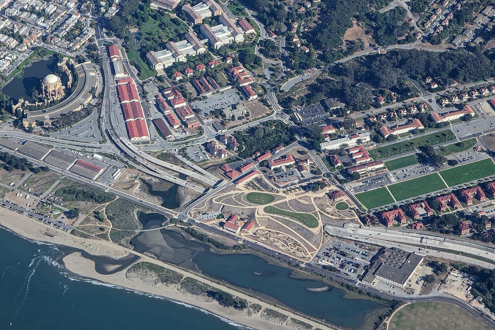
Look around first
What to notice
- Lawns above the tunnels
- Path to the waterfront
- Children's playgrounds
- Open view of the bay
The story of the place
Beneath the lawns and playgrounds here are the concrete decks of two road tunnels, where automobile traffic continues. On the fourteen acres above, paths, lawns, and spaces for children's activities were created; they were designed by a separate team that gathered suggestions from more than ten thousand city residents. From the Main Post of the former military settlement, a route extends from here to the waterfront and the open bay.
For many years, Michael Painter rode a bus from Mill Valley to San Francisco along the high elevated roadway by the Presidio. He was a landscape architect and advocated that, when this road was replaced, the military post should once again be connected to the waterfront. Painter made his living on projects for his own firm; at first, no one paid him for his work on the elevated roadway or officially commissioned it.
After the Loma Prieta earthquake of nineteen eighty-nine, the old road was declared seismically unsafe. While agencies and civic organizations argued over what the new route to the bridge should be, Painter came to a working-group meeting and unrolled a six-meter color plan. In it, the elevated roadway descended to the ground, part of the traffic went into two tunnels, and a park continued above them. From the Main Post, people could once again walk to the water at ground level without crossing the highway.
Caltrans, California's transportation agency, initially considered the proposal too expensive and complicated. Painter kept revising the calculations and drawings. Over ten years, he spent more than two thousand hours on them, often without pay. In nineteen ninety-nine, his scheme became one of the official options, and then withstood comparison with four competing designs. Painter was later hired as a consultant, although the working drawings were already prepared by other specialists.
In nineteen fifteen, automobiles began using the new route beneath this point. In Painter's drawings, the tunnel roofs remained simply green areas: paths, lawns, and children's playgrounds were designed by a separate team that gathered suggestions from more than ten thousand city residents. This is how fourteen acres of park appeared above the road, where people now picnic, hold activities with children, and walk down from the former barracks to the waterfront.
Painter lived to see the tunnels open, but not the park. He died of cancer in nineteen eighteen. A year later, they began placing earth on the concrete decks, and visitors were admitted here in July nineteen twenty-two.
The name “Tunnel Tops” literally means “above the tunnels.” Cars still move beneath the lawns and playgrounds, and the path between the Main Post and the waterfront runs where the elevated roadway cut through it before Painter's plan.
Useful on site
Open area at Presidio Tunnel Tops in the Presidio; Outpost usually 09:30-18:00 Apr-Oct and 09:30-17:00 Nov-Mar; Field Station Wed-Fri 11:00-16:00, Sat-Sun 10:00-17:00.
Checked: June 26, 2026. Check the official source before visiting.Stay on the paths: the gentle terrain conceals an engineering structure, and the popular routes can be busy.