 Guide On Map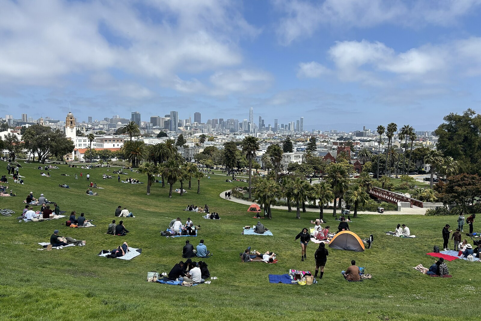
Look around first
What to notice
- Open slopes
- Broad fields
- Paths
- Sports courts
The story of the place
Where these broad fields now lie, there were once two cemetery blocks belonging to Jewish congregations. When the burials were moved out of the city, Mission District residents spent several years seeking to ensure that the cleared land would remain shared rather than be developed. The city bought the site for a park and asked the gardener John McLaren to lay out paths, courts, and green slopes here. Today’s fields, where people picnic and play ball, follow his layout.
In the fall of nineteen oh six, a small wooden house was put up at the corner of 19th Street and Dolores Street. It was considered San Francisco’s first standardized cottage for people left homeless by the earthquake. There were hardly any lawns here yet. There were tents, bare ground, and families facing a winter without a roof.
This open space existed thanks to two Jewish congregations—Congregation Emanu-El and Congregation Sherith Israel. Since the eighteen sixties, each had occupied its own cemetery block here. As San Francisco grew, the congregations opened new cemeteries south of the city and moved the burials there. Nearly one thousand burials were removed from Congregation Emanu-El’s property alone. By the middle of the eighteen nineties, the two blocks between 18th Street and 20th Street stood empty.
Residents of the densely populated Mission District saw this land as a chance to gain a large park of their own. In eighteen ninety-seven, they formed the Mission Park Association and spent several years seeking the purchase of the cemeteries. Opponents replied that the city already had enough in Golden Gate Park, that the new parcel would be an unnecessary expense for taxpayers, and that neighboring property owners would profit from it.
Then more than one thousand homeowners from the southern neighborhoods got a municipal bond measure approved by vote. In nineteen oh five, San Francisco paid the two congregations two hundred ninety-one thousand three hundred fifty dollars. The sellers were promised that the former cemeteries would remain a beautiful public place forever. The city’s chief gardener, John McLaren, prepared a plan with paths, courts, and greenery.
A year later, that plan had to be put aside. The earthquake and fires of April eighteenth, nineteen oh six left hundreds of thousands of city residents homeless. The newly purchased blocks had not yet been built over or planted, so people were housed right here. The park residents had sought for recreation turned out to be vacant land near the surviving neighborhoods and immediately became a camp.
Tents were poorly suited to long-term living. By fall, relief organizations began putting up small cottages in city parks, with wooden walls, plank floors, and cedar-shingle roofs. The first such house in all of San Francisco appeared right here. Then the cottages were arranged in rows along the slope.
A family paid two dollars a month; the payments were credited toward the purchase price—fifty dollars. For people with small but steady earnings, this was a chance to own a home for the first time. The poorest people could not afford even this arrangement. Once the full price had been paid, the cottage had to be removed from the camp. Owners bought inexpensive lots on the outskirts, and the wooden houses were transported there on horse-drawn platforms. Sometimes two or three cottages were joined into one dwelling.
When the last temporary structures were taken away, the gardeners returned to McLaren’s plan. Its main layout remains: open slopes, broad fields, paths, and courts. Now people picnic here, play soccer, basketball, and tennis, and bring children to the playground. This open land exists because Mission District residents insisted on a public park where two congregations had already cleared a full two city blocks.
At first, the place was called Mission Park. The name “Dolores” gradually passed to it from the street and the neighboring mission. The mission itself received its common name from the vanished stream and Nuestra Señora de los Dolores Lagoon—Our Lady of Sorrows, one of the names of the Virgin Mary.
Not a single camp cottage remains on the lawn. Their disappearance was stipulated by the agreement: a person who had paid for a house had to take it away from here and begin life with it on a lot of their own.
Useful on site
The park is open daily from 06:00 to 22:00. Restrooms: in spring and summer from 08:00 to 20:00, in fall and winter from 08:00 to 17:30.
Checked: June 30, 2026. Check the official source before visiting.For the narration, it is best to go to the park’s upper edge without blocking paths or resting places. On the open slope, there can be bright sunshine and wind.