 Guide On Map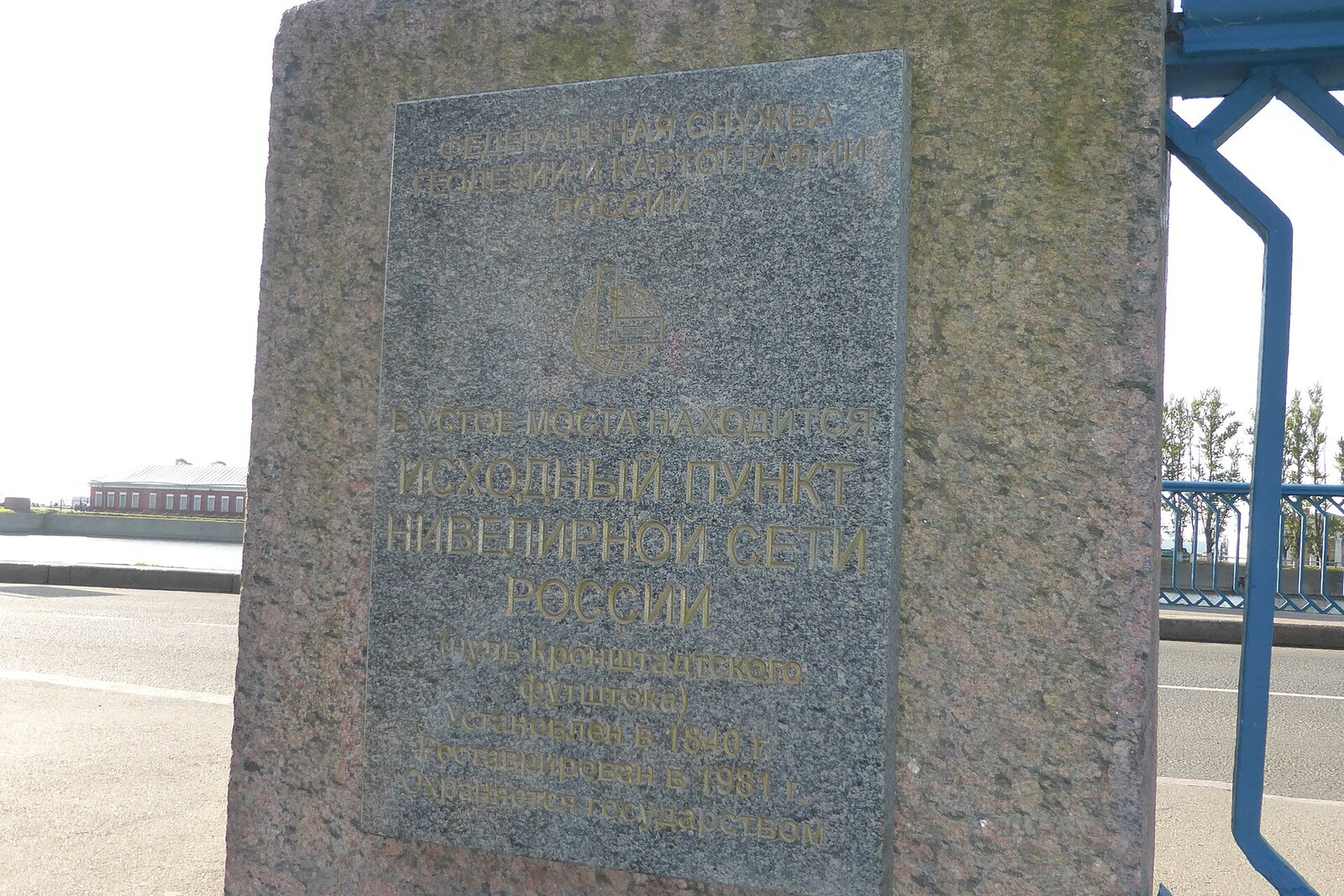
Look around first
What to notice
- Blue railings
- Cast-iron tide-gauge staff
- Flood mark
- Tide recorder
The story of the place
The people of Kronstadt named this crossing the Blue Bridge after the color of its wooden parts. The present bridge is metal, but its railings are still blue. The most important object here is fixed below the sidewalk, on a granite abutment: a graduated cast-iron staff. This is a tide gauge—an instrument for measuring sea level.
The staff was moved to the bridge as early as eighteen hundred. The Obvodny Canal connects with the Gulf of Finland, so the water at the abutment rises and falls together with the Baltic Sea. But for a long time, coastal tide gauges had their own zero points, assigned approximately. Observations from different harbors could not be reliably combined. For sailors, this meant a very real risk: charted depth is measured from an accepted level, and an error in the zero point leaves a ship with less water under its keel than the figure promises.
Mikhail Reineke, a naval officer and hydrographer who sought a single basis for Baltic depth soundings, was assigned to resolve this. Hydrography was both his service and his source of pay: Reineke compiled charts by which the fleet was to navigate among shoals. He was not the only one to spend fifteen years at the staff. Observers regularly recorded rises and falls in the water, while Reineke gathered these series, compared several points in the Gulf of Finland, and calculated the average long-term sea level.
In eighteen forty, at his proposal, a horizontal line was carved into the granite of the Blue Bridge. It was adopted as zero: a reading above the line meant rising water, and one below it meant falling water. Thus depths, water levels, and elevations acquired a common reference mark. Reineke died in eighteen fifty-nine. He did not live to see the decision of the General Staff, which in eighteen seventy-two selected his line as the initial level for a large measurement network.
Two years later, builders began replacing the wooden bridge with a metal one and dismantled its stone support down to the water. Reineke’s original line disappeared. The tide gauge was temporarily moved to the Italian Pond, and the temporary mark shifted during a flood as well. Surveyors and hydrologists had to restore the lost elevation from surviving benchmarks and leveling connections to the land. Later, they fixed it several times with metal plates and checked it again against ground marks. The present mark continues the level calculated by Reineke, but his own carving on the bridge is gone.
In nineteen forty-six, the restored Kronstadt Datum was adopted as the starting point of the unified Baltic Height System. The elevation of a mountain or a building is not measured by a long line directly from here: surveyors transfer the mark through a chain of benchmarks, each time determining the difference in elevation between neighboring points.
A separate plaque is mounted on the north side of the bridge: three point sixty-seven meters, eighteen twenty-four. It shows how high the water rose during the catastrophic flood and does not serve as a second zero point. Beside the bridge, a tide recorder continuously records fluctuations in the level, while an employee of the hydrometeorological station goes down to the staff every six hours, takes a reading by hand, and enters it in a log.
Useful on site
An open city site, accessible around the clock; the instruments can be viewed only from the embankment.
Checked: June 24, 2026. Check the official source before visiting.The main details are low down and may be hard to notice at first glance. Examine them from the safe part of the bridge, without leaning over the railing.