 Guide On Map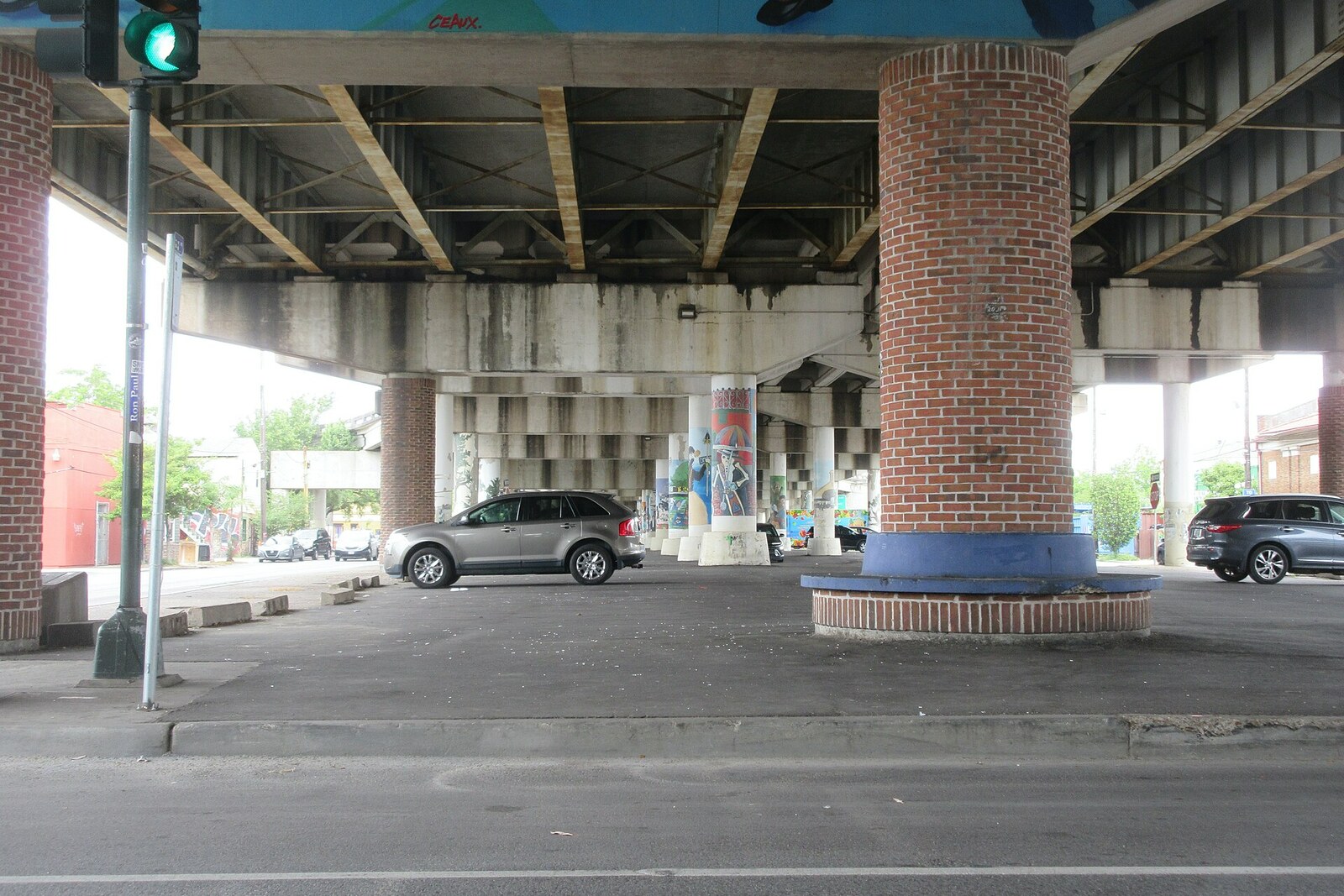
Look around first
What to notice
- The overpass roadway
- Four rows of concrete columns
- Painted oak trunks and branches
- The wide median
The story of the place
Six lanes of Interstate 10 run above North Claiborne Avenue. Concrete columns stand in the street’s wide median—on the “neutral ground,” as New Orleans calls a dividing strip. Before the overpass appeared, an oak-lined promenade stretched here.
The street was laid out in eighteen twenty-six and named for William Charles Cole Claiborne, Louisiana’s first American governor. It was made more than fifty meters wide: ditches ran down the center, carrying water away from Tremé and the French Quarter. Later, the ditches were filled in, and oak trees began to be planted in the median. By the middle of the twentieth century, their canopies formed an almost unbroken cover over the promenade.
Black business owners opened pharmacies, shoe repair shops, cafés, funeral homes, and insurance offices along North Claiborne Avenue. Segregation laws and customs barred them from many of the city’s stores and public spaces, so having their own commercial street was a matter of income and everyday independence. People bought food there, looked for a doctor, borrowed money for medical treatment, and buried relatives. Children played ball in the median, while club parades, jazz funerals, and Black Carnival passed through it.
Louis Charbonnet III worked at the family funeral home near the intersection of Claiborne and St. Philip Street. The family had been in the business since eighteen eighty-three. Their income depended on Tremé residents and Creole families who, for generations, had turned to the same funeral directors. Processions from the funeral home emerged onto Claiborne—the street served both as the business’s address and as part of its work.
In nineteen fifty-seven, the city planning commission included North Claiborne Avenue in a ring of elevated expressways around downtown. Officials wanted to bring the flow of cars from the suburbs to the business district. The wide median made it possible to carry the highway above the existing street, although the state still had to acquire one hundred fifty-five properties for ramps and interchanges. The elevated highway along the French Quarter was then planned as a separate project; Claiborne was not its later replacement.
In February nineteen sixty-six, workers from the park commission arrived with saws and excavators. Many neighbors learned the project’s final scale when the cutting had already begun. Charbonnet and other owners tried to organize resistance, but they did not have time to get it underway. Mandatory public hearings did not yet exist, there were only a handful of Black representatives in city institutions, and local activists were then fighting for the right to study, travel, and eat without segregation. The trees seemed a less urgent front until they began to be felled.
Builders removed more than two hundred oak trees. In nineteen sixty-eight, they drove the piles and then assembled the roadway. Ramps cut the former connections between neighborhoods, and construction deprived stores of their usual flow of customers. Of the one hundred twenty-three businesses operating along this stretch in nineteen fifty, forty-four remained nearly half a century later. Owners closed down or moved elsewhere in the city. Charbonnet Funeral Home survived: the building stood slightly away from the main area of work, and Tremé families continued bringing their dead here.
After the highway was built, Charbonnet decided to seek representation for the neighborhood himself and won election to the Louisiana State Legislature in the early nineteen seventies. The family funeral home still operates on St. Philip Street, and funeral and Sunday processions still emerge onto North Claiborne Avenue. Where people once walked between four rows of living oak trees, four rows of concrete columns now stand. On some of them, artists have painted oak trunks and branches—right over the line of the lost promenade.
Useful on site
Open urban space. Visit during the day; crossings and traffic beneath the overpass require attention. Checked 2026-06-30.
Checked: June 30, 2026. Check the official source before visiting.It is noisy here, so choose a safe place away from traffic and parking-lot entrances. Do not look for a single surviving “monument”: the meaning of this stop lies in the scale of the space between the columns.