 Guide On Map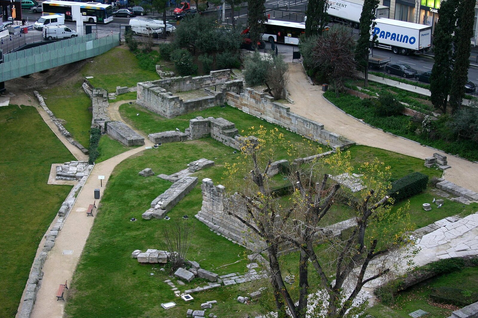
Look around first
What to notice
- Greek road
- Stone quay
- City-gate towers
- Excavator-bucket grooves
The story of the place
The Archaeological Garden shows the boundary of ancient Marseille: four gate towers, a road to the city center, and a quay by the water. The dead were buried beyond the walls, while the road from the gates led toward Italy. At the southern end of Lacydon Bay, the Romans deepened an inlet for vessels, built a quay, and created a freshwater basin. Later, the inlet silted up, and workshops, houses, and new burials occupied the former shore; the Greek road remained beneath the later Roman paving.
In the spring of nineteen sixty-seven, a construction pit was being dug here for a commercial and office complex and an underground parking garage. Antiquities were known about in advance: as early as nineteen thirteen, builders had found a section of massive wall. The municipal council permitted the old masonry to be dismantled stone by stone and then reassembled on the site above the future parking garage.
The excavator buckets exposed far more than the planners had expected. The excavations were directed by François Salviat, responsible for the antiquities of Provence and Corsica, and Maurice Euzennat, director of the Institut d'archéologie méditerranéenne. They pressed to preserve the finds in place. The blocks removed from the ground could still have been displayed, but their connection with the gate, road, shore, and graves would then have disappeared.
The archaeologists cleared about one hundred fifty meters of fortifications, four towers, a monumental entrance, and a stone quay. Beneath the Roman paving, they discovered an earlier Greek road. The masonry inside the garden dates from different centuries because the excavations reached the boundary of the ancient city.
Everything a person arriving in Marseille needed came together at this boundary. The road from Italy passed between the towers and continued toward the city center. Burial grounds lay outside the walls. Farther south, the shore curved into a narrow end of Lacydon Bay—the body of water of which today’s Vieux-Port remains a part. In Roman times, people deepened a mooring inlet here, built a stone quay, and created a freshwater basin for sailors and residents. Later, the inlet silted up, and workshops, dwellings, and new burials appeared on the former shore.
Paul-Marie Duval, professor of archaeology and the history of Gaul at the Collège de France and chairman of the High Archaeological Council, put his professional authority behind preserving the excavation. In August nineteen sixty-seven, he publicly explained that moving it would destroy the order of the masonry and make the defensive system impossible to understand. Archaeologists showed the finds to journalists and residents, publishing preliminary results and distinguishing what had been proven from hypotheses.
In October, the minister of cultural affairs André Malraux declared the excavations to be in the public interest and transferred the site to the state archaeological service for one year. Builders had to withdraw from part of the area. Research continued, the complex discovered received historic-monument status, and in nineteen eighty-three a museum and the Jardin des Vestiges opened here. The shopping center was built on the plots the archaeologists gave up; about one hectare was kept open.
One of the saved fragments is still called the Wall of Crinas. Crinas was a physician from Marseille in the first century CE. He went to Rome for wealthy clients, prescribed diets according to the movement of the stars, grew rich, and spent part of his fortune on the fortifications of his native Massalia—ancient Marseille. When the wall was found in nineteen thirteen, it was associated with this gift.
The excavations by Salviat and Euzennat corrected the attribution: the masonry was built around the middle of the second century BCE, almost two centuries before Crinas. His name remained attached to the wall as the former explanation for the find.
Several ancient blocks bear wide parallel grooves. They were left by the teeth of an excavator bucket in nineteen sixty-seven.
Useful on site
Archaeological site of the ancient port: free admission; official schedule as of the verification date — Tuesday — Sunday, 09:00 — 18:00. Access is indicated via Rue Barbusse.
Checked: June 29, 2026. Check the official source before visiting.View only from open areas and permitted walkways. If the garden is closed, the main ruins can be seen from the accessible outer edge; do not go beyond the barriers.