 Guide On Map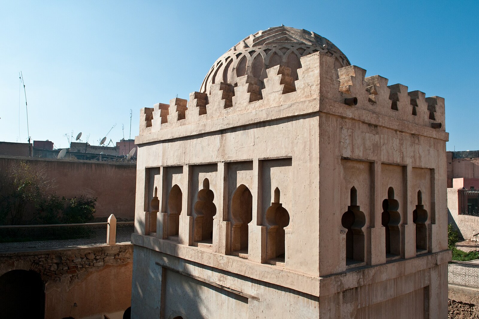
Look around first
What to notice
- Carved dome
- Dry basin
- Water channel
- Damaged inscription
The story of the place
Under the carved dome, the lower part of the old city waterworks has survived: a dry basin, a channel, pipes, and a cistern show where water was collected and drained here. Nearby, archaeologists uncovered public latrines and a large watering place with troughs, so this place was used by more than worshippers. Most researchers link the pavilion to ablutions before prayer at the mosque of Ali ibn Yusuf, although the former mosque stood about twenty-five meters from here. The decoration beneath the dome has survived better than the words on the damaged inscription: the patron’s name can be reconstructed, but the time of construction can no longer be.
The Koubba stands almost six meters below the surrounding streets. Its floor preserves the level of Marrakesh in the early twelfth century; later residents gradually raised the ground around the structure with buildings, ash, and construction debris.
At that time, the city had existed for only a few decades. The Almoravids, a Berber dynasty from the Sahara that founded Marrakesh, made it the capital of their possessions in North Africa and al-Andalus. Emir Ali ibn Yusuf worked to ensure that the new capital had enough water for its residents, mosques, and gardens. He assigned this task to Ubayd Allah ibn Yunus, an Andalusi engineer who earned his living by bringing water to places with almost no noticeable slope.
The medieval geographer al-Idrisi recorded how the engineer chose an elevated site, ordered a broad square well dug, and led an underground gallery from it to a garden. The slope had to be measured with an instrument: it was impossible to make it out by eye. Water reached the lowest point by gravity. Ali ibn Yusuf paid the engineer in silver and clothing, and residents began to repeat his method. Underground channels, known as khettaras, appeared in different parts of Marrakesh; gardens and houses multiplied around the water.
The Koubba belonged to this water system. The word “koubba” means a pavilion beneath a dome. Under it was a basin with a channel for draining spilled water; nearby, archaeologists found a cistern, pipes, public latrines, and a large street watering place with troughs. Most researchers consider the pavilion a place for ablutions before prayer at the mosque of Ali ibn Yusuf. However, it stood about twenty-five meters beyond the former mosque, so its original purpose is still debated: perhaps it was initially a ceremonial fountain marking the installation of the city water supply, and was adapted for ablutions later.
Ali ibn Yusuf turned a useful structure into a dynastic monument. Beneath the dome ran a fifteen-meter inscription that named the patron “emir of the Muslims” and asked God to grant him victory. That is why the water was below, among basins and drainage channels, while the craftsmen placed the most expensive carved ornaments high above it.
In eleven forty-seven, Abd al-Mu'min, leader of the Almohads, captured Marrakesh and ended the Almoravid dynasty. The last Almoravid emir, Ishaq ibn Ali, was killed; the mosque and the palace of his father were destroyed. In the Koubba, Abd al-Mu'min’s men deliberately knocked off part of the inscription bearing the former patron’s name. The construction year ceased to be legible, and researchers now debate whether it was eleven seventeen or later.
Over time, the pavilion ended up beneath seven to eight meters of additions, ash, and rubble. It was discovered in nineteen forty-seven, and then the archaeologists Henri Terrasse and Jacques Meunié cleared the walls and preserved the surviving carving. “Ba'adiyn” is a later and not entirely clear name, tentatively associated with an Almohad guard. The name Almoravid Koubba, a pavilion beneath a dome, is confirmed by the damaged inscription: its year has been knocked out, the name Ali ibn Yusuf can still be reconstructed, and below remain a dry basin and a water channel.
Useful on site
Archaeological site with variable access; check entry on site.
Checked: date not specified. Check the official source before visiting.First, take in the difference between the modern street and the building’s historic level. When looking from below, shift your gaze up to the vault often.