 Guide On Map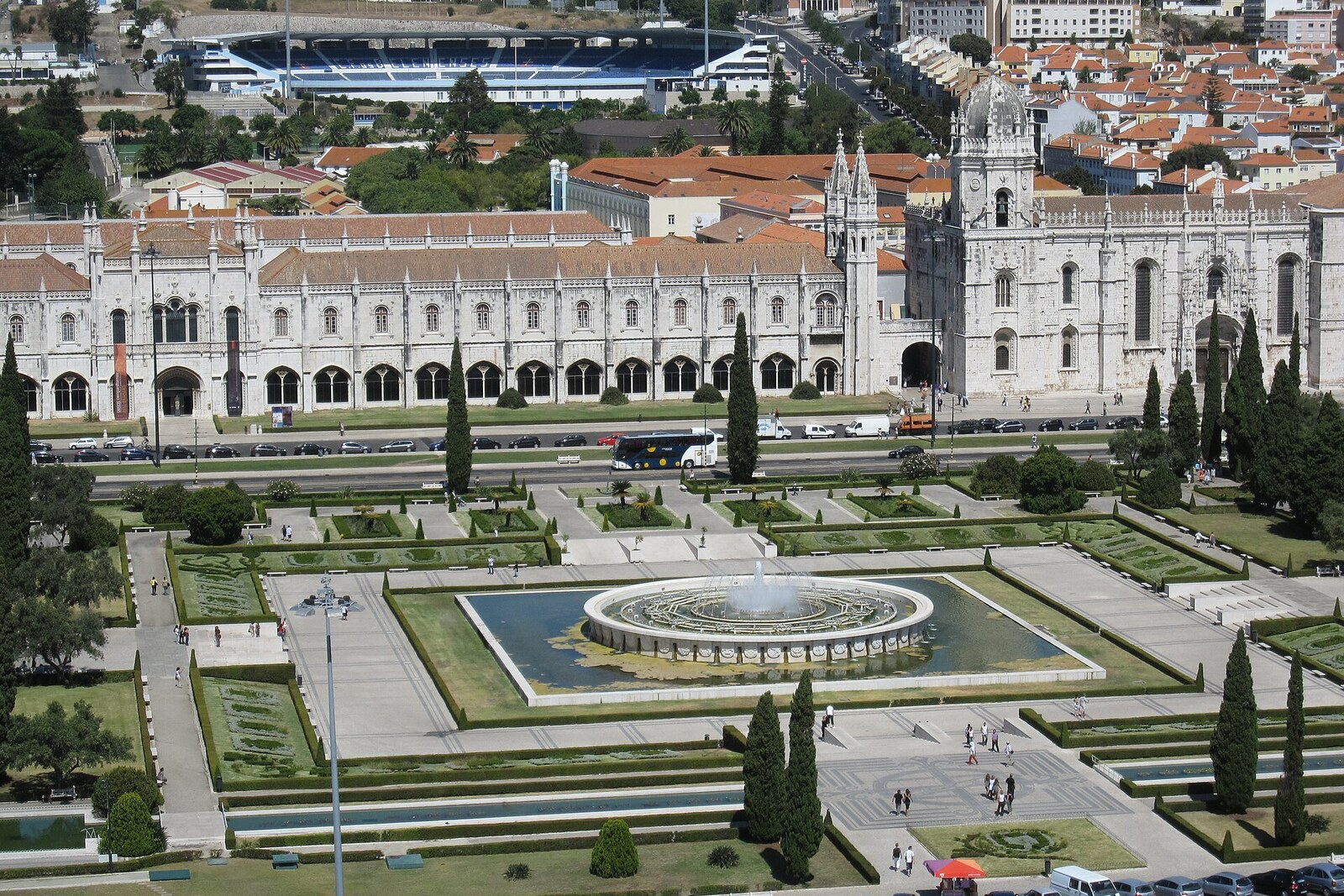
Look around first
What to notice
- The lowered center of the garden
- The square basin
- The fountain with stone coats of arms
- The straight direction between the monastery and the Tagus
The story of the place
Before the present garden, there were homes and shops here, streets intersected, and a market operated. The center of the square lies below the roads at its edges; it contains a square basin, forty-six meters to a side, with a fountain surrounded by stone coats of arms. Paths stretch from the water toward the Tagus and Jerónimos Monastery, linking the river to its façade.
In the personal archive of the architect Cottinelli Telmo, a note has survived bearing the annotation: written, but not sent. In it, he wanted to record who came up with the square and how its present layout was approved in one long session.
Cottinelli was the chief architect of the Portuguese World Exhibition—the largest spectacle that António de Oliveira Salazar's regime was preparing for the summer of nineteen forty. The exhibition was meant to link the eight-hundredth anniversary of Portugal's founding and the three-hundredth anniversary of the restoration of its independence with the country's overseas possessions. The word “Empire” in the square's name meant precisely the Portuguese Empire. Belém was chosen because Jerónimos Monastery and the bank of the Tagus already connected this story with sea voyages.
A garden for the square was first commissioned from the architect Vasco de Lacerda Marques. But his design did not fit well with the exhibition pavilions, and the permanent upkeep of the garden was considered too expensive. The project was set aside. Cottinelli, whose main job was the exhibition, urgently took the work on himself.
The discussion at Lisbon City Hall began at ten in the morning and ended at three in the morning. Cottinelli sketched the perspective freehand during the meeting itself. The minister of public works, Duarte Pacheco, remained in the room until the end, proposed changes, and pressed for the monastery to rise behind the garden. Cottinelli credited him with the very idea of Empire Square with Jerónimos Monastery in the background. By morning, the preliminary drawing had effectively become the approved design. The first architect lost the commission; Cottinelli had seventeen months to bring the new concept, together with the rest of the exhibition, to completion for the opening.
On official plans, Belém looked almost like an empty construction site. In reality, there were homes and shops here, streets ran through it, and a market operated. About half of the former neighborhood was demolished for the exhibition. At first, residents awaited the promised renewal; then they asked for the destruction to stop, and in the end they lost their homes, places of business, and the familiar connections between streets. The boundaries of the new square incorporated the former Vasco da Gama Square and sections of Rua Paulo da Gama and Rua Vieira Portuense.
Cottinelli lowered the middle of the garden below the surrounding roads and placed a square basin, forty-six meters to a side, at its center. Two directions spread out from the fountain. One connected the temporary pavilions on either side of the square; the other linked the Tagus and the monastery. This is how visitors were distributed through the exhibition: across the square, they passed between pavilions displaying Portuguese possessions, sea voyages, and the achievements of António de Oliveira Salazar's regime. The stone coats of arms on the fountain continued the same imperial list.
The exhibition opened on June twenty-third and closed on December second, nineteen forty. The pavilions were built of metal and wood, covered with stone-like shells; after the celebration, they were dismantled. The square was the only part of the complex that was intended from the outset to be preserved.
In nineteen forty-eight, the city officially gave it the name already in use since the time of the exhibition. The two enormous pavilions are no longer on either side. What remains is the square geometry of the garden, the lowered center, the fountain with coats of arms, and the direction from the Tagus to Jerónimos Monastery—the very drawing that Cottinelli Telmo traced freehand between ten in the morning and three in the morning.
Useful on site
Accessible around the clock; the garden and fountain operate during daylight hours.
Checked: June 17, 2026. Check the official source before visiting.It is best to listen to this stop from the central axis, to see how the space directs the eye. This is an open square, with no need to enter anywhere.