 Guide On Map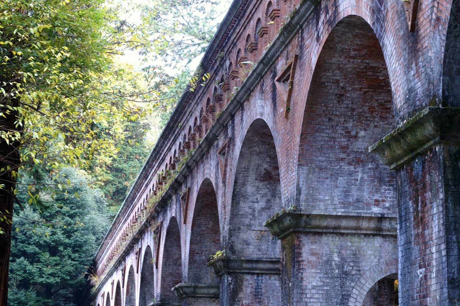
Look around first
What to notice
- A row of brick arches
- Granite details
- The water trough above the brickwork
- Blind arches on the upper level
The story of the place
Suirokaku's water trough rests on a long stretch of brickwork with granite details. The northern branch of the Lake Biwa Canal still runs through it: the canal was conceived for water for fields and firefighting, power for workshops, and a new freight route. Farther on, the flow feeds the gardens of eastern Kyoto and heads toward the Philosopher's Path. On the lower level, semicircular arches open up the brickwork, while blocked-up niches above them divide the wall into sections.
The brick arches appeared here because of a tomb that builders were forbidden to approach.
Kyoto Governor Kitagaki Kunimichi conceived the Lake Biwa Canal after the capital was moved to Tokyo. The city needed water for fields and firefighting, power for workshops, and a new route for freight. The construction was expected to cost roughly twice the prefecture's annual budget. The governor invited Tanabe Sakuro, a recent engineering-school graduate who had written his thesis on such a canal, to lead it. This was Tanabe's first major post, and he was entrusted with Kyoto's most expensive project.
The canal's northern branch was initially meant to run through a tunnel behind Nanzen-in, a small temple within Nanzen-ji. Part of the remains of the monk-emperor Kameyama, the founder of the monastery here, is buried near the garden. The imperial authorities did not allow digging near Emperor Kameyama's tomb. The route was shifted farther west, through the grounds of Nanzen-ji.
The temple objected and took its dispute with the prefecture to court. The governor did not want to abandon this branch: the water was intended to be directed through it to northern Kyoto. Tanabe had to take the canal across a dip in the terrain while preserving the required elevation and gentle gradient. That is how a bridge with a water trough on top came to be built.
Over ninety-three meters of this crossing cost the engineer more than one percent of the entire canal's cost, despite the budget being constantly tight. Tanabe prepared detailed drawings of the future structure, chose brick and granite, built a series of semicircular arches, and added blind arches on the upper level so that the long wall would not appear unbroken. Nanzen-ji's objections did not stop the construction, but they made Tanabe responsible for how the alien structure would fit into the temple garden.
The bridge was completed in eighteen eighty-eight, and the entire first stage of the canal opened two years later. On his own drawing, Tanabe modestly called the structure a bridge at Nanzen-ji. The name Suirokaku, “pavilion of the water channel,” took hold later: the row of tall arches no longer looked like an ordinary bridge.
Water still runs through the trough above the brickwork. Farther on, this branch feeds the gardens of eastern Kyoto and heads toward the stretch along which the Philosopher's Path runs. It crosses Nanzen-ji precisely here because the original tunnel was not allowed near Kameyama's burial.
Useful on site
Free access, around the clock
Checked: June 22, 2026. Check the official source before visiting.The aqueduct remains part of the water infrastructure: do not climb onto the structure or enter service areas. Beneath the arches, watch for other visitors and wet stone.