 Guide On Map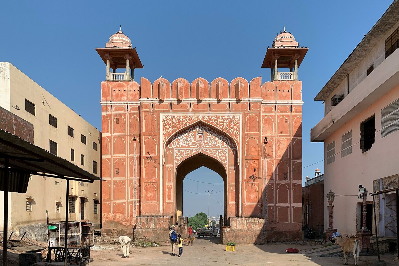
Look around first
What to notice
- Gate arch
- Domed chhatris
- Road toward the slope
- Wide storm-drain covers
The story of the place
The arch of Galta Gate stands beyond the former city wall, where Jaipur’s built-up area gave way to the road through the hills to the sacred Galta valley. It is easy to mistake it for the city’s eastern gate, although the actual eastern passage lay farther west. By the arch, the road leads toward the slope, and small domed chhatris—pavilions by a cremation site—can still be made out among the houses. During the January festival, pilgrims come through here on their way to the bathing pools of Galta, and even the wide, flat covers of the storm drains become bases for temporary stalls.
In seventeen twenty-seven, Sawai Jai Singh II, ruler of the Kingdom of Amber, began moving the capital from mountainous Amber to the plain. He wanted a city where merchants would find it profitable to settle, store goods, and open workshops. The ruler invited merchants personally, while his officials laid out broad streets over four years and set aside sites for markets, palaces, and residential quarters. Jaipur was meant to bring income to the kingdom, rather than crowd around the old fortress.
Jai Singh and his architect Vidyadhar Bhattacharya drew up the plan. Jai Singh studied astronomy; as early as seventeen eighteen, measuring instruments appeared here that could accurately determine the cardinal directions. Researchers believe these instruments also helped lay out the directions of the city.
The main line ran from west to east. At one end was Chandpole Gate—the western passage through the city wall. The line crossed markets, squares, and the palace quarter, then continued toward Galta Gate. Surya Temple stands on the slope above this line, and the route climbs toward it from here.
Galta Gate is often mistaken for the eastern gate of old Jaipur. The city wall ended earlier: its eastern passage was Surajpole Gate, located farther west. Galta Gate stood beyond the fortifications and marked the road to the sacred Galta valley. Its name told travelers the direction: a short walking route through the hills to pilgrimage sites began here.
At the end of the nineteenth century, photographers from the Jaipur studio of Gobindram and Udeyram set up a camera here and photographed the road leading from the gate toward the slope. In photographs from that time, the arch stands almost alone amid open ground; on the right are chhatris—small domed pavilions by a cremation site. The images preserved the former arrangement of this spot: the city remained behind, and the pilgrims’ road began ahead.
Now houses press in on the arch from both sides, while the chhatris on the right can still be made out among the buildings. During the January festival of Makar Sankranti, a celebration of the sun and the harvest, worshippers pass through Galta Gate on their way to the bathing pools of Galta, and temporary market stalls appear nearby. During improvements, even the covers of the storm drains here were made flat and wide so that stalls could fit on them on pilgrimage days.
Useful on site
Open city passage; it is safer to go in daylight, when there are people on the path and you can see the stone beneath your feet.
Checked: July 1, 2026. Check the official source before visiting.Put away food before beginning the climb: macaques notice bags and hand movements. Do not obstruct the passage of people or the rituals at the neighboring cremation site.