 Guide On Map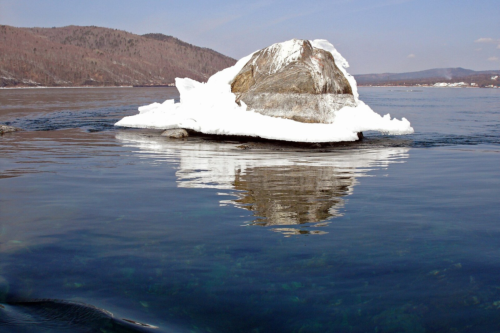
Look around first
What to notice
- The tip of Shaman Rock
- The water surface at the source of the Angara River
- The shore of Port Baikal
- The opposite shore
The story of the place
At the source of the Angara River, Shaman Rock is visible above the water. Beneath it stretches a bedrock ridge across Lake Baikal's only surface outlet, where lake water leaves for the river. After the construction of the Irkutsk Hydroelectric Power Station, the water covered the broad summit, leaving a section of rock about one and a half meters high above the surface. At low water, the hidden threshold determines both the depth of the passage and how much water can leave Lake Baikal.
In December nineteen sixty-seven, Captain Kazimir Andruleitis was assigned to take the old icebreaker Angara from Port Baikal to Irkutsk Reservoir. The vessel was no longer operating, but it was intended for use farther downstream. Istok Rapids lay between Lake Baikal and the reservoir. The icebreaker drew nearly four meters of water, while the depth of the shipping channel here barely reached two meters ninety centimeters.
The boats were removed from Angara, and its ballast and spare parts were unloaded. That was not enough. The crew then sank two cargo barges, brought them alongside the icebreaker, and tied the entire structure together with twenty-five cables. Water was pumped out of the barges. As they rose, they lifted Angara's hull by nearly one meter.
There was still no depth to spare: the lowest point of the stern drew the same two meters ninety centimeters that were available beneath the keel. The steamboat Suvorov led the linked vessels through the rapids. Andruleitis took the icebreaker through without grounding it on the rocks. That was how Angara left Lake Baikal. After long years of neglect and restoration, it became a museum in Irkutsk and still stands on the reservoir farther downstream.
That passage shows the true scale of the obstacle under the water. Shaman Rock is the summit of a bedrock ridge that crosses Lake Baikal's only surface outlet. Above the ridge, lake water begins the flow of the Angara River; at low water, this threshold limits both the depth and the amount of water leaving the lake.
Long before captains and depth measurements, the Buryats used the same rock as the final authority in important legal disputes. If witnesses and evidence were insufficient, the accused was taken here to swear an oath. Ama Sagan Noyon, the master of the source of the Angara River and a formidable judge, was believed to be present on the rock. Refusing the oath meant admitting guilt; anyone who withstood it confirmed his word. A person risked honor, property, and life: the summit was reached by boat, and a strong current remained all around. Old records mention people who confessed, lost consciousness, or fell into the water.
Later, legend made the ordeal even harsher: the accused was supposedly left on the rock for the whole night and pardoned if found alive in the morning. The oath itself is more reliably attested; the nighttime ordeal remained a legend.
After the construction of the Irkutsk Hydroelectric Power Station, the water level rose and covered most of the ridge. The broad summit where those taking the oath were put ashore is no longer above water. Usually only a tip about one and a half meters high is visible—above the threshold that Angara passed with not a single centimeter to spare.
Useful on site
Open space with no ticket office; it is best to come in daylight and with normal visibility.
Checked: date not specified. Check the official source before visiting.Observe from a safe shore or an equipped platform: the current here is strong, and it is not worth approaching the water for a photograph. The rock is easier to make out through binoculars.