 Guide On Map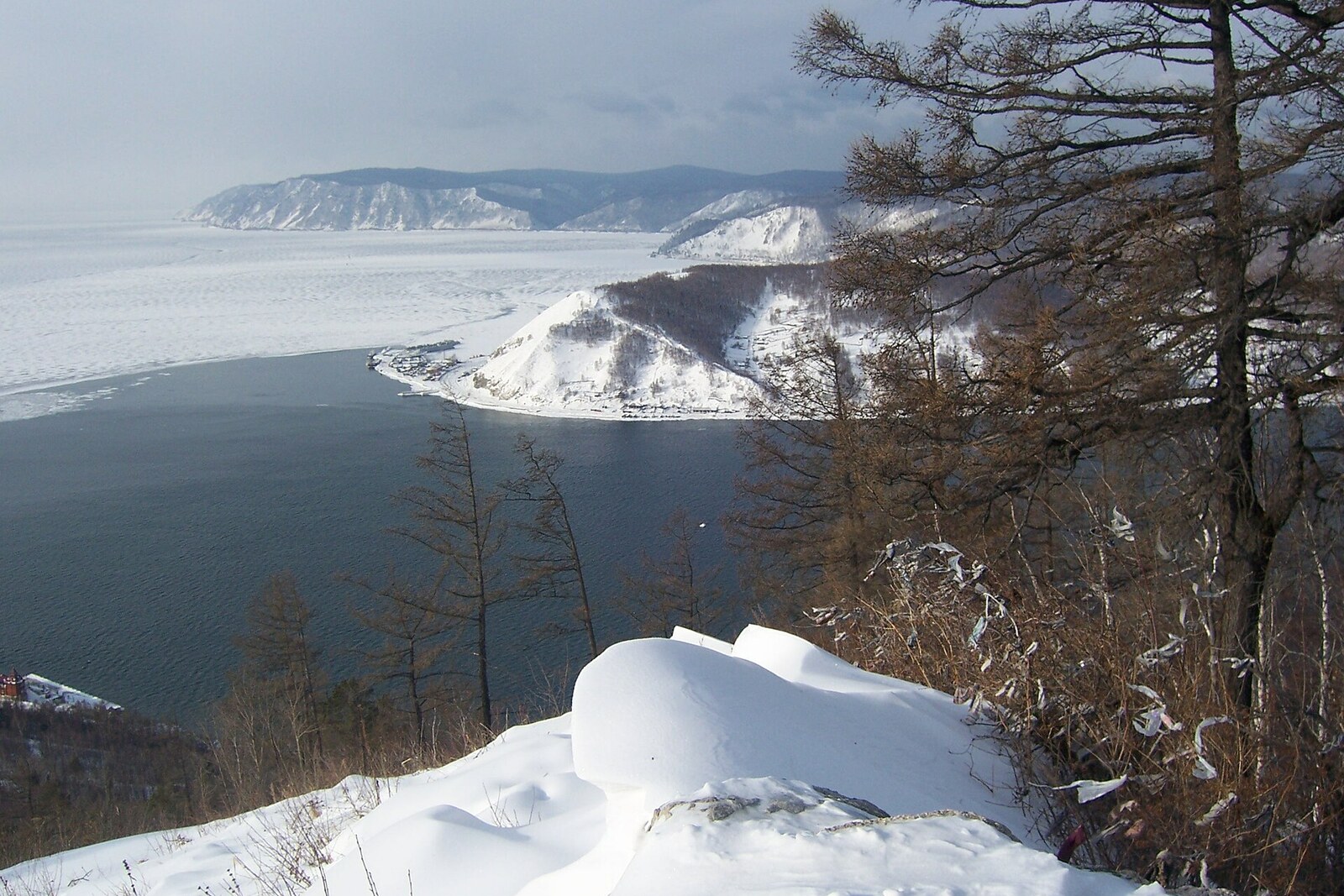
Look around first
What to notice
- Summit rocks
- Shaman Rock
- Source of the Angara River
- Opposite shore
The story of the place
Chersky Stone is the name of the entire summit above Listvyanka. At an elevation of seven hundred twenty-eight meters, there is a viewing platform: from here, you can see the southern basin of Lake Baikal, the source of the Angara River, Shaman Rock, and the opposite shore by Port Baikal.
In geological records from the nineteenth century, this mountain was still called White Stone. Jan Czerski worked here. In Russia, he was called Ivan Dementyevich. He was an employee of the Irkutsk museum and a geologist who sought a systematic description of the shores of Lake Baikal.
He did not have a professorial chair. At eighteen, Czerski took part in the uprising of eighteen sixty-three, was stripped of his noble title and property, and sent to Siberia as a private soldier without a return date. After being discharged because of illness, he was not allowed to study at a university for a long time. The Russian Geographical Society secured his transfer to Irkutsk. Here, Czerski earned a living through three occupations at once: as a clerk, a librarian, and a curator of museum collections.
In eighteen seventy-eight, during the second season of Lake Baikal research, he studied rocks near the source of the Angara River. On White Stone, Czerski compared the rock outcrop underfoot with Shaman Rock in the middle of the source and with rocks on the left bank. He assigned them to one geological formation and noted how the same layer continued into the valleys of Listvyanka. The panorama that people now climb here to see enabled him to connect scattered outcrops on both sides of the river.
He then had to test this method around the entire lake. In the first season, Czerski had two horses, two workers, and a supply of tools. He then bought a small boat and often took the oars himself. Over four field seasons, the geologist surveyed nearly one thousand nine hundred kilometers of shoreline, entered river mouths, made geological sections, and mapped the rocks. The first results earned him the Geographical Society's small gold medal. In eighteen eighty-six, his major report with a detailed geological map of Lake Baikal was published in Irkutsk.
In the first half of the twentieth century, the former White Stone was given the researcher's surname. From the present-day platform, three points from his record are still visible: the summit rocks, Shaman Rock in the source, and the opposite bank of the Angara River.
Useful on site
Mon 10:00–20:00; Tue 12:00–20:00; first Tuesday of the month 16:00–20:00; Wed–Thu 10:00–20:00; Fri–Sat 10:00–21:00; Sun 10:00–20:00. The last ascent is 15 minutes before closing. It does not operate below −25 degrees or in winds of 10–15 m/s.
Checked: date not specified. Check the official source before visiting.The open platform can be windy, and distant landmarks depend on visibility. First find the source below, then move your gaze in sequence to the opposite shore and the mountains.