 Guide On Map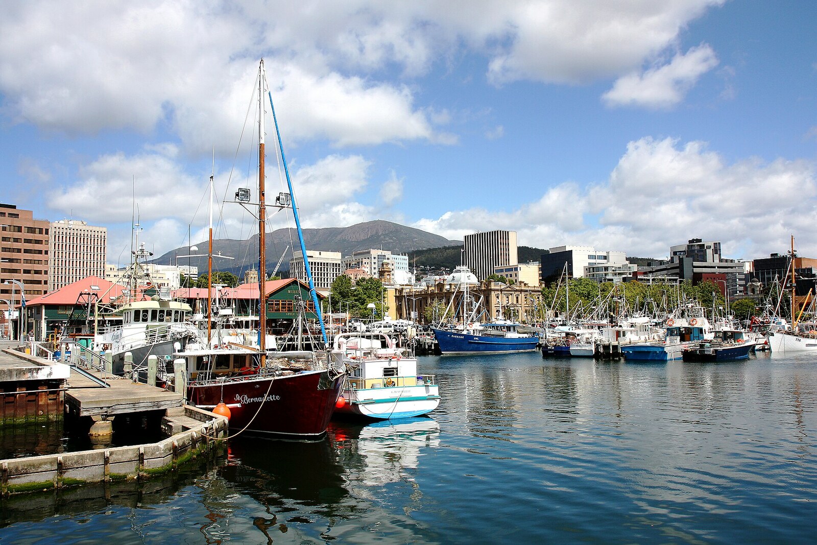
Look around first
What to notice
- Wharves
- Hunter Street
- Fishing vessels
- Antarctic vessels
The story of the place
The nipaluna waterfront stretches along a sheltered bay of the River Derwent, where a pedestrian shore stands beside working wharves. Fishing vessels and Antarctic expedition vessels berth here alongside yachts and ferries, while Hunter Street runs behind the port warehouses. Before port development, the Muwinina gathered shellfish on this shore, caught fish and birds near the creeks, met, traded, and held ceremonies. The creek's fresh water and the river's salt water made this shore a long-inhabited place.
When British ships entered this bay in eighteen oh four, Wurati, a Nununi man from Bruny Island, witnessed the arrival of the settlers. In his later account, Aboriginal people took the first ship for an evil spirit. They saw the newcomers cutting down trees, building houses, and digging the ground. Aboriginal people went into the mountains, told others, and then returned to watch. More and more ships arrived. Twenty-seven years later, Wurati, by then a guide and interpreter on a government expedition, gave an official the name of the land around Hobart: “nibberloonne,” the name of all this land. He clarified that it was the name of the Muwinina—the people to whom the land between the River Derwent and kunanyi / Mount Wellington belonged. From several records made by Englishmen by ear, the creators of the revived palawa kani language reconstructed the form “nipaluna.” The word refers to the whole land on which the city stands.
The Muwinina used the fresh water of the creek and the salt water of the river here. Shell middens from collected shellfish lay along the shore; fish and birds were caught near the creeks. The riverbanks served as places for meeting, trade, and ceremonies. This bay was already an inhabited place when David Collins's ships approached it.
Collins was the lieutenant-governor assigned to establish a British penal colony. His party's previous camp at Port Phillip had proved unsuccessful, and the anchorage on the opposite bank of the River Derwent suffered from a shortage of water. Here Collins found a permanent creek, a deep sheltered bay, and a small island in its middle. Boats with supplies could be brought to the island, and warehouses separated by water were easier to guard.
On February twentieth, under military guard, the first group of convicts was landed: they put up tents for the camp. The next day, the remaining people and supplies began to be brought ashore from the ships. Most arrivals were convicts transported across the ocean and required to work a specified number of hours. Salt beef, pork, flour, and sugar were issued to them from a list; anyone who failed to answer roll call was left without a week's ration.
A few days later, Collins ordered a jetty and a road from the island to the camp to be built. Convicts reinforced the sandspit that was covered by water at high tide. Over the following decades, builders filled in the shallows, extended the wharves, and diverted the creek into a new channel. The island and the sandspit gradually became enclosed within the land. For the Muwinina, these works meant the loss of the shore, fresh water, and familiar routes to the river. The invasion and the ensuing war destroyed the Muwinina as a distinct community; Tasmanian Aboriginal people survived, and the name recorded by Wurati returned to urban speech.
The British name of the city is linked to Robert Hobart, 4th Earl of Buckinghamshire, and Secretary of State for War and the Colonies. The settlement was named Hobart Town in his honor, and the name was later shortened to Hobart.
Today, an open waterfront and a working port stand side by side here: fishing, cruise, and Antarctic vessels, yachts, and city ferries dock at the wharves. The former island lies beneath the buildings of Old Wharf. Hunter Street bears its name: Collins named the island after his former commander, John Hunter. Beneath the street and warehouses still lie the remains of the island, the first road to it, and the reclaimed shore.
Useful on site
Open urban space; accessible around the clock, best explored in daylight.
Checked: date not specified. Check the official source before visiting.Stay in the accessible public part of the waterfront and do not enter the working wharf areas.