 Guide On Map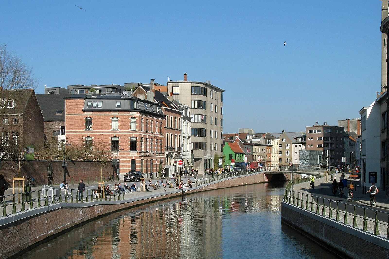
Look around first
What to notice
- The De Reep channel
- Lowered quay
- Old channel walls
- Wijdenaardbrug
The story of the place
On August sixteenth, nineteen sixty, the first trucks carrying earth arrived at Wijdenaardbrug. City Hall officials intended to remove two hundred meters of the Lower Scheldt from the map—the part of the river that runs through central Ghent and is called De Reep here.
Their decision was explained by entirely everyday needs. After the Ringvaart ring canal was built, cargo vessels bypassed the center. Wastewater was still discharged into the city’s waterways, and the rapidly growing number of cars needed parking. The officials decided to fill in the channel, no longer needed for navigation, conceal the polluted water, and make space for cars.
The Commission for Monuments and Townscapes was not shown the project. Its members could object only after the work had begun: they pointed out that the historic city boundary ran here and that this was the actual confluence of the Lys and the Scheldt. Their complaint changed nothing. Sand excavated during the construction of the very Ringvaart that had diverted vessels from here was dumped into the channel. Bulldozers leveled the fill, and asphalt was laid on top. For fifty-eight years, the two rivers then joined outside the center.
The word “reep” originally meant a straight strip of land along the water: this was the name of the local quay, and later of this stretch of the Scheldt itself. After it was filled in, the name remained with the street, although there was no longer any water beside it.
When wastewater was diverted into the sewers, the original reason for filling in the channel disappeared. In two thousand two, the city and Flemish water authorities began returning the river. They had to build three bridges and a lock, connect sections with different water levels, and reinforce the old embankments: their masonry had become unstable below ground. The project dragged on so long that in January two thousand fourteen, one participant in a city architecture forum created a page with a promise: if it received one thousand marks, residents would dig up De Reep themselves. When he returned home that evening, he saw that the required number had already been exceeded.
On January twenty-fifth, dozens of Ghent residents came here with shovels. They did not reach the river—the action was symbolic—but afterward the city services published a new schedule. The real work began only in November two thousand sixteen. Builders removed thirteen thousand cubic meters of fill and preserved the old channel walls.
On September twenty-fourth, two thousand eighteen, workers removed the last earthen barrier at Wijdenaardbrug. Water reached Portus Ganda again, and Scaldis Lock opened a circular route through the center for small vessels. The present channel runs exactly where dump trucks were unloading in nineteen sixty, while the lowered quay occupies the edge of the former car park.
Useful on site
Open city waterfront; movement restrictions are possible near the lock and bridges.
Checked: June 30, 2026. Check the official source before visiting.See the channel as a modern restoration of a historic connection, not as an untouched fragment of old Ghent; there is no need to go right up to the water’s edge.